Viaggio alla scoperta di Civitella di Romagna e del Parco ... OPEN civitella piandelgrado... ·...
32
Viaggio alla scoperta di Civitella di Romagna e del Parco Nazionale delle Foreste Casentinesi Progetto OPEN - Opportunità per nuove esperienze
Transcript of Viaggio alla scoperta di Civitella di Romagna e del Parco ... OPEN civitella piandelgrado... ·...
Viaggio alla scoperta di Civitella di Romagna e del Parco Nazionale delle Foreste Casentinesi
Progetto OPEN - Opportunità per nuove esperienze
Indice
Civitella di Romagna - Storia- Tradizioni, eventi, gastronomia e prodotti tipici - La Val Bidente: aspetti naturalistici
Il Parco Nazionale delle Foreste Casentinesi- Territorio- Foresta- La perla del Parco: Sasso Fratino- Storia e tradizioni- Riscoperta della storia e della cultura della Romagna Toscana- La cultura materiale- Religione e ambiente- La Flora- La Fauna- I Geositi- La Lama- La cascata dell’Acquacheta e la Piana dei Romiti- Le Riserve Naturali- Prodotti tipici
Luoghi da Visitare: Pian del Grado
Come arrivareDove dormire
- 2 -

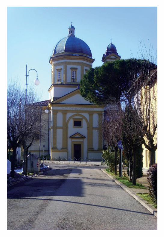
Civitella di Romagna
Civitella di Romagna
Civitella di Romagna è una ridente cittadina collinare della provincia di Forlì – Cesena, in Romagna. La sua popolazione è di 3.870 abitanti sparsi sui 117,80 chilometri quadrati di superficie. Secondo i dati ISTAT al 31 dicembre 2010, la popolazione straniera residente era di 621 persone (16%). Le nazionalità maggiormente rappresentate in base alla loro percentuale sul totale della popolazione residente erano: Marocco 169 (3,83%); Macedonia 119 (3,23%); Albania 79 (2,14%); Cina 63 (1,54%); Romania 48 (1,20%).
Storia
La graziosa località di Civitella, con il suo piccolo centro ricco di storia e di cultura, fino al 1891 era capoluogo di tre comuni: Civitella, Mortano e Predappio. Geograficamente Civitella di Romagna è posta nella Valle del Bidente e le sue origini sono antiche. Essa s’eleva a 238 metri sul livello del mare e dista circa trenta chilometri da Forlì, sulla provinciale della vallata del Ronco che percorrendo la foresta di Campigna, conduce a Santa Sofia, Mortano.Sorge a destra del fiume Ronco-Bidente e alle falde del colle Girone. Scriveva Emilio Rossetti alla fine dell’ottocento: “Dove questo fa una rapida rivolta e dove riceve il torrente Filippo, che si attraversa sopra un arditissimo ponte prima di entrare in paese dalla parte di Forlì”.Dell’antico castello di Civitella rimangono pochi resti: la torre, ricostruita in stile gotico, ha l’orologio installato nel 1842 che sostituisce l’altro ricordato fin dal 1554. Probabilmente le origini del paese risalgono agli Etruschi o ai Romani, ma le prima citazioni del nome risalgono al X secolo. La località è menzionata nel 996 quale possedimento della Chiesa di Ravenna, poi divenne feudo dei conti di Giaggiolo che persero nella cd. battaglia di Civitella (1276). Passò ai Manfredi di Faenza e poi a Malatesta (1462) e, dopo alterne vicende, a Napoleone Orsini e ai
veneziani del duca d’Urbino. Nel ‘500 subì il saccheggio da parte della soldataglia del Conestabile di Borbone, in marcia verso Roma; altro saccheggio ebbe luogo nel 1642 da parte dei soldati di Odoardo Farnese, che transitavano per questi luoghi diretti a Castro, in Toscana, che volevano conquistare. Al centro della vallata del Bidente, dove il corso del fiume si restringe, s’incontra Civitella, il cui nome deriva dal latino Civitatula (cittadella - piccola città). Ancor oggi è cittadina piccola di nome e di fatto, ma di estremo interesse storico (il castello) e religioso (il Santuario della Madonna della Suasia). La zona più interna del paese è il cuore antico del paese che affonda i propri ricordi fin nel X secolo. L’abitato iniziale di Civitella era compreso infatti entro la cinta muraria castellare bastionata. Vissuta per lungo tempo all’ombra della potente Abbazia di S.Ellero di Galeata e contesa fra le signorie che si disputavano i castelli, anche Civitella subì assedi e distruzioni, dovute, queste ultime, anche a terribili terremoti. Nel XV se., con l’estinguersi delle signorie, Civitella, città di confine tra Stato Pontificio e il Granducato di Toscana, venne assorbita dalla Chiesa. Il 14 marzo 1785, il Granducato di Toscana si rivolse alla Santa sede per ottenere la soppressione del Nullius di S.Ellero di Galeata e la consegna delle parrocchie situate nei terreni dello Stato Pontificio, 12 compresa Civitella, furono aggregate alla diocesi di Bertinoro.
Tradizioni, eventi, gastronomia e prodotti tipici.
A Civitella di Romagna molte sono le manifestazioni organizzate durante l’intero anno e tra queste si ricorda la Sagra della Ciliegia che si tiene l’ultima domenica del mese di giugno e dove tra le diverse attività dell’agricoltura rurale vi è quella della raccolta delle ciliegie. E ancora la Sagra del Prugnolo, la seconda domenica del mese di maggio con i famosi porcini (boletus edulis), e anche i prataioli e tutte le altre varietà di funghi che si possono trovare sotto le querce e i faggi del crinale appenninico. La Sagra del Tartufo invece si svolge a Cusercoli frazione di Civitella di Romagna, nelle prime due domeniche del mese di novembre.A Civitella di Romagna inoltre è possibile assaporare anche altre prelibatezze gastronomiche, come per esempio la “panza” che è un dolce che appartiene ad un’antica ricetta. E’ caratterizzata da tortelli fritti con olio di oliva e ripieni di una buonissima marmellata di ciliege della qualità denominata “morette”.Infine, si passa alle lavorazioni artigianali come quella dell’ intreccio del vimini, attività che in passato era largamente diffusa tra i contadini, ma che ora funziona solo per la realizzazione di oggettistica e souvenirs.E per concludere tra i tanti eventi di questo Comune nella provincia di Forlì-Cesena, si ricorda il suggestivo Carnevale: con grandi carri e costumi che sfilano attraversando il paese di Civitella di Romagna da oltre 40 anni.
Il Parco Nazionale delle Foreste Casentinesi
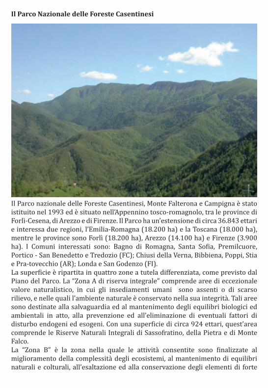
Il Parco nazionale delle Foreste Casentinesi, Monte Falterona e Campigna è stato istituito nel 1993 ed è situato nell’Appennino tosco-romagnolo, tra le province di Forlì-Cesena, di Arezzo e di Firenze. Il Parco ha un’estensione di circa 36.843 ettari e interessa due regioni, l’Emilia-Romagna (18.200 ha) e la Toscana (18.000 ha), mentre le province sono Forlì (18.200 ha), Arezzo (14.100 ha) e Firenze (3.900 ha). I Comuni interessati sono: Bagno di Romagna, Santa Sofia, Premilcuore, Portico - San Benedetto e Tredozio (FC); Chiusi della Verna, Bibbiena, Poppi, Stia e Pra-tovecchio (AR); Londa e San Godenzo (FI).La superficie è ripartita in quattro zone a tutela differenziata, come previsto dal Piano del Parco. La “Zona A di riserva integrale” comprende aree di eccezionale valore naturalistico, in cui gli insediamenti umani sono assenti o di scarso rilievo, e nelle quali l’ambiente naturale è conservato nella sua integrità. Tali aree sono destinate alla salvaguardia ed al mantenimento degli equilibri biologici ed ambientali in atto, alla prevenzione ed all’eliminazione di eventuali fattori di disturbo endogeni ed esogeni. Con una superficie di circa 924 ettari, quest’area comprende le Riserve Naturali Integrali di Sassofratino, della Pietra e di Monte Falco.La “Zona B” è la zona nella quale le attività consentite sono finalizzate al miglioramento della complessità degli ecosistemi, al mantenimento di equilibri naturali e colturali, all’esaltazione ed alla conservazione degli elementi di forte

caratterizzazione paesaggistica, storica, monumentale, ancorché non coerenti con le caratteristiche di naturalità peculiari della zona stessa. Nella zona B sono conservate le caratteristiche naturali, nello stato più indisturbato possibile, mantenute attraverso la mera protezione, l’intervento attivo dell’Ente Parco e il mantenimento dei soli usi didattici, educativi,divulgativi, ricreativi ed agro-silvo-pastorali tradizionali, compatibili con la conservazione delle caratteristiche di massima naturalità. L’area comprende gran parte delle foreste demaniali regionali, il complesso monumentale della Verna e le Riserve Naturali Biogenetiche dello Stato (Camaldoli, Scodella, Campigna e Badia Prataglia).La “Zona C” è caratterizzata dalla presenza di risorse naturali, paesaggistiche ed ambientali meritevoli di protezione e valorizzazione. Comprende aree di interesse naturalistico, caratterizzate dal fatto che l’attività umana ha conformato l’aspetto dei luoghi e l’ambiente portandolo allo stato attuale meritevole di protezione, che sono oggetto di tutela paesaggistica attraverso il mantenimento dell’equilibrio tra il sistema insediativo umano e quello naturale. La “Zona D” comprende tutti i centri urbani e le loro previste espansioni, le aree a destinazione produttiva tradizionale, piccoli centri di valore storico e di valenza turistica.La sorveglianza del Parco è affidata al Corpo Forestale dello Stato, organizzato nel Coordinamento Territoriale per l’Ambiente cui fanno capo 10 comandi stazione forestali. La proprietà del Parco è suddivisa tra Demanio dello Stato, Demanio delle Regioni e privati. All’interno del Parco risiedono circa 2.000 persone. La superficie boscata è oltre l’80% della superficie totale. I principali corsi d’acqua che attraversano il Parco sono in Toscana, l’alto corso dell’Arno coi suoi affluenti: Staggia, Fiu-micello, Archiano e Corsalone; in Romagna i torrenti Tramazzo, Montone, Rabbi ed il fiume Bidente coi sui rami di Corniolo, Ridracoli e Pietrapazza. Nel Parco è situato anche un grande lago artificiale, quello di Ridracoli.La cima più alta è il Monte Falco 1658 metri s.l.m. mentre i punti più bassi sono 430 m nella valle del Bidente di Ridracoli; 450 m nelle valli del Bidente di Corniolo e del Montone; 470 m nella valle del torrente Corsalone.
Territorio
Il paesaggio del Parco è caratterizzato da rocce sedimentarie, prevalentemente arenarie intercalate a marne, che in Romagna appaiono frequentemente con caratteristiche scarpate stratificate, o con crinali spogli. È differente la conformazione nella zona sud-est del Parco, dove il Monte della Verna, con le sue rupi calcaree, si distingue in un paesaggio con ampie pendici tondeggianti interrotte da calanchi che rivelano la presenza di argille. Il Parco dal punto di vista naturalistico è una delle aree forestali più pregiate d’Europa, il cui cuore è costituito dalle Foreste Demaniali Casentinesi, al cui interno si trova la già citata Riserva Naturale Integrale di Sasso Fratino. È anche un territorio con centri abitati ricchi

di storia e di testimonianze artistiche e architettoniche, con una flora e fauna tra cui spicca la più importante popolazione di lupo dell’Appennino settentrionale, nonché l’eccezionale presenza di cinque specie di ungulati: cinghiale, capriolo, daino, cervo e muflone. All’interno del Parco si trovano il Santuario della Verna e l’Eremo di Camaldoli.Il Parco comprende un’area nella quale l’uomo ha sempre vissuto e lavorato, ed è questo il motivo della presenza dei numerosi ruderi e borghi abbandonati nel suo territorio, dopo il massiccio esodo che si è verificato a partire dal secondo dopoguerra.
Foresta
Il Parco Nazionale delle Foreste Casentinesi offre un’emozione unica e un’esperienza indimenticabile: scoprire una fra le foreste più antiche d’Europa. Foreste imponenti, ricche di boschi misti ricoprono infatti quasi tutto il territorio del Parco, al punto che lo si potrebbe attraversare in tutta la sua estensione senza mai uscire dal lussureggiante e rigoglioso manto verde che lo avvolge. Foreste millenarie, testimoni del continuo evolversi della natura e impregnate di storia, dove il rapporto con l’uomo ha radici lontane nel tempo e ben documentate fin dal 1012, allorquando San Romualdo diede vita all’Ordine dei Monaci Camaldolesi, che per secoli saranno custodi e gestori di questo patrimonio. Da queste foreste si è tratto il pregiato legname per le impalcature di opere monumentali come il gigantesco Duomo di Firenze, o le travi lunghe e dritte per costruire le navi della flotta pisana. Foreste accoglienti, che ai nostri giorni permettono ai visitatori di vivere sensazioni vive e profonde, affascinanti nei loro colori, con tutte le tonalità del verde che in autunno esplodono in suggestive macchie di colore ambrate e rossastre, cariche di meditativi silenzi che in un attimo si possono trasformare in stupefacenti rumori, regalando l’occasione di avvistamenti e incontri da raccontare.
La perla del Parco: Sasso Fratino
Nel cuore del suo territorio, come una lucente perla, il Parco racchiude un tesoro prezioso: la Riserva Naturale Integrale di Sasso Fratino.Questo tratto di rigogliosa foresta, aggrappato alla scoscesa parte centrale del bastione che dà vita a due importanti rami del Bidente, ricco di fossi e torrenti, è quanto oggi di più vicino “all’antica silva”. Una morfologia aspra, con ripide pendenze e numerosi affioramenti rocciosi, e la mancanza di vie di accesso hanno reso nei secoli difficile la penetrazione dell’uomo e hanno permesso al bosco di rimanere nella condizione più prossima alla massima “naturalità”, con un’eccezionale ricchezza di specie arboree che in piena libertà nascono, crescono, si adattano e naturalmente muoiono.

- 9 -
Un luogo incantato e così fondamentale per capire e studiare la “vita” dei boschi, che sin dal 1959 lo si è voluto salvaguardare, precludendo a chiunque il libero accesso e ogni forma di intervento, con l’istituzione della prima Riserva Naturale Integrale in Italia. Dal 1985 la Riserva viene insignita, con cadenza quinquennale, del Diploma Europeo delle Aree Protette.
Storia e Tradizioni Senza voler indagare la storia più remota, che ha comunque lasciato tracce importanti sul territorio - si pensi ai primi insediamenti etruschi, di cui il «Lago degli Idoli» costituisce il più importante sito archeologico del nostro Appennino o, in epoca medievale, alle vie percorse dai pellegrini - specialmente tedeschi - che attraversavano il crinale per il Passo Serra, per il Casentino e poi per Roma – possiamo comunque dire che una buona parte del territorio del parco è stato sottoposto a gestioni unitarie di lunga durata, il che ha costituito probabilmente la fortuna delle nostre foreste. Terminata l’epoca feudale, con alcune grandi famiglie comitali come i Guidi, e la presenza di

forti entità religiose e amministrative come Camaldoli, in seguito alle numerose vicende storiche che sconvolsero l’Italia intera fu la volta del dominio fiorentino, la Repubblica e la Signoria che gestirono in modo lungimirante, attraverso la laica Opera del Duomo di Firenze, fino ad arrivare all’epoca granducale e alla costituzione del Regno d’Italia, durante il quale anche il versante romagnolo del parco continuò ad essere parte della Toscana. Questo lembo di Appennino ha colpito e suggestionato nei secoli santi (Ellero, Romualdo, Francesco e Pier Damiani ne fecero il loro luogo di meditazione), scrittori, pittori e artisti in genere. Tra i più illustri visitatori che il parco annovera c’è senz’altro Dante, il quale rimase particolarmente colpito dalla cascata dell’Acquacheta che celebrò in un canto dell’Inferno. In epoca moderna Dino Campana, una voce originale nella poesia del ‘900, ha raccontato nei «Canti orfici» il suo viaggio a piedi da Marradi a La Verna. Tanti sono stati anche i pittori (da Mazzuoli e Fedi, autori di splendide vedute settecentesche, a Marchini, Lega fino ad alcuni illustri contemporanei) che hanno ritratto le nostre foreste, così come i viaggiatori stranieri che, in epoche in cui il viaggio era considerato un’esperienza di vita irrinunciabile, si sono innamorati del Casentino e delle sue ricchezze artistiche e storiche, delle foreste e degli eremi che vi sono incastonati, della maestosità del paesaggio.Il territorio è costellato di segni della presenza umana, che vanno da monumenti e opere d’arte a oggetti artigianali o di semplice uso quotidiano. Tutto questo ci parla di un mondo e di una cultura scomparsi, ma non per questo da dimenticare. Insomma, la presenza di un borgo, di un semplice casolare, di un opificio sono la testimonianza concreta del rapporto che l’uomo aveva instaurato con il territorio e con la natura. L’Area protetta ha anche il ruolo di preservare e recuperare queste testimonianze della presenza umana nel territorio del Parco e di un rapporto con la natura che è durato fino a pochi decenni fa senza grandi differenze con il passato più lontano.
Religione e ambiente
Il parco ha al suo interno due luoghi straordinariamente importanti e affascinanti dal punto di vista spirituale e storico: l’Eremo di Camaldoli, fondato nel 1012 da San Romualdo, che scelse questo luogo splendido circondato da folte selve di abeti come luogo di ritiro e meditazione, riconoscendo alla cura del bosco un’importanza tale da divenire parte della regola dell’ordine; il Santuario della Verna, costruito

sulla montagna che San Francesco ricevette in dono nel 1213 per farne un luogo di eremitaggio, che domina impressionanti strapiombi e balze rocciose da un lato e, dall’altro, è protetto dalla secolare selva di abeti e faggi conservata intatta per quasi otto secoli dai francescani. La presenza di queste comunità arricchisce indubbiamente il nostro parco, rendendolo unico nel panorama nazionale
La Flora Abetine secolari, boschi di faggio e acero montano, boschi misti con incredibili varianti di specie che in autunno creano variopinte macchie di colore: faggi, aceri, frassini, olmi, tigli, ornielli e i rari tassi e agrifogli. Il Parco è coperto in larga parte dal bosco, che diviene foresta secolare negli oltre 5.000 ettari delle “Foreste Casentinesi” e nella Foresta che avvolge il Santuario Francescano della Verna. Oltre alla vegetazione della fascia montana, troviamo ben rappresentate anche tutte le tipologie di bosco della sottostante fascia submontana: ostrieti dominati dal Carpino nero, boschi di Querce a Cerro e a Roverella, Castagneti (soprattutto nella zona di Camaldoli e a Castagno d’Andrea nel versante fiorentino), rimboschimenti di Pino nero. Tra gli alberi ricordiamo la rara Cerro-sughera e, in luoghi caldi e rocciosi, alcuni esemplari relitti di Leccio. Ma la flora è costituita soprattutto dalle specie erbacee: oltre 1000 le specie finora censite, di cui solo 48 sono alberi e arbusti. Tra le specie citiamo l’Anemone a fiori di narciso (Anemone narcissiflora), la Sassifraga a foglie opposte (Saxifraga oppositifolia), il Mirtillo rosso (Vaccinium vitis-idaea) tutte legate alle alte montagne e ricordo del periodo glaciale che si è andato esaurendo circa 12.000 anni fa. La Viola di Eugenia (Viola eugeniae) simbolo della flora italiana e caratteristica dei massicci appenninici dell’Italia centrale, raggiunge qui il suo limite settentrionale di distribuzione. Altre specie di grande interesse naturalistico: la Sassifraga alpina (Saxifraga paniculata), il Mirtillo nero (Vaccinium myrtillus) e la Sassifraga solcata (Saxifraga moschata). Uno spettacolo da non perdere è la fioritura primaverile (aprile-maggio) di Cardamini, Bucaneve, Scilla e Coridali. Luoghi privilegiati per conoscere e studiare la flora del Parco sono il Giardino

Botanico di Valbonella a Corniolo (S.Sofia) e l’Arboreto “Siemoni” a Badia Prataglia.
La Fauna Il territorio del Parco si contraddistingue per la grande ricchezza e varietà della fauna, che presenta anche elementi di grande interesse scientifico. La grande estensione dei boschi, specialmente quelli di alto fusto, la presenza di molte piante di notevoli dimensioni e di differente età, l’esistenza di ambienti e tipi di vegetazione diversi, la scarsa presenza dell’uomo, sono tutti elementi che favoriscono la presenza della fauna selvatica, sia vertebrata che invertebrata. Tra la fauna vertebrata, ricordiamo i grandi mammiferi, in particolare gli ungulati, presenti con cinque specie (Cervo, Daino, Capriolo, Cinghiale e Muflone), e il Lupo, il più grande predatore presente oggi nel Parco. Tra gli uccelli, il Rampichino alpestre e il Ciuffolotto, la Sterpazzolina e lo Zigolo nero, l’Allocco, Cincia mora, Cincia bigia e Cinciarella, Picchio muratore, Picchio rosso minore e maggiore, Picchio verde e Picchio nero. Tra i rapaci, il Falco pecchiaiolo e Lodolaio, lo Sparviere e Astore. Sulle aspre rupi del versante romagnolo nidificano l’Aquila
reale, il Gufo reale e il Falco pellegrino. Nel Parco vivono 12 specie di anfibi, tra cui segnaliamo per la loro importanza e rarità la Salamandrina di Savi, il Tritone alpestre, che ha qui le stazioni più meridionali in Italia, la Salamandra pezzata e il piccolo Geotritone italiano. Delle 11 specie di rettili quello più noto e ingiustamente temuto è sicuramente la Vipera, importante anello della catena alimentare. Sono presenti anche il Colubro d’Esculapio, l’elegante e velocissimo Biacco, il Colubro liscio ed il Colubro di Riccioli. Chiudono l’elenco degli ofidi la Natrice dal collare e la Biscia tassellata.
La Lama
Il nome “lama” deriva dal latino classico e significa acquitrino, pantano, terreno paludoso e in effetti la piana che caratterizza in questo punto il fondovalle dell’omonimo fosso, deriva dal riempimento di un antico lago. Questo si formò in epoche storiche a causa di un’imponente frana che sbarrò la valle causando l’allagamento delle zone retrostanti, che ospitarono a lungo uno specchio lacustre ramificato verso monte, in corrispondenza della confluenza tra i fossi della Lama e delle Ripe. La frana si staccò da Poggio Fonte Murata, una zona ancora ben riconoscibile, corrispondente ad uno scivolo ripidissimo, con forma a doccia e rivestito da un rado bosco. Nel corso del tempo, seguendo l’evoluzione di tutti i bacini lacustri, anche il lago della Lama si è lentamente riempito con i sedimenti trasportati dai due immissari, sino a scomparire dando origine ad un ambiente umido di torbiera.
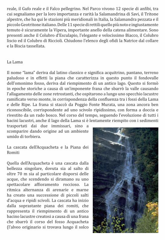
La cascata dell’Acquacheta e la Piana dei Romiti
Quella dell’Acquacheta è una cascata dalla bellezza singolare, dovuta sia al salto di oltre 70 m sia al particolare disporsi delle acque, che scendendo si diramano su uno spettacolare affioramento roccioso. La ritmica alternanza di arenarie e marne ha creato una successione di piccoli salti d’acqua e ripidi scivoli. La cascata ha inizio dalla soprastante piana dei romiti, che rappresenta il riempimento di un antico bacino lacustre creatosi a causa di una frana che sbarrò il corso del fosso Acquacheta (l’alveo originario si trovava lungo il solco
che si percorre salendo alla piana dei Romiti con il sentiero 411). A valle della cascata si susseguono suggestive forme di erosione torrentizia, con pozze limpidissime, rapide e affioramenti rocciosi. Il luogo è stato immortalato da Dante (Inf., XVI, 94-102), ma forse era già oggetto di culto in epoca antica, se davvero, com’è stato ipotizzato in base al toponimo, vi si trovava una fonte oracolare
Le Riserve Naturali
Le Riserve Naturali sono definite come Aree naturali protette caratterizzate dalla presenza di uno o più elementi naturali, quali specie faunistiche, floristiche ed ecosistemi, che si dstinguono per il loro particolare valore naturalistico e che quindi svolgono un ruolo strategico nella conservazione della biodiversità. Nel Parco ci sono sette Riserve Naturali Statali che svolgono un ruolo di primaria importanza, poiché tutelano aree di grande valore naturalistico sul panorama nazionale ed europeo. Alberi e boschi vetusti e monumentali, entità floristiche rare o al limite del loro areale di distribuzione, ecosistemi ben conservati tutelati a livello europeo, sono le principali emergenze. Un lustro ad un territorio già di per sè prezioso e ricco di biodiversità.
Prodotti Tipici
“Dimmi cosa mangi e ti dirò chi sei” è un vecchio detto che ha sempre trovato riscontro nelle persone che vivono le mille diversità del nostro paese. In questi anni, grazie anche a progetti avviati dal Parco insieme a Slow Food, assistiamo alla riscoperta delle tradizioni gastronomiche e dei prodotti naturali e culinari tipici del territorio. La conservazione della cultura delle popolazioni del Parco è legata anche al recupero di tradizioni e modi di vivere oggi sempre più a rischio di “estinzione”. Esempi di prodotti tipici sono: il miele, il pecorino toscano, la gota, il marrone del Mugello, la pesca regina di Londa, il raviggiolo, il tortello sulla lastra, la melata d’abete, la salsiccia matta, la razza chianina e la razza romagnola.
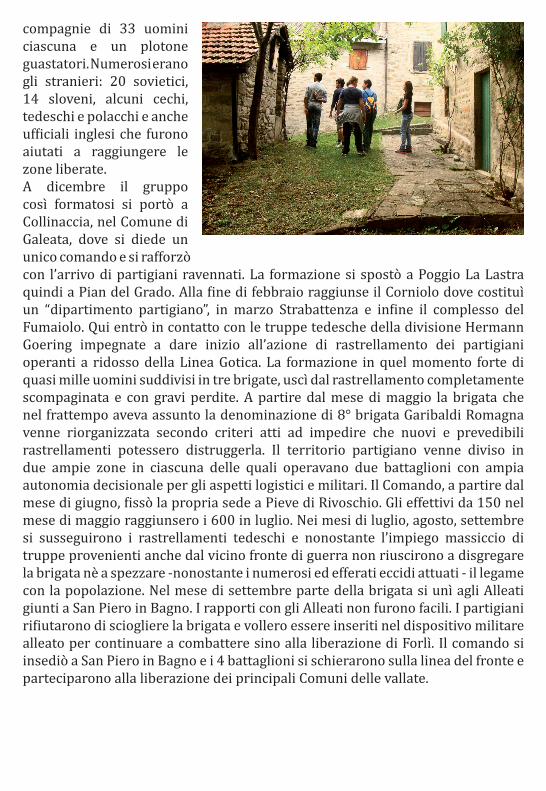
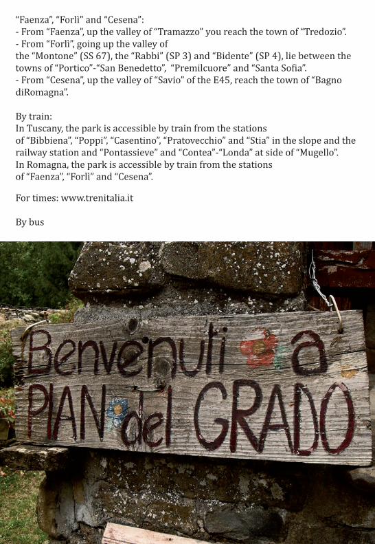
Luoghi da visitare: PIAN DEL GRADO
Antico borgo restaurato ed ancora saltuariamente abitato, uno splendido esempio dell’architettura rurale tipica dell’appennino tosco-romagnolo.Sede di avvenimenti storici importanti: nel febbraio del 1944 si insediò la formazione partigiana che verrà poi denominata 8° brigata Garibaldi “Romagna”, in quel momento consistente di oltre 200 partigiani inquadrati in cinque
compagnie di 33 uomini ciascuna e un plotone guastatori. Numerosi erano gli stranieri: 20 sovietici, 14 sloveni, alcuni cechi, tedeschi e polacchi e anche ufficiali inglesi che furono aiutati a raggiungere le zone liberate.A dicembre il gruppo così formatosi si portò a Collinaccia, nel Comune di Galeata, dove si diede un unico comando e si rafforzò con l’arrivo di partigiani ravennati. La formazione si spostò a Poggio La Lastra quindi a Pian del Grado. Alla fine di febbraio raggiunse il Corniolo dove costituì un “dipartimento partigiano”, in marzo Strabattenza e infine il complesso del Fumaiolo. Qui entrò in contatto con le truppe tedesche della divisione Hermann Goering impegnate a dare inizio all’azione di rastrellamento dei partigiani operanti a ridosso della Linea Gotica. La formazione in quel momento forte di quasi mille uomini suddivisi in tre brigate, uscì dal rastrellamento completamente scompaginata e con gravi perdite. A partire dal mese di maggio la brigata che nel frattempo aveva assunto la denominazione di 8° brigata Garibaldi Romagna venne riorganizzata secondo criteri atti ad impedire che nuovi e prevedibili rastrellamenti potessero distruggerla. Il territorio partigiano venne diviso in due ampie zone in ciascuna delle quali operavano due battaglioni con ampia autonomia decisionale per gli aspetti logistici e militari. Il Comando, a partire dal mese di giugno, fissò la propria sede a Pieve di Rivoschio. Gli effettivi da 150 nel mese di maggio raggiunsero i 600 in luglio. Nei mesi di luglio, agosto, settembre si susseguirono i rastrellamenti tedeschi e nonostante l’impiego massiccio di truppe provenienti anche dal vicino fronte di guerra non riuscirono a disgregare la brigata nè a spezzare -nonostante i numerosi ed efferati eccidi attuati - il legame con la popolazione. Nel mese di settembre parte della brigata si unì agli Alleati giunti a San Piero in Bagno. I rapporti con gli Alleati non furono facili. I partigiani rifiutarono di sciogliere la brigata e vollero essere inseriti nel dispositivo militare alleato per continuare a combattere sino alla liberazione di Forlì. Il comando si insediò a San Piero in Bagno e i 4 battaglioni si schierarono sulla linea del fronte e parteciparono alla liberazione dei principali Comuni delle vallate.
Come arrivare
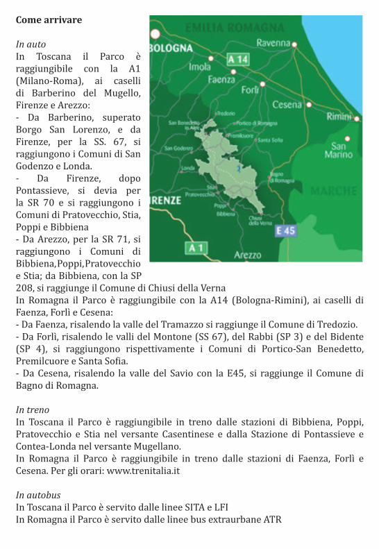
In auto In Toscana il Parco è raggiungibile con la A1 (Milano-Roma), ai caselli di Barberino del Mugello, Firenze e Arezzo: - Da Barberino, superato Borgo San Lorenzo, e da Firenze, per la SS. 67, si raggiungono i Comuni di San Godenzo e Londa. - Da Firenze, dopo Pontassieve, si devia per la SR 70 e si raggiungono i Comuni di Pratovecchio, Stia, Poppi e Bibbiena - Da Arezzo, per la SR 71, si raggiungono i Comuni di Bibbiena, Poppi, Pratovecchio e Stia; da Bibbiena, con la SP 208, si raggiunge il Comune di Chiusi della Verna In Romagna il Parco è raggiungibile con la A14 (Bologna-Rimini), ai caselli di Faenza, Forlì e Cesena: - Da Faenza, risalendo la valle del Tramazzo si raggiunge il Comune di Tredozio. - Da Forlì, risalendo le valli del Montone (SS 67), del Rabbi (SP 3) e del Bidente (SP 4), si raggiungono rispettivamente i Comuni di Portico-San Benedetto, Premilcuore e Santa Sofia. - Da Cesena, risalendo la valle del Savio con la E45, si raggiunge il Comune di Bagno di Romagna.
In treno In Toscana il Parco è raggiungibile in treno dalle stazioni di Bibbiena, Poppi, Pratovecchio e Stia nel versante Casentinese e dalla Stazione di Pontassieve e Contea-Londa nel versante Mugellano. In Romagna il Parco è raggiungibile in treno dalle stazioni di Faenza, Forlì e Cesena. Per gli orari: www.trenitalia.it
In autobus In Toscana il Parco è servito dalle linee SITA e LFI In Romagna il Parco è servito dalle linee bus extraurbane ATR
Per gli orari: SITA www.sitabus.it - ATR www.atr-online.it - LFI http://www.lfi.it/servizi_linee_lfi_et-mob.asp
In aereo Il territorio del Parco è servito dagli aereoporti di Firenze, Bologna, Forlì e Rimini.
Dove dormire Agriturismi. A Portico S.Benedetto: La Montanara - Coop. Agroippoituristica Ridolla -
Albergo Ristorante “Al Vecchio Convento” – Portico S.Benedetto (FC) – Agriturismo - Premilcuore (FC) Residenza Turistica Fiumicello – Appartamenti - Premilcuore (FC) Camping Acquacheta – Campeggi - San Benedetto in Alpe (FC) Fangacci – Agriturismo - Corniolo (FC) Leonardo - Alberghi - Corniolo (FC) Pini – Alberghi - Corniolo (FC) Albergo Trattoria Pizzeria Da Gigino – Alberghi - Corniolo (FC) Badia di Sasso – Ostelli - Corniolo (FC) Poderone – Agriturismo - Santa Sofia (FC) Rio Sasso – Agriturismo - Santa Sofia (FC) Granduca – Alberghi - Santa Sofia (FC) Cà Gianna – Agriturismo - Tredozio (FC) Mulino di Culmolle – Agriturismo - Bagno di Romagna (FC) Pianconvento – Agriturismo - Bagno di Romagna (FC) Euroterme – Alberghi - Bagno di Romagna (FC) Miramonti – Alberghi - Bagno di Romagna (FC) Il Palazzo – Alberghi - Bagno di Romagna (FC) Cà di Veroli – Alberghi - Bagno di Romagna (FC)

Civitella di Romagna
Civitella di Romagna is a hill town in the province of Forlì-Cesena, in Romagna. It has a population of 3870 people spread over 117,80 km square. In reference to ISTAT data of December 31st, 2010, the foreign population was 621 people (16%). The nationalities most represented according to their percentage of the total resident population were: Morocco 169 (3,83%); Macedonia 119 (3,23%); Albania 79 (2,14%); China 63 (1,54%); Romania 48 (1,20%).
History
The graceful citizen of Civitella, with its little city centre full of history and culture, till 1891 was chief town of three municipalities: Civitella, Mortano and Predappio. Geographically Civitella di Romagna is located in the “Bidente valley” and its origins are ancient. It rises 238 meters above sea level and is about 30 kilometres far from Forlì, along the road of the “Ronco valley” that runs through the Campignia forest and leads to Santa Sofia, Mortano. It rises on the right of the “Ronco-Bidente River” and at the food of the hill Girone. Emilio Rosetti wrote in the late nineteenth century: “ Where does this quickly revolt and which receives the stream Filippo, that can be cross by daunting bridge before entering in town from Forlì side.” Of the ancient castle of Civitella few vestiges remain: the tower, it rebuilt in the Gothic style, has the clock installed in 1842 replacing the other mentioned since 1554. Probably the town’s origins dates back to the Etruscans or Romans, but the first citation of the name dates back to the tenth century. The village is mentioned in 996 as a possession of the Church of Ravenna, then it became a fief of the Counts of Giaggiolo who lost the battle of Civitella (1276). It passed to Manfredi of Faenza and then to Malatesta family (1462) and, after various vicissitudes, to Napoleon Orsini and to the Venetians, into the hands of Duke of Urbino. In the’500 the soldiery of the Constable of Bourbon sacked it, during the march towards Rome; more looting took place in 1642 by soldiers of Edoardo Farnese, who passed through these places direct to Castro, in Tuscany, who wanted to conquer. At the center of the “Bidente valley”, where the river becomes narrows, it meets Civitella, whose name derives from the latin, “Civitatula” (cittadella – small town). Today is still a small town in name and fact, but of great historical interest (the castle) and religious (The Shrine of “Madonna della Suasia”). The most inland region of the century is the ancient heart of the country showing their memories from the tenth century. The native village of Civitella was inside the castle rampart walls. It lived for long time in the shadow of the powerful “S.Ellero Abbey” of Galeata and it strife between the lords who were tearing the castle, also, it suffered sieges and destruction caused
even from dreadful earthquakes. In the fifteenth century, with the extinction of the lordships, Civitella, a town on the border between the Papal States and the Grand Duchy of Tuscany, it was absorbed by the Church. On 14 March 1785, the Grand Duchy of Tuscany asked the Holy See for the suppression of the Nullius of S.Ellero of Galeata and the delivery of the parishes located in the grounds of the Papal States, including Civitella were added to the Diocese of Bertinoro.
Traditions, events, gastronomy and local products.
In Civitella di Romagna there many events held throughout the year and among these is remembered the “Cherry Festival” (Sagra della Ciliegia), held the last Sunday of the month of June and among different activities involved in rural agriculture there is one that harvest cherries. More festivals as the “Blackthorn Festival” (Sagra del Prugnolo), the second Sunday of the month of May with the famous “Porcini” mushrooms (Boletus edulis), an even “Prataioli” mushrooms and all other varieties of mushrooms that are found under the oaks and beeches of the Apennine ridge. The “Truffle Festival” (Sagra del tartufo) takes place in rather Cusercoli hamlet of Civitella di Romagna, in the first two Sundays of the month of November. In Civitella di Romagna is also possible to taste other gastronomic delights, such as the “Belly” (pancia), which is a cake that belongs to an ancient recipe. It baking fried “ravioli” with olive oil and stuffed with a delicious cherry jam quality called “Morette”. In the end among the many events of this municipality in the province of Forlì-Cesena, remembers the impressive Carnival with great costumes and floats that parade through the village of Civitella di Romagna for over 40 years.
“Foreste Casentinesi” National Park
The “Foreste Casentinesi” National Park, “Falterona” Mount, Campigna was established in 1993 on the two side of the Apennine watershed between Romagna and Tuscany, and is divided between the province of Forlì-Cesena and Florence. The park covers about 36.843 hectares and covers two regions, Emilia-Romagna (18.200 ha) and Tuscany (18.000 ha), while the provinces are Forlì (18.200 ha), Arezzo (14.100 ha) and Florence (3,900 ha). The towns involved are: Bagno di Romagna, Santa Sofia, Premilcuore, Portico, San Benedetto e Tredozio (FC); Chiusi della Verna, Bibbiena, Poppi, Stia e Pratovecchio (AR); Londa and San Godenzo (FI). The surface is divided into four zones with differentiated protection, as provided by park’s lows. The “A” zone, strict nature reserve includes areas of huge natural

value, where human settlements are absent or not very important, and the natural environment is preserved in its integrity. These areas are intended to safeguard and maintain the environment and biological balances in place for preventing and remove any endogenous and exogenous disturbance. With an area of about 924 ha, this area includes the “Sasso Fratino”, “Pietra” and “Monte Falco” Nature Reserves.
The “B” zone is the zone where the permitted activities are aimed at improving the complexity of ecosystems, maintaining natural balance and cultivation, preservation and exaltation of the strong elements of its landscape, historical, monumental, although not consistent with the peculiar characteristics of naturalness of the zone. In “B” zone are preserved the natural, undisturbed state as possible, maintained through the law, the active intervention of the Park and the maintenance of educational uses only, educational, informative, recreational and traditional agro-forestry-pastoral, compatible with the preservation of the characteristics of maximum naturalness. The area includes most of the regional state forests, the monumental “Complesso di Verna” and biogenetic State Natural Reserves (Camaldoli, Scodella, Campigna and Badia Prataglia). The “C” zone is characterized by the presence of natural resources, landscape and environmental features worthy of protection and enhancement. Includes areas of natural interest, characterized by the fact that human activity has shaped the look of the place and bring it to the current state of the environment worthy of protection, which are the subject of landscape protection, by maintaining a balance between human settlement patterns and natural. The “D” zone includes all urban centres and their planned expansion, the traditional production areas to target, small towns of historical and tourist value. The surveillance of the park is entrusted to the State Forestry Corps, organized in the Local Coordination Environment, which owns 10 commands forest station. Ownership of the Park is divided between the State Property, Estate of the Regions and private. Inside the park there are nearly 2,000 people. The wooded area is over 80% of the total area. The main rivers that cross the Park are in Tuscany, the “Arno River” with its tributaries: “Staggia”, “Fiumicello”, ”Archiano” and “Corsalone”; while in Romagna streams “Tramazzo”, “Montone”, “Rabbi” and the “Bidente river” with its branches “Corniolo”, “Ridracoli” and “Pietrapazza”. At the Park is located in a large artificial lake, called “Ridracoli”. The highest peak is Mount Falcon 1658 meters above sea level while the lowest point is 430 m in the “valle del Bidente di Ridracoli”, 450 m in the “valle del Bidente di Corniolo” and the “valli del Bidente, 470 m in the “valli del Bidente del Montone; 470 m in the “valle del torrente Corsalone”.
Territory The Park’s landscape is characterized by sedimentary rocks, mainly sandstones

intercalated with marl, which appear frequently in Romagna with features layered escarpments, or bare ridges. It is different conformation in the south-east of the Park, where the “Monte della Verna”, with its limestone cliffs, stands in a landscape with large rounded slopes interrupted by badlands that reveal the presence of clays. The park from the point of view of nature is one of the most valuable forest areas of Europe, whose heart is made up of the “Foreste Demaniali Casentinesi”, which inside is the aforementioned “Sasso Fratino” Nature Reserve. It is also an area with towns rich in history and artistic and architectural elements, with a flora and fauna, with the largest wolf population in the northern Apennines, and the exceptional presence of five species of ungulates: wild boar, roe deer, fallow deer and mouflon. Inside the park there is the Sanctuary of La Verna and Camaldoli Hermitage. The park covers an area in which man has always lived and worked, and this is the reason for the presence of numerous ruins and deserted villages in its territory, after the massive exodus that has occurred since World War II. Forest The “Foreste Casentinesi” National Park offers a unique experience and an unforgettable experience: discover one of the oldest forests in Europe. Towering forests, mixed forests rich in fact cover almost the entire territory of the park, to the point that you can pass in its full extent without ever leaving the lush, lush green mantle that surrounds it. Ancient forests, witness the continuing evolution of nature and steeped in history, where the relationship with man has its roots far back in time and well-documented since 1012, when San Romualdo gave rise to the Order of the Camaldolese Monks, who will be guardians for centuries and operators of this heritage. From these forests has drawn the prized timber for the scaffolding of monumental works as the gigantic cathedral of Florence, or long and straight beams to build the ships of the fleet of Pisa. Forests comfortable, which in our day it allows visitors to experience vivid and deep sensations, fascinating in their colours, all shades of green that esplode in autumn and suggestive spots of reddish amber color, full of meditative silence in a moment can transform into amazing sounds, giving the chance of sightings and encounters to tell.

The pearl of the Park: Sasso Fratino.
In the heart of its territory as a shining pearl, the park holds a precious treasure: the “Sasso Fratino Natural Reserve”. This stretch of lush forest clinging to the steep central part of the rampart which gives rise to two major branches of Bidente, full of ditches and streams, as is now the closest “ancient forest”. A rough morphology, with steep slopes and numerous rock outcrops, and lack of access ways through the centuries have made it difficult to penetrate the wood man and allowed to remain in the position closest to the maximum “natural”, with exceptional wealth of tree species that freely born, grow, adapt and die naturally. An enchanted and so fundamental to understand and study the “life” of the woods, which since 1959 has wanted to preserve it, precluding open access to anyone and any form of intervention, with the establishment of the first Natural Reserve in Italy .Since 1985, the Reserve is honored, every five years, the European Diploma of Protected Areas.
History and Traditions. Without wishing to investigate the earliest history, it has still left important traces in the area - think of the first Etruscan settlements, of which the “Lake of the Idols” (Lago degli Idoli) is the most important archaeological site of the Apennines, or, in medieval times, the routes followed by pilgrims - especially Germans - who crossed the ridge to the “Passo Serra”, to the “Casentino” and then to Rome - we can still say that the park has been subjected to long-term management unit, which has been probably the lucky for our forests. After the feudal era, with some great families such as the Committees Guidi, and the presence of strong religious and administrative entities as Camaldoli, in response to several historical events that shook the whole of Italy was once the domain of the Florentine Republic and Lordship who ran so far-seeing, through the secular Opera del Duomo in Florence, until get back to Grand Duke and the establishment of the Kingdom of Italy, during which also the Romagna side of the park continued to be part of Tuscany. This stretch of the Apennines has influenced and affected over the centuries Saints (“Ellero”, “Romualdo”, “Pier Francesco Damiani” made it their place of meditation), writers, painters and artists in general. Among the most distinguished visitors that the park is undoubtedly includes Dante, who was particularly impressed by the “Acquacheta” waterfall who celebrated in a song of Dante’s Hell (Inferno di Dante). In modern times, Dino Campana, an original voice in the poetry of 900, told the “Orphic Songs” (Canti Orfici) his journey on foot from “Marradi” to “La Verna”. Many were even painters (from “Marradi” and Fedi, with great views of eighteenth-century
authors, to “Marchini”, “Lega” until a few illustrious contemporaries) that have portrayed our forests, as well as foreign travels who, in times when the trip was considered essential experience of life, they fell in love of Casentino and its artistic and historical treasures, forests and hermitages that are set, the majesty of the landscape. The area is dotted with signs of human presence, ranging from monuments and works of art crafts or simple everyday use. All this speaks of a world and a culture disappeared, but not to forget. In short, the presence of a village, a simple farmhouse, a mill is the concrete proof of the relationship that the man had established with the land and with nature. The protected area also has the role to preserve and restore these testimonies of human presence in the territory of the Park and a relationship with nature that lasted until a few decades ago without any major differences with the more distant past. Religion and Environment. The park has two locations inside the extraordinarily important and fascinating in terms of spiritual and historical: the Hermitage of Camaldoli (L’Eremo di Camaldoli), founded in 1012 by San Romualdo, who chose this beautiful place surrounded by dense forests of fir trees as a place of retreat and meditation, recognizing the care of the forest to become such an important part of the rule of order, and the Sanctuary of La Verna (Santuario della Verna), built on the mountain that Saint Francis received a gift in 1213 as a place of retreat, overlooking impressive cliffs and rocky outcrops from one side and the other is protected from the secular forest of fir and beech trees preserved intact for nearly eight centuries by the Franciscans. The presence of these communities certainly enriches our park, making it unique in the country.
The Flora Fir trees, beech and sycamore forest, mixed forests with incredible variations of species in autumn create colorful splashes of color: beech, maple, ash, elms, lindens, flowering ash and holly trees and rare rates. The park is covered largely by forest, which becomes old forest in more than 5,000 hectares of “Foreste Casentinesi” and in the forest that surrounds the “Sanctuary of La Verna Franciscan” (Santuario Francesano della Verna). In addition to the vegetation of the mountain zone, it well represented all types of forests of the submontane belt below: area dominated by black Carpino, oak forests in Cerro and in Roverella, Chestnut (especially in the area of Camaldoli and Castagno d’Andrea in the Florentine side ), plantations of black Pine. Among the trees include the rare cork-Cerro and, in hot and rocky place, some specimens remnants of oak.

But the flora is composed mainly by grass species: over 1000 species surveyed so far, of which only 48 are trees and shrubs. Among the species include the flowers of Narcissus Anemone (Anemone narcissiflora), the opposite-leaved Saxifrage (Saxifraga oppositifolia), the Cranberry (Vaccinium vitis-idaea) are all linked to the high mountains of the glacial period, and remember that it went running out about 12,000 years ago. The Eugenia Viola (Viola eugeniae) symbol of the Italian flora characteristic of the Apennine massifs of Central Italy, here reaches its northern limit of distribution. Other species of great interest: the Alpine Saxifrage (Saxifraga paniculata), the Bilberry (Vaccinium myrtillus) and Furrowed Saxifrage (Saxifraga moschata). A show not to miss the spring bloom (April-May) of “Cardamini”, “Bucaneve”, “Scilla” and “Coridali”. Places privileged to know and study the flora of the Park are the Botanical Gardens at Valbonella a Corniolo (Santa Sofia) and the Arboretum “Siemoni” at Badia Prataglia. The Wildlife The Park is characterized by great richness and variety of wildlife, which also has elements of great scientific interest. The vast expanse of forests, especially those with tall trees, the presence of many plants of considerable size and of different ages, the existence of different environments and types of vegetation, the lack of human presence, are all factors that favor the presence wildlife, invertebrate and vertebrate that. Among the vertebrates, we recall the large mammals, especially ungulates, these five species (deer, fallow deer, roe

deer, mouflon and wild boar), and the Wolf, the largest predator in the Park here today. Among birds, the “Eurasian Tree-creeper”, Subalpine Warbler and the Black Bunting, the Owl, Coal Tit, nuthatch, lesser and greater spotted Woodpecker, green Woodpecker and black Woodpecker. Among the birds of prey, the Hobby and Honey Buzzard, Goshawk and the Sparrowhawk. The rugged cliffs of the Romagna region nesting golden Eagles, the Eagle owl and peregrine Falcon. In the park live 12 species of amphibians, including mention of their importance and rarity of the salamander Savi, the alpine Newts, which has stations here in southern Italy, the Salamander and the little Italian cave Salamander. Of the 11 species of reptiles, the most famous and unjustly feared the Viper is certainly an important link in the food chain. There are also Colubro of Aesculapius, the elegant and very quick sand Lizard, smooth Coluber and the Coluber of Riccioli. Rounding out the list of the Grass snakes and Dice snake. The Lama The name “Lama” comes from classical Latin and means marsh, swamp, marshland and the plain fact that characterizes this point in the homonymous valley ditch, comes from the filling of an ancient lake. This was formed in historical times due to a massive landslide that blocked the valley causing flooding of areas behind, which hosted a long-branched surface of the lake to the mountain, at the confluence of the ditches of the Blade and Ripe. The landslide broke away from Poggio Source Murata, an area still very recognizable, corresponding to a steep slide, shaped like a shower and covered with a thin wood. Over time, following the evolution of all the lakes, including Lake of the blade is slowly filled with sediments transported by two tributaries, until it disappears, giving rise to a moist peat bog.
The Acquacheta waterfall and the Plain of Romiti.
That Acquacheta is a waterfall of singular beauty, due to the jump of over 70 m and the particular arrangement of water, which spread down on a spectacular rocky outcrop. The rhythmic alternation of sandstones and marls has created a series of small waterfalls and steep chutes. The waterfall begins above the plane of the hermits, who represents the filling of an ancient lake basin has arisen because of a landslide that blocked the course of the Acquacheta ditch (the original river bottom was along the groove that runs going up to the Plain of Romiti on path 411). Downstream of the waterfall impressive forms of torrential erosion, with crystal clear pools, rapids and rocky outcrops. The place was immortalized by Dante

(Inferno, XVI, 94-102), but maybe it was already the subject of worship in ancient times, if indeed, as has been suggested based on the name, there was a source of oracular. The Nature Reserves The Nature Reserves are defined as protected natural areas characterized by the presence of one or more natural elements, such as fauna, flora and ecosystems, which distinguished for their special natural value and therefore play a strategic role in the conservation of biodiversity. In the park there are seven State Nature Reserves, which play a major role as protecting areas of great natural value on the national and European level. And ancient and monuments trees, rare flora or entities to limit their range of distribution, well-preserved ecosystems protected at European level, are the major emergencies. A prestige to a territory in itself valuable and rich biodiversity. Typical Products “Tell me what you eat and I’ll tell you who you are” is an old saying that has always been reflected in the many different people living in our country. In recent years, thanks to projects initiated by the Park and slow food, we witness the rediscovery of the culinary traditions and natural products and traditional culinary territory. The preservation of the culture of the peoples of the Park is also linked to the recovery of traditions and ways of life now increasingly at risk of “extinction”. Examples of typical products are: honey, “Pecorino Toscano”cheese, “La Gota” sausage, “Il Marrone del Mugello”, fishing queen of Londa, the Raviggiolo, Tortello on the slab, fir honeydew, crazy sausage, the Chianina and Romagnola breed.
Places to go: Pian del Grande Restored old village and still occasionally inhabited, it is a splendid example of rural architecture typical of the Tuscan-Romagna. Home to important historical events: in February of 1944 settled the partisan group that will then be called 8th Brigade Garibaldi “Romagna”, at that time consisting of over 200 partisans classified into five companies of 33 men each and a sapper platoon. Many foreigners were: 20 Russians, 14 Slovenes, some Czechs, Germans and Poles and even British officers who were helped to reach the liberated areas.

In December, the group thus formed is brought “Collinaccia”, in the city of “Galeata”, where it gave a single command and was reinforced with the arrival of partisans Ravenna. Training moved to “Poggio La Lastra” then Pian of the “Grado”. At the end of February reached the “Corniolo” which constituted a “partisan department”, in March the “Strabattenza” and in the end the whole of the “Fumaiolo” Stack. Here it came into contact with German troops of the Hermann Goering Division commitment to start mopping up action of partisans operating behind the Gothic Line. The formation at that time was nearly a thousand men divided into three brigades, left the raid completely disrupted and with heavy losses. Since May, the brigade had meanwhile taken the title of 8th Brigade Garibaldi “Romagna” was reorganized according to criteria designed to prevent new and predictable sweeps could destroy it. The partisan territory was divided into two broad areas in each of the two battalions which operated with great autonomy for decision-making and military logistics. The Command, from the month of June, it made its home at “Pieve di Rivoschio”. The headcount from 150 in May reached 600 in July. During July, August and September there were several German roundups and despite the massive use of troops coming also from the neighboring war front could not break down or break the brigade-and despite numerous brutal massacres carried out - the link with the population. In September, the brigade joined the allies came to “San Piero in Bagno”. Relations with the allies were not easy. The partisans refused to dissolve the company and wanted to be included in the allied military presence to continue to fight until the liberation of “Forlì”. The command settled in “San Piero in Bagno” and 4 battalions lined up on the front line and participated in the liberation of the main towns of the valleys.
How to get there
By car: In Tuscany, the park is accessible by the away A1 (Milan-Rome), the tollgate of “Barberino” of ”Mugello”, “Florence” and “Arezzo”: - From “Barberino”, passed “Borgo San Lorenzo”, and “Florence”, for the SS. 67, it can be get to towns of “San Godenzo” and “Londa”. - From “Florence”, after “Pontassieve”, turn to SR 70 and will reach the towns of “Pratovecchio”, “Stia”, “Poppi” and “Bibbiena”. - From “Arezzo”, for the SR 71, can reach the towns of “Bibbiena”, “Poppi”, “Pratovecchio” and “Stia”; “Bibbiena”, with the SP 208, one reaches the town of “Chiusi della Verna”. In Romagna, the park is accessible by the A14 (Bologna-Rimini), the tollgate of
“Faenza”, “Forlì” and “Cesena”: - From “Faenza”, up the valley of “Tramazzo” you reach the town of “Tredozio”. - From “Forlì”, going up the valley of the “Montone” (SS 67), the “Rabbi” (SP 3) and “Bidente” (SP 4), lie between the towns of “Portico”-“San Benedetto”, “Premilcuore” and “Santa Sofia”. - From “Cesena”, up the valley of “Savio” of the E45, reach the town of “Bagno diRomagna”. By train: In Tuscany, the park is accessible by train from the stations of “Bibbiena”, “Poppi”, “Casentino”, “Pratovecchio” and “Stia” in the slope and the railway station and “Pontassieve” and “Contea”-“Londa” at side of “Mugello”. In Romagna, the park is accessible by train from the stations of “Faenza”, “Forlì” and “Cesena”.
For times: www.trenitalia.it By bus
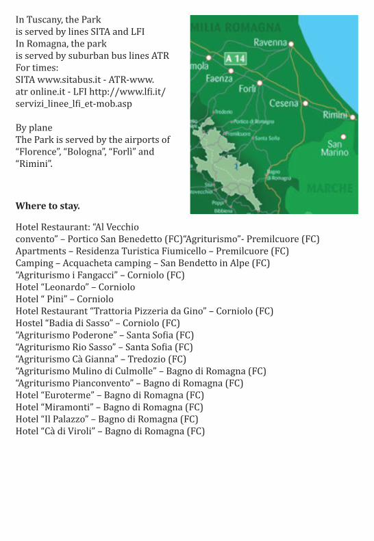
In Tuscany, the Park is served by lines SITA and LFI In Romagna, the park is served by suburban bus lines ATR For times: SITA www.sitabus.it - ATR-www.atr online.it - LFI http://www.lfi.it/servizi_linee_lfi_et-mob.asp By plane The Park is served by the airports of “Florence”, “Bologna”, “Forlì” and “Rimini”.
Where to stay.
Hotel Restaurant: “Al Vecchio convento” – Portico San Benedetto (FC)“Agriturismo”- Premilcuore (FC) Apartments – Residenza Turistica Fiumicello – Premilcuore (FC) Camping – Acquacheta camping – San Bendetto in Alpe (FC) “Agriturismo i Fangacci” – Corniolo (FC) Hotel “Leonardo” – Corniolo Hotel “ Pini” – Corniolo Hotel Restaurant “Trattoria Pizzeria da Gino” – Corniolo (FC) Hostel “Badia di Sasso” – Corniolo (FC) “Agriturismo Poderone” – Santa Sofia (FC) “Agriturismo Rio Sasso” – Santa Sofia (FC) “Agriturismo Cà Gianna” – Tredozio (FC) “Agriturismo Mulino di Culmolle” – Bagno di Romagna (FC) “Agriturismo Pianconvento” – Bagno di Romagna (FC) Hotel “Euroterme” – Bagno di Romagna (FC) Hotel “Miramonti” – Bagno di Romagna (FC) Hotel “Il Palazzo” – Bagno di Romagna (FC) Hotel “Cà di Viroli” – Bagno di Romagna (FC)
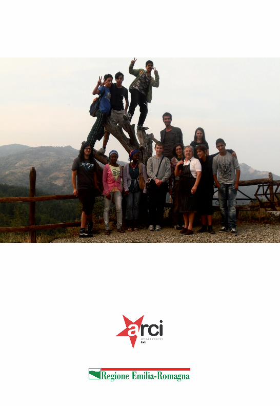
Hanno partecipato al progetto OPEN:
Said Balward Ashar Afaq Qureshi Alfio Giuffrida Aminata Dene Adjaratou Dene Raghe Mostafa Oleg Valentini Matilde Petretti Lorenzo Ravaioli Naibil El Hathout Gianluca Zaccarelli Mercedes Santos
Le attività del progetto OPEn nella provincia di Forlì-Cesena sono state realizzate a Civitella da Arci Forlì, in collaborazione con il Comune di Civitella - Assessorato alle Politiche sociali e giovanili
Il progetto OPEN è stato realizzato da Arci Emilia-Romagna con il finanziamento della Regione Emilia-Romagna - Assessorato alle politiche giovanili