SAVINO, - Laventa Esplorazioni · PDF fileA. DE VIVO, F. LO MASTRO, G. SAVINO, G. BOLDRINI Il...
9
A. DE VIVO, F. LO MASTRO, G. SAVINO, G. BOLDRINI Il fiume sotto la montagna The river under the mountain Estratto da: Kur, 9, 2007 Reprinted from: Kur, 9, 2007
Transcript of SAVINO, - Laventa Esplorazioni · PDF fileA. DE VIVO, F. LO MASTRO, G. SAVINO, G. BOLDRINI Il...
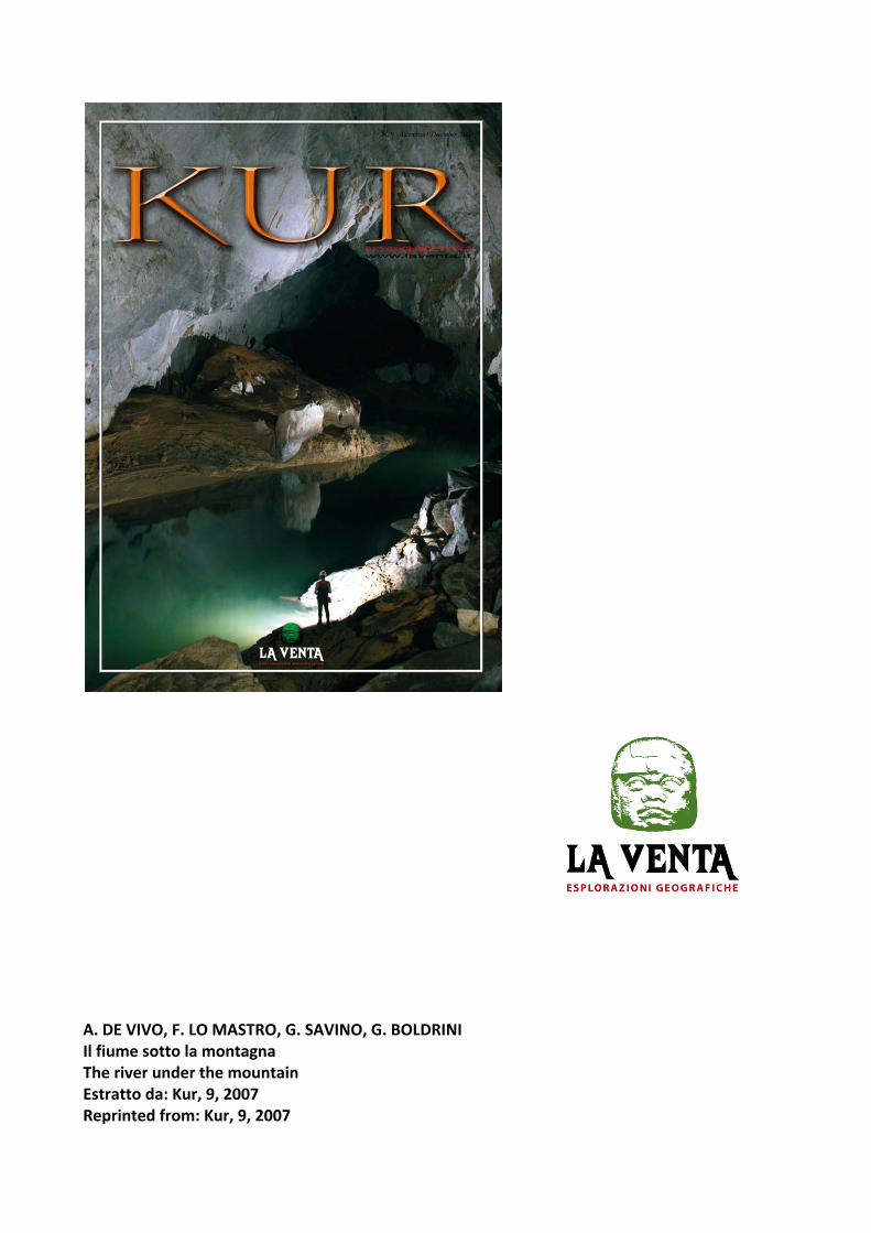
A. DE VIVO, F. LO MASTRO, G. SAVINO, G. BOLDRINI Il fiume sotto la montagna The river under the mountain Estratto da: Kur, 9, 2007 Reprinted from: Kur, 9, 2007

ES
PL
OR
AZ
ION
I G
EO
GR
AF
ICH
E
ES
PL
OR
AZ
ION
I G
EO
GR
AF
ICH
E
6
Puerto Princesa Subterranean River
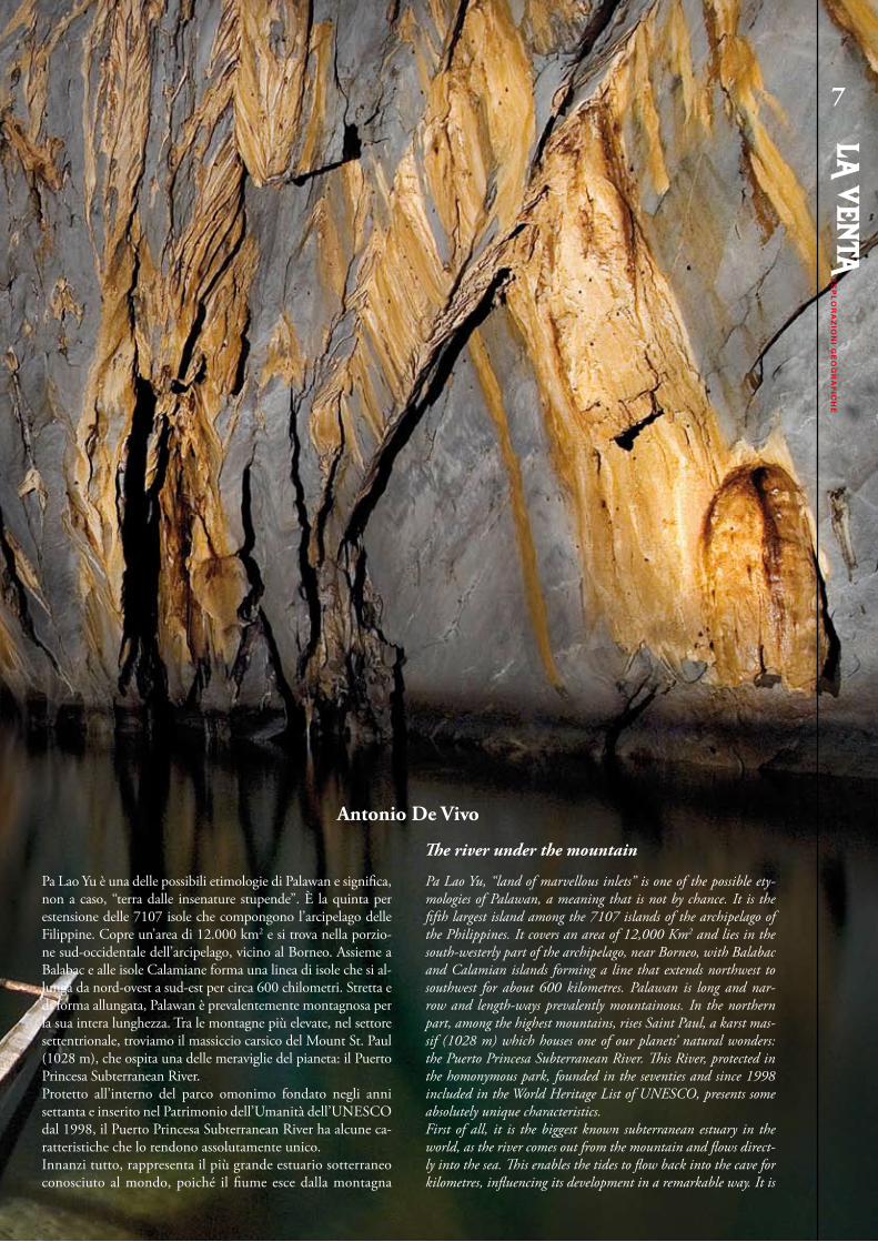
Pa Lao Yu è una delle possibili etimologie di Palawan e significa, non a caso, “terra dalle insenature stupende”. È la quinta per estensione delle 7107 isole che compongono l’arcipelago delle Filippine. Copre un’area di 12.000 km2 e si trova nella porzio-ne sud-occidentale dell’arcipelago, vicino al Borneo. Assieme a Balabac e alle isole Calamiane forma una linea di isole che si al-lunga da nord-ovest a sud-est per circa 600 chilometri. Stretta e di forma allungata, Palawan è prevalentemente montagnosa per la sua intera lunghezza. Tra le montagne più elevate, nel settore settentrionale, troviamo il massiccio carsico del Mount St. Paul (1028 m), che ospita una delle meraviglie del pianeta: il Puerto Princesa Subterranean River.Protetto all’interno del parco omonimo fondato negli anni settanta e inserito nel Patrimonio dell’Umanità dell’UNESCO dal 1998, il Puerto Princesa Subterranean River ha alcune ca-ratteristiche che lo rendono assolutamente unico.Innanzi tutto, rappresenta il più grande estuario sotterraneo conosciuto al mondo, poiché il fiume esce dalla montagna
Pa Lao yu, “land of marvellous inlets” is one of the possible ety-mologies of Palawan, a meaning that is not by chance. It is the fifth largest island among the 7107 islands of the archipelago of the Philippines. It covers an area of 12,000 Km2 and lies in the south-westerly part of the archipelago, near Borneo, with Balabac and Calamian islands forming a line that extends northwest to southwest for about 600 kilometres. Palawan is long and nar-row and length-ways prevalently mountainous. In the northern part, among the highest mountains, rises Saint Paul, a karst mas-sif (1028 m) which houses one of our planets’ natural wonders: the Puerto Princesa Subterranean River. This River, protected in the homonymous park, founded in the seventies and since 1998 included in the World Heritage List of UNESCO, presents some absolutely unique characteristics.First of all, it is the biggest known subterranean estuary in the world, as the river comes out from the mountain and flows direct-ly into the sea. This enables the tides to flow back into the cave for kilometres, influencing its development in a remarkable way. It is
Antonio De Vivo
ES
PL
OR
AZ
ION
I GE
OG
RA
FIC
HE
ES
PL
OR
AZ
ION
I GE
OG
RA
FIC
HE
7
The river under the mountain
ES
PL
OR
AZ
ION
I G
EO
GR
AF
ICH
E
ES
PL
OR
AZ
ION
I G
EO
GR
AF
ICH
E8
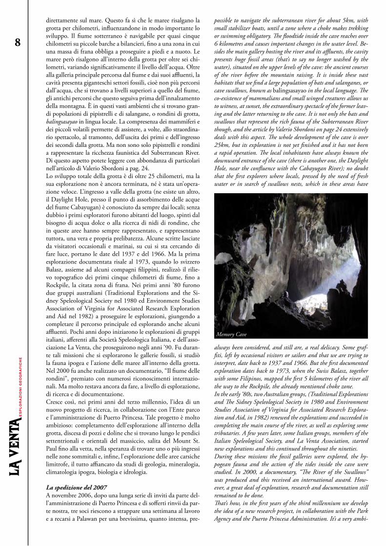
possible to navigate the subterranean river for about 5km, with small stabilizer boats, until a zone where a choke makes trekking or swimming obligatory. The floodtide inside the cave reaches over 6 kilometres and causes important changes in the water level. Be-sides the main gallery hosting the river and its affluents, the cavity presents huge fossil areas (that’s to say no longer washed by the water), situated on the upper levels of the cave: the ancient courses of the river before the mountain raising. It is inside these vast habitats that we find a large population of bats and salanganes, or cave swallows, known as balingsasayao in the local language. The co-existence of mammalians and small winged creatures allows us to witness, at sunset, the extraordinary spectacle of the former leav-ing and the latter returning to the cave. It is not only the bats and swallows that represent the rich fauna of the Subterranean River though, and the article by Valerio Sbordoni on page 24 extensively deals with this aspect. The whole development of the cave is over 25km, but its exploration is not yet finished and it has not been a rapid operation. The local inhabitants have always known the downward entrance of the cave (there is another one, the Daylight Hole, near the confluence with the Cabayugan River); no doubt that the first explorers where locals, pressed by the need of fresh water or in search of swallows nests, which in these areas have
always been considered, and still are, a real delicacy. Some graf-fiti, left by occasional visitors or sailors and that we are trying to interpret, date back to 1937 and 1966. But the first documented exploration dates back to 1973, when the Swiss Balasz, together with some Filipinos, mapped the first 5 kilometres of the river all the way to the Rockpile, the already mentioned choke zone. In the early ‘80s, two Australian groups, (Traditional Explorations and The Sidney Speleological Society in 1980 and Environment Studies Association of Virginia for Associated Research Explora-tion and Aid, in 1982) renewed the explorations and succeeded in completing the main course of the river, as well as exploring some tributaries. A few years later, some Italian groups, members of the Italian Speleological Society, and La Venta Association, started new explorations and this continued throughout the nineties. During these missions the fossil galleries were explored, the hy-pogean fauna and the action of the tides inside the cave were studied. In 2000, a documentary, “The River of the Swallows” was produced and this received an international award. How-ever, a great deal of exploration, research and documentation still remained to be done.That’s how, in the first years of the third millennium we develop the idea of a new research project, in collaboration with the Park Agency and the Puerto Princesa Administration. It’s a very ambi-
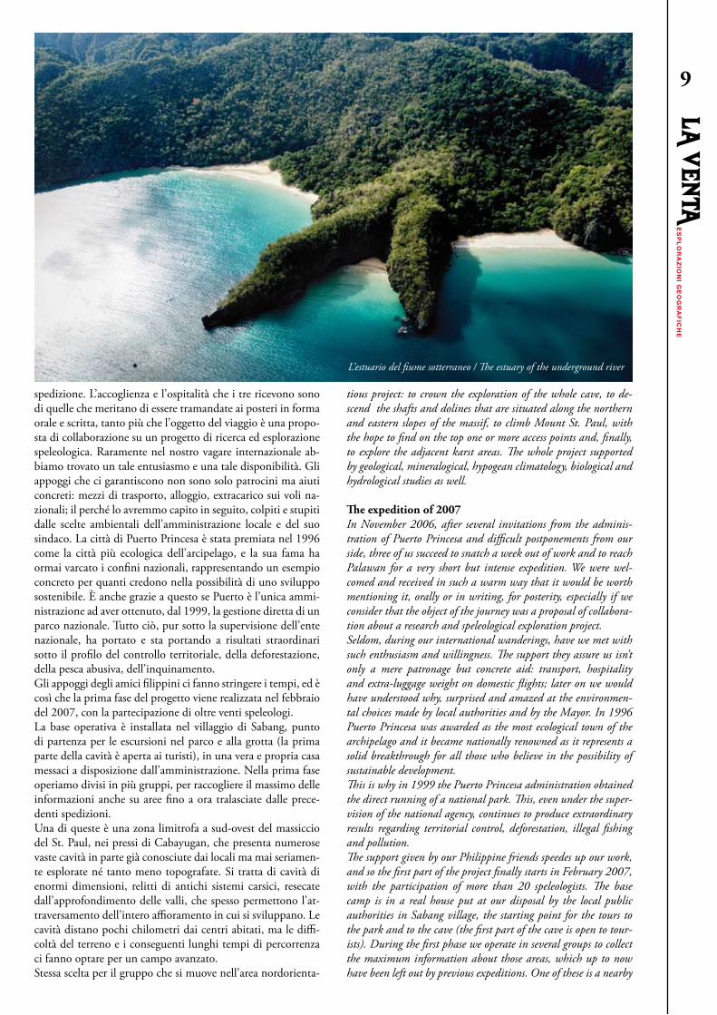
direttamente sul mare. Questo fa sì che le maree risalgano la grotta per chilometri, influenzandone in modo importante lo sviluppo. Il fiume sotterraneo è navigabile per quasi cinque chilometri su piccole barche a bilancieri, fino a una zona in cui una massa di frana obbliga a proseguire a piedi e a nuoto. Le maree però risalgono all’interno della grotta per oltre sei chi-lometri, variando significativamente il livello dell’acqua. Oltre alla galleria principale percorsa dal fiume e dai suoi affluenti, la cavità presenta giganteschi settori fossili, cioè non più percorsi dall’acqua, che si trovano a livelli superiori a quello del fiume, gli antichi percorsi che questo seguiva prima dell’innalzamento della montagna. È in questi vasti ambienti che si trovano gran-di popolazioni di pipistrelli e di salangane, o rondini di grotta, balingsasayao in lingua locale. La compresenza dei mammiferi e dei piccoli volatili permette di assistere, a volte, allo straordina-rio spettacolo, al tramonto, dell’uscita dei primi e dell’ingresso dei secondi dalla grotta. Ma non sono solo pipistrelli e rondini a rappresentare la ricchezza faunistica del Subterranean River. Di questo aspetto potete leggere con abbondanza di particolari nell’articolo di Valerio Sbordoni a pag. 24. Lo sviluppo totale della grotta è di oltre 25 chilometri, ma la sua esplorazione non è ancora terminata, né è stata un’opera-zione veloce. L’ingresso a valle della grotta (ne esiste un altro, il Daylight Hole, presso il punto di assorbimento delle acque del fiume Cabayugan) è conosciuto da sempre dai locali; senza dubbio i primi esploratori furono abitanti del luogo, spinti dal bisogno di acqua dolce o alla ricerca di nidi di rondine, che in queste aree hanno sempre rappresentato, e rappresentano tuttora, una vera e propria prelibatezza. Alcune scritte lasciate da visitatori occasionali e marinai, su cui si sta cercando di fare luce, portano le date del 1937 e del 1966. Ma la prima esplorazione documentata risale al 1973, quando lo svizzero Balasz, assieme ad alcuni compagni filippini, realizzò il rilie-vo topografico dei primi cinque chilometri di fiume, fino a Rockpile, la citata zona di frana. Nei primi anni ’80 furono due gruppi australiani (Traditional Explorations and the Si-dney Speleological Society nel 1980 ed Environment Studies Association of Virginia for Associated Research Exploration and Aid nel 1982) a proseguire le esplorazioni, giungendo a completare il percorso principale ed esplorando anche alcuni affluenti. Pochi anni dopo iniziarono le esplorazioni di gruppi italiani, afferenti alla Società Speleologica Italiana, e dell’asso-ciazione La Venta, che proseguirono negli anni ’90. Fu duran-te tali missioni che si esplorarono le gallerie fossili, si studiò la fauna ipogea e l’azione delle maree all’interno della grotta. Nel 2000 fu anche realizzato un documentario, “Il fiume delle rondini”, premiato con numerosi riconoscimenti internazio-nali. Ma molto restava ancora da fare, a livello di esplorazione, di ricerca e di documentazione. Cresce così, nei primi anni del terzo millennio, l’idea di un nuovo progetto di ricerca, in collaborazione con l’Ente parco e l’amministrazione di Puerto Princesa. Tale progetto è molto ambizioso: completamento dell’esplorazione all’interno della grotta, discesa di pozzi e doline che si trovano lungo le pendici settentrionali e orientali del massiccio, salita del Mount St. Paul fino alla vetta, nella speranza di trovare uno o più ingressi nelle zone sommitali e, infine, l’esplorazione delle aree carsiche limitrofe, il tutto affiancato da studi di geologia, mineralogia, climatologia ipogea, biologia e idrologia.
La spedizione del 2007A novembre 2006, dopo una lunga serie di inviti da parte del-l’amministrazione di Puerto Princesa e di sofferti rinvii da par-te nostra, tre soci riescono a strappare una settimana al lavoro e a recarsi a Palawan per una brevissima, quanto intensa, pre-
ES
PL
OR
AZ
ION
I GE
OG
RA
FIC
HE
ES
PL
OR
AZ
ION
I GE
OG
RA
FIC
HE
9
spedizione. L’accoglienza e l’ospitalità che i tre ricevono sono di quelle che meritano di essere tramandate ai posteri in forma orale e scritta, tanto più che l’oggetto del viaggio è una propo-sta di collaborazione su un progetto di ricerca ed esplorazione speleologica. Raramente nel nostro vagare internazionale ab-biamo trovato un tale entusiasmo e una tale disponibilità. Gli appoggi che ci garantiscono non sono solo patrocini ma aiuti concreti: mezzi di trasporto, alloggio, extracarico sui voli na-zionali; il perché lo avremmo capito in seguito, colpiti e stupiti dalle scelte ambientali dell’amministrazione locale e del suo sindaco. La città di Puerto Princesa è stata premiata nel 1996 come la città più ecologica dell’arcipelago, e la sua fama ha ormai varcato i confini nazionali, rappresentando un esempio concreto per quanti credono nella possibilità di uno sviluppo sostenibile. È anche grazie a questo se Puerto è l’unica ammi-nistrazione ad aver ottenuto, dal 1999, la gestione diretta di un parco nazionale. Tutto ciò, pur sotto la supervisione dell’ente nazionale, ha portato e sta portando a risultati straordinari sotto il profilo del controllo territoriale, della deforestazione, della pesca abusiva, dell’inquinamento. Gli appoggi degli amici filippini ci fanno stringere i tempi, ed è così che la prima fase del progetto viene realizzata nel febbraio del 2007, con la partecipazione di oltre venti speleologi.La base operativa è installata nel villaggio di Sabang, punto di partenza per le escursioni nel parco e alla grotta (la prima parte della cavità è aperta ai turisti), in una vera e propria casa messaci a disposizione dall’amministrazione. Nella prima fase operiamo divisi in più gruppi, per raccogliere il massimo delle informazioni anche su aree fino a ora tralasciate dalle prece-denti spedizioni. Una di queste è una zona limitrofa a sud-ovest del massiccio del St. Paul, nei pressi di Cabayugan, che presenta numerose vaste cavità in parte già conosciute dai locali ma mai seriamen-te esplorate né tanto meno topografate. Si tratta di cavità di enormi dimensioni, relitti di antichi sistemi carsici, resecate dall’approfondimento delle valli, che spesso permettono l’at-traversamento dell’intero affioramento in cui si sviluppano. Le cavità distano pochi chilometri dai centri abitati, ma le diffi-coltà del terreno e i conseguenti lunghi tempi di percorrenza ci fanno optare per un campo avanzato. Stessa scelta per il gruppo che si muove nell’area nordorienta-
tious project: to crown the exploration of the whole cave, to de-scend the shafts and dolines that are situated along the northern and eastern slopes of the massif, to climb Mount St. Paul, with the hope to find on the top one or more access points and, finally, to explore the adjacent karst areas. The whole project supported by geological, mineralogical, hypogean climatology, biological and hydrological studies as well.
The expedition of 2007In November 2006, after several invitations from the adminis-tration of Puerto Princesa and difficult postponements from our side, three of us succeed to snatch a week out of work and to reach Palawan for a very short but intense expedition. We were wel-comed and received in such a warm way that it would be worth mentioning it, orally or in writing, for posterity, especially if we consider that the object of the journey was a proposal of collabora-tion about a research and speleological exploration project. Seldom, during our international wanderings, have we met with such enthusiasm and willingness. The support they assure us isn’t only a mere patronage but concrete aid: transport, hospitality and extra-luggage weight on domestic flights; later on we would have understood why, surprised and amazed at the environmen-tal choices made by local authorities and by the Mayor. In 1996 Puerto Princesa was awarded as the most ecological town of the archipelago and it became nationally renowned as it represents a solid breakthrough for all those who believe in the possibility of sustainable development.This is why in 1999 the Puerto Princesa administration obtained the direct running of a national park. This, even under the super-vision of the national agency, continues to produce extraordinary results regarding territorial control, deforestation, illegal fishing and pollution.The support given by our Philippine friends speedes up our work, and so the first part of the project finally starts in February 2007, with the participation of more than 20 speleologists. The base camp is in a real house put at our disposal by the local public authorities in Sabang village, the starting point for the tours to the park and to the cave (the first part of the cave is open to tour-ists). During the first phase we operate in several groups to collect the maximum information about those areas, which up to now have been left out by previous expeditions. One of these is a nearby
L’estuario del fiume sotterraneo / The estuary of the underground river
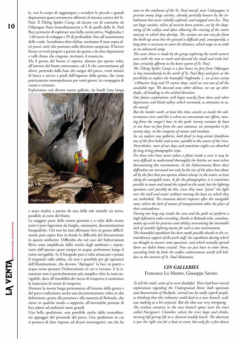
le, con lo scopo di raggiungere e scendere le piccole e grandi depressioni quasi certamente afferenti al sistema carsico del St. Paul. Il Tilting Spider Camp, ad alcune ore di cammino da Odjongan (baia immediatamente a N di quella della St. Paul Bay) permette di esplorare una bella cavità attiva, Nagbituka 1 -140 metri di sviluppo e 95 di profondità- fino all’esaurimento delle corde. Scendiamo altre doline, mettiamo il naso sopra al-tri pozzi, tutti che puntano nella direzione auspicata. Il lavoro futuro avverrà proprio a partire da queste e da altre depressioni e valli chiuse che cingono, invitanti, il massiccio. Ma il grosso del lavoro ci aspetta, almeno per questa volta, all’interno del fiume sotterraneo, ed è lì che concentriamo gli sforzi, partendo dalla base dei ranger del parco, venti minuti di barca o un’ora a piedi dall’ingresso della grotta, che viene praticamente monopolizzata per venti giorni, in compagnia di varani e scimmie.Esploriamo così diverse nuove gallerie, sia fossili (una lunga
e aerea risalita a partire da una delle sale iniziali) sia attive, parallele al corso del fiume. La maggior parte delle nostre giornate e a volte delle nostre notti è però fagocitata da lunghe, estenuanti, documentazioni fotografiche. Chi non ha mai effettuato foto in grotta difficil-mente può capire fino in fondo le difficoltà del documentare in questo ambiente. Difficoltà che nel caso del Subterranean River sono amplificate dalla vastità degli ambienti e soprat-tutto dall’operare quasi sempre in acqua, perlomeno lungo il tratto navigabile. Se il fotografo può a volte attraccare e posare il treppiede sulla sabbia, ciò non è possibile per gli operatori dell’illuminazione, che devono “dipingere” la luce su pareti e acqua senza spostare l’imbarcazione in cui si trovano. E la si-tuazione non è particolarmente più semplice oltre la zona na-vigabile, dove all’instabilità dei mezzi di trasporto si sostituisce la mancanza di mezzi di trasporto. Durante la nostra lunga permanenza all’interno della grotta e del parco realizziamo anche una documentazione video in alta definizione, grazie alla presenza e alla maestria di Rolando, che riesce in qualche modo a sopperire all’inevitabile penuria di luci adatte ad ambienti tanto grandi. Una bella spedizione, resa possibile anche dallo straordina-rio appoggio del personale del parco. Una spedizione in cui si pensava di dare risposte ad alcuni interrogativi, ma che ha
zone to the southwest of the St. Paul massif, near Cabayugan; it presents many large cavities, already partially known by the in-habitants but never reliably explored, and mapped even less. They are huge cavities, relicts of ancient karst systems, cut by the deep-ening of the valleys and often allowing the crossing of the entire outcrop in which they develop. The cavities are not very far from the built-up areas but the ground is difficult and, consequently, a long time is necessary to cover the distance, which urges us to settle at an advanced camp.The same choice is made by the group exploring the north-eastern area with the aim to reach and descend the small and wide hol-lows certainly afferent to the karst system of St. Paul. The Tilting Spider Camp is a few hours on foot from Odjongan (a bay immediately to the north of St. Paul Bay) and gives us the possibility to explore the beautiful Nagbituka 1, an active cavity -140metres long and 95 metres deep- until we run out of all the available rope. We descend some other dolines, we eye up other shafts, all heading in the wished direction. Our future explorations will begin exactly from these and other depressions and blind valleys which surround, so attractive to us, the massif. But the harder work, at least this time, awaits us inside the sub-terranean river, and this is where we concentrate our efforts, mov-ing from the ranger’s base in the park, twenty minutes by boat or one hour on foot from the cave entrance; we monopolise it for twenty days, in the company of varans and monkeys. So, we explore new galleries, both fossil (a long aerial climbfrom one of the first halls) and active, parallel to the course of the river. Nevertheless, most of our days and sometimes nights are absorbed by long tiring photographic trips. For those who have never taken a photo inside a cave it may be very difficult to understand thoroughly the hitches we meet when documenting this environment. In the Subterranean River these difficulties are increased not only by the size of the place but above all by the fact that you operate almost always in the water, at least along the navigable tract. As for the photographer, it is sometimes possible to moor and stand the tripod on the sand, but the lighting operators can’t possibly do this, since they must “paint” the light over the wall and water without moving the boat on which they are embarked. The situation doesn’t improve after the navigable zone, where the lack of means of transportation takes the place of their unsteadiness.During our long stay inside the cave and the park we perform a high definition video recording, thanks to Rolando who, somehow, makes up with his presence and ability, overcoming the inevitable lack of suitable lighting means for such a vast environment.This beautiful expedition has been made possible thanks to the ex-traordinary support of the park staff. An expedition during which we thought to answer some questions, and which actually opened doors we didn’t know existed. Now we just have to enter them, unveiling little by little the endless subterranean world still hid-den in the interior of St. Paul Mountain.
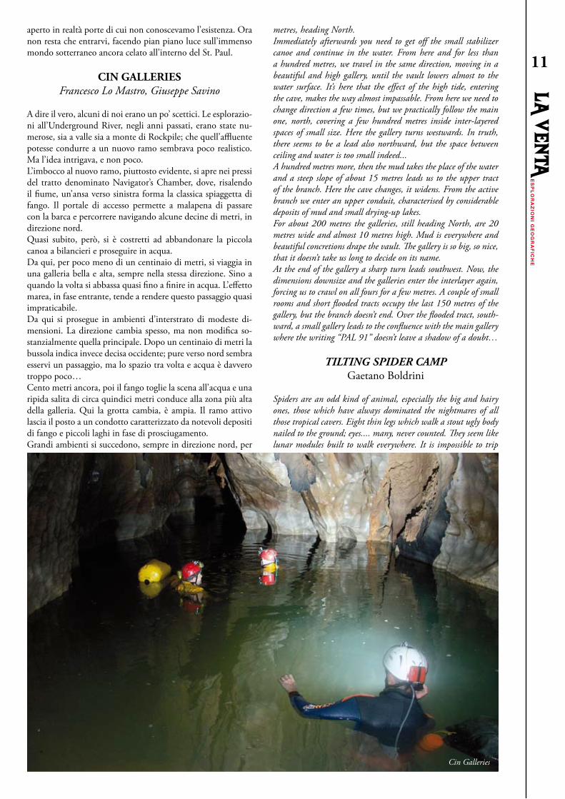
CIN GALLERIESFrancesco Lo Mastro, Giuseppe Savino
To tell the truth, some of us were doubtful. There had been several explorations regarding the Underground River, both upstream and downstream of Rockpile, carried out by really superb people, so thinking that this tributary could lead to a new branch, well, was making us a bit sceptical. But the idea was very intriguing.The evident entrance to the new branch opens near the tract called Navigator’s Chamber, where the river loops and climbs, turning left giving life to a classical muddy beach. The doorway is just the right size for a boat to enter, but only for a few dozen
ES
PL
OR
AZ
ION
I G
EO
GR
AF
ICH
E
ES
PL
OR
AZ
ION
I G
EO
GR
AF
ICH
E10
aperto in realtà porte di cui non conoscevamo l’esistenza. Ora non resta che entrarvi, facendo pian piano luce sull’immenso mondo sotterraneo ancora celato all’interno del St. Paul.
CIN GALLERIESFrancesco Lo Mastro, Giuseppe Savino
A dire il vero, alcuni di noi erano un po’ scettici. Le esplorazio-ni all’Underground River, negli anni passati, erano state nu-merose, sia a valle sia a monte di Rockpile; che quell’affluente potesse condurre a un nuovo ramo sembrava poco realistico. Ma l’idea intrigava, e non poco.L’imbocco al nuovo ramo, piuttosto evidente, si apre nei pressi del tratto denominato Navigator’s Chamber, dove, risalendo il fiume, un’ansa verso sinistra forma la classica spiaggetta di fango. Il portale di accesso permette a malapena di passare con la barca e percorrere navigando alcune decine di metri, in direzione nord.Quasi subito, però, si è costretti ad abbandonare la piccola canoa a bilancieri e proseguire in acqua. Da qui, per poco meno di un centinaio di metri, si viaggia in una galleria bella e alta, sempre nella stessa direzione. Sino a quando la volta si abbassa quasi fino a finire in acqua. L’effetto marea, in fase entrante, tende a rendere questo passaggio quasi impraticabile.Da qui si prosegue in ambienti d’interstrato di modeste di-mensioni. La direzione cambia spesso, ma non modifica so-stanzialmente quella principale. Dopo un centinaio di metri la bussola indica invece decisa occidente; pure verso nord sembra esservi un passaggio, ma lo spazio tra volta e acqua è davvero troppo poco…Cento metri ancora, poi il fango toglie la scena all’acqua e una ripida salita di circa quindici metri conduce alla zona più alta della galleria. Qui la grotta cambia, è ampia. Il ramo attivo lascia il posto a un condotto caratterizzato da notevoli depositi di fango e piccoli laghi in fase di prosciugamento.Grandi ambienti si succedono, sempre in direzione nord, per
metres, heading North.Immediately afterwards you need to get off the small stabilizer canoe and continue in the water. From here and for less than a hundred metres, we travel in the same direction, moving in a beautiful and high gallery, until the vault lowers almost to the water surface. It’s here that the effect of the high tide, entering the cave, makes the way almost impassable. From here we need to change direction a few times, but we practically follow the main one, north, covering a few hundred metres inside inter-layered spaces of small size. Here the gallery turns westwards. In truth, there seems to be a lead also northward, but the space between ceiling and water is too small indeed... A hundred metres more, then the mud takes the place of the water and a steep slope of about 15 metres leads us to the upper tract of the branch. Here the cave changes, it widens. From the active branch we enter an upper conduit, characterised by considerable deposits of mud and small drying-up lakes.For about 200 metres the galleries, still heading North, are 20 metres wide and almost 10 metres high. Mud is everywhere and beautiful concretions drape the vault. The gallery is so big, so nice, that it doesn’t take us long to decide on its name. At the end of the gallery a sharp turn leads southwest. Now, the dimensions downsize and the galleries enter the interlayer again, forcing us to crawl on all fours for a few metres. A couple of small rooms and short flooded tracts occupy the last 150 metres of the gallery, but the branch doesn’t end. Over the flooded tract, south-ward, a small gallery leads to the confluence with the main gallery where the writing “PAL 91” doesn’t leave a shadow of a doubt…
TILTING SPIDER CAMPGaetano Boldrini
Spiders are an odd kind of animal, especially the big and hairy ones, those which have always dominated the nightmares of all those tropical cavers. Eight thin legs which walk a stout ugly body nailed to the ground; eyes.... many, never counted. They seem like lunar modules built to walk everywhere. It is impossible to trip
ES
PL
OR
AZ
ION
I GE
OG
RA
FIC
HE
ES
PL
OR
AZ
ION
I GE
OG
RA
FIC
HE
11
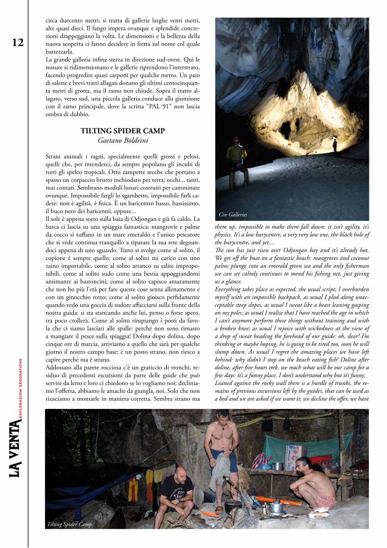
circa duecento metri; si tratta di gallerie larghe venti metri, alte quasi dieci. Il fango impera ovunque e splendide concre-zioni drappeggiano la volta. Le dimensioni e la bellezza della nuova scoperta ci fanno decidere in fretta sul nome col quale battezzarla. La grande galleria infine sterza in direzione sud-ovest. Qui le misure si ridimensionano e le gallerie riprendono l’interstrato, facendo progredire quasi carponi per qualche metro. Un paio di salette e brevi tratti allagati donano gli ultimi centocinquan-ta metri di grotta, ma il ramo non chiude. Sopra il tratto al-lagato, verso sud, una piccola galleria conduce alla giunzione con il ramo principale, dove la scritta “PAL 91” non lascia ombra di dubbio.
TILTING SPIDER CAMPGaetano Boldrini
Strani animali i ragni, specialmente quelli grossi e pelosi, quelli che, per intenderci, da sempre popolano gli incubi di tutti gli speleo tropicali. Otto zampette secche che portano a spasso un corpaccio brutto inchiodato per terra; occhi... tanti, mai contati. Sembrano moduli lunari costruiti per camminare ovunque. Impossibile fargli lo sgambetto, impossibile farli ca-dere: non è agilità, è fisica. È un baricentro basso, bassissimo, il buco nero dei baricentri, eppure...Il sole è appena sorto sulla baia di Odjongan e già fa caldo. La barca ci lascia su una spiaggia fantastica: mangrovie e palme da cocco si tuffano in un mare smeraldo e l’unico pescatore che si vede continua tranquillo a riparare la sua rete degnan-doci appena di uno sguardo. Tutto si svolge come al solito, il copione è sempre quello; come al solito mi carico con uno zaino importabile, come al solito arranco su salite impropo-nibili, come al solito sudo come una bestia appoggiandomi ansimante ai bastoncini; come al solito capisco amaramente che non ho più l’età per fare queste cose senza allenamento e con un ginocchio rotto; come al solito gioisco perfidamente quando vedo una goccia di sudore affacciarsi sulla fronte della nostra guida: si sta stancando anche lui, penso o forse spero, tra poco crollerà. Come al solito rimpiango i posti da favo-la che ci siamo lasciati alle spalle: perché non sono rimasto a mangiare il pesce sulla spiaggia! Dolina dopo dolina, dopo cinque ore di marcia, arriviamo a quello che sarà per qualche giorno il nostro campo base: è un posto strano, non riesco a capire perché ma è strano. Addossato alla parete rocciosa c’è un graticcio di tronchi, re-siduo di precedenti escursioni da parte delle guide che può servire da letto e loro ci chiedono se lo vogliamo noi; declinia-mo l’offerta, abbiamo le amache da giungla, noi. Solo che non riusciamo a montarle in maniera corretta. Sembra strano ma
them up, impossible to make them fall down: it isn’t agility, it’s physics. It’s a low barycentre, a very very low one, the black hole of the barycentre, and yet....The sun has just risen over Odjongan bay and it’s already hot. We get off the boat on a fantastic beach: mangroves and coconut palms plunge into an emerald green sea and the only fisherman we can see calmly continues to mend his fishing net, just giving us a glance.Everything takes place as expected, the usual script; I overburden myself with an impossible backpack, as usual I plod along unac-ceptable steep slopes, as usual I sweat like a beast leaning gasping on my poles; as usual I realise that I have reached the age in which I can’t anymore perform these things without training and with a broken knee; as usual I rejoice with wickedness at the view of a drop of sweat beading the forehead of our guide: oh, dear! I’m thinking or maybe hoping, he is going to be tired too, soon he will slump down. As usual I regret the amazing places we have left behind: why didn’t I stop on the beach eating fish! Doline after doline, after five hours trek, we reach what will be our camp for a few days: it’s a funny place, I don’t understand why but it’s funny.Leaned against the rocky wall there is a hurdle of trunks, the re-mains of previous excursions left by the guides, that can be used as a bed and we are asked if we want it; we decline the offer, we have
ES
PL
OR
AZ
ION
I G
EO
GR
AF
ICH
E
ES
PL
OR
AZ
ION
I G
EO
GR
AF
ICH
E12
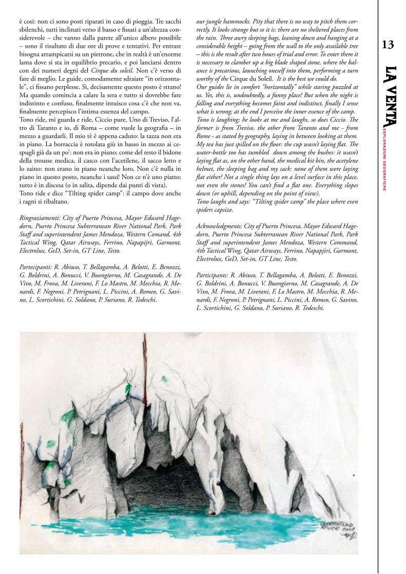
è cosi: non ci sono posti riparati in caso di pioggia. Tre sacchi sbilenchi, tutti inclinati verso il basso e fissati a un’altezza con-siderevole – che vanno dalla parete all’unico albero possibile – sono il risultato di due ore di prove e tentativi. Per entrare bisogna arrampicarsi su un pietrone, che in realtà è un’enorme lama dove si sta in equilibrio precario, e poi lanciarsi dentro con dei numeri degni del Cirque du soleil. Non c’è verso di fare di meglio. Le guide, comodamente sdraiate “in orizzonta-le”, ci fissano perplesse. Sì, decisamente questo posto è strano! Ma quando comincia a calare la sera e tutto si dovrebbe fare indistinto e confuso, finalmente intuisco cosa c’è che non va, finalmente percepisco l’intima essenza del campo. Tono ride, mi guarda e ride, Ciccio pure. Uno di Treviso, l’al-tro di Taranto e io, di Roma – come vuole la geografia – in mezzo a guardarli. Il mio tè è appena caduto: la tazza non era in piano. La borraccia è rotolata giù in basso in mezzo ai ce-spugli già da un po’: non era in piano; come del resto il bidone della trousse medica, il casco con l’acetilene, il sacco letto e lo zaino: non erano in piano neanche loro. Non c’è nulla in piano in questo posto, neanche i sassi! Non ce n’è uno piatto; tutto è in discesa (o in salita, dipende dai punti di vista). Tono ride e dice “Tilting spider camp”: il campo dove anche i ragni si ribaltano.
Ringraziamenti: City of Puerto Princesa, Mayor Edward Hage-dorn, Puerto Princesa Subterranean River National Park, Park Staff and superintendent James Mendoza, Western Comand, 4th Tactical Wing, Qatar Airways, Ferrino, Napapijri, Garmont, Electrolux, GeD, Set-in, GT Line, Testo.
Partecipanti: R. Abiuso, T. Bellagamba, A. Belotti, E. Benozzi, G. Boldrini, A. Bonucci, V. Buongiorno, M. Casagrande, A. De Vivo, M. Frova, M. Liverani, F. Lo Mastro, M. Mecchia, R. Me-nardi, F. Negroni, P. Petrignani, L. Piccini, A. Romeo, G. Savi-no, L. Scortichini, G. Soldano, P. Suriano, R. Tedeschi.
our jungle hammocks. Pity that there is no way to pitch them cor-rectly. It looks strange but so it is: there are no sheltered places from the rain. Three awry sleeping bags, leaning down and hanging at a considerable height – going from the wall to the only available tree – this is the result after two hours of trial and error. To enter them it is necessary to clamber up a big blade shaped stone, where the bal-ance is precarious, launching oneself into them, performing a turn worthy of the Cirque du Soleil. It is the best we could do.Our guides lie in comfort “horizontally” while staring puzzled at us. yes, this is, undoubtedly, a funny place! But when the night is falling and everything becomes faint and indistinct, finally I sense what is wrong; at the end I perceive the inner essence of the camp.Tono is laughing; he looks at me and laughs, so does Ciccio. The former is from Treviso, the other from Taranto and me - from Rome - as stated by geography, laying in between looking at them. My tea has just spilled on the floor: the cup wasn’t laying flat. The water-bottle too has tumbled down among the bushes: it wasn’t laying flat as, on the other hand, the medical kit bin, the acetylene helmet, the sleeping bag and my sack: none of them were laying flat either! Not a single thing lays on a level surface in this place, not even the stones! you can’t find a flat one. Everything slopes down (or uphill, depending on the point of view).Tono laughs and says: “Tilting spider camp” the place where even spiders capsize.
Acknowledgments: City of Puerto Princesa, Mayor Edward Hage-dorn, Puerto Princesa Subterranean River National Park, Park Staff and superintendent James Mendoza, Western Command, 4th Tactical Wing, Qatar Airways, Ferrino, Napapjiri, Garmont, Electrolux, GeD, Set-in, GT Line, Testo.
Participants: R. Abiuso, T. Bellagamba, A. Belotti, E. Benozzi, G. Boldrini, A. Bonucci, V. Buongiorno, M. Casagrande, A. De Vivo, M. Frova, M. Liverani, F, Lo Mastro, M. Mecchia, R. Me-nardi, F. Negroni, P. Petrignani, L. Piccini, A. Romeo, G. Savino, L. Scortichini, G. Soldano, P. Suriano, R. Tedeschi.
ES
PL
OR
AZ
ION
I GE
OG
RA
FIC
HE
ES
PL
OR
AZ
ION
I GE
OG
RA
FIC
HE
13