Paolo Tarolli CV (Ita) - intra.tesaf.unipd.itintra.tesaf.unipd.it/people/tarolli/Curriculum...
22
Legnaro (PD), 6 Gennaio 2020 1 - 22 Paolo Tarolli - Curriculum Vitae PAOLO TAROLLI PROFESSORE ASSOCIATO Settore: AGR/08 Idraulica Agraria e Sistemazioni Idraulico Forestali Settore Concorsuale 07/C1 – Ingegneria agraria, forestale e dei biosistemi Dipartimento Territorio e Sistemi Agroforestali Università degli Studi di Padova viale dell’Università 16, 35020 Legnaro (PD) ufficio: 049 8272677 / fax: 049 8272686 skype: paolopaolo525 e-mail: [email protected], [email protected] web-page: http://www.tesaf.unipd.it/en/paolo-tarolli ORCID: http://orcid.org/0000-0003-0043-5226 SOMMARIO Paolo Tarolli è Professore Associato (abilitazione I fascia ottenuta nel 2018) presso l’Università degli Studi di Padova, docente in Integrated Watershed Management e Water Resources Management, e coordinatore del gruppo di ricerca Earth Surface Processes and Society. Ricopre l’incarico di Visiting Professor presso la China University of Geosciences e la Dalian University of Technology (P.R. Cina) e di Adjunct Professor presso la University of Georgia (USA). È Vicepresidente della Natural Hazard division per la European Geosciences Union (EGU) e Vicepresidente della sezione VII (Tecnologie informatiche e della comunicazione) della Associazione Italiana di Ingegneria Agraria. Tarolli è dal 2018 Executive Editor della rivista Natural Hazards and Earth System Sciences (Copernicus). È Associate Editor delle riviste Remote Sensing (MDPI), Land Degradation & Development (Wiley) e membro del comitato editoriale di altre riviste. Tarolli è autore, dall'anno del titolo di dottorato (2006), di più di 10 articoli pubblicati (2 invited review articles) e in corso di stampa su riviste internazionali con i seguenti indici bibliometrici: Google Scholar (h- index 37, tot. citations 4131), SCOPUS (h-index 33, tot. citations 3094). Tarolli tratta tematiche inerenti la geomorfologia, l’idrologia di bacini idrografici in ambito agrario e forestale, la tecnologia laser scanner (LiDAR) per la ricostruzione di modelli digitali del terreno, la tecnica di fotogrammetria Structure from Motion per la ricostruzione di modelli digitali della superficie, GIS. È stato relatore su invito di 20 presentazioni (3 keynote talks) in istituti di ricerca internazionali e Accademie straniere di alta qualificazione (Princeton University, EPFL, AgroParisTech, Massey University, National Cheng Kung University, China University of Geosciences in Beijing, Chinese Academy of Sciences, University of Innsbruck) ed a conferenze internazionali (IGC, AAG, ISPRS, RGS-IBG, AOGS- AGU, Soil Science Society of China). È stato revisore di progetti internazionali per i seguenti Enti: U.S. National Science Foundation (NSF), International Swiss National Science Foundation (SNSF), Netherlands Organization for Scientific Research (NWO), National Science Centre (NCN) of Poland, FWF Austrian Science Fund. È membro dell’American Geophysical Union, Geological Society of America, European Geosciences Union, British Society for Geomorphology, Asia Oceania Geosciences Society (AOGS). INDICE Formazione Carriera Incarichi esterni-Leadership-Commission of Trust Fellowships-Premi-Riconoscimenti Supervisione assegni di ricerca, tesi dottorato e laurea Attività didattica Organizzazione convegni scientifici Responsabilità accademiche Comitati editoriali riviste e attività di servizio Affiliazioni Progetti di ricerca Principali collaborazioni Presentazioni su invito Pubblicazioni ………..………………………..……………………2 ………..………………………..……………………2 ………..………………………..……………………2 ………..………………………..……………………3 ………..………………………..……………………3 ………..………………………..……………………4 ………..………………………..……………………4 ………..………………………..……………………5 ………..………………………..……………………5 ………..………………………..……………………5 ………..………………………..……………………6 ………..………………………..……………………6 ………..………………………..……………………6 ………..………………………..……………………7
Transcript of Paolo Tarolli CV (Ita) - intra.tesaf.unipd.itintra.tesaf.unipd.it/people/tarolli/Curriculum...
Legnaro (PD), 6 Gennaio 2020
1 - 22 Paolo Tarolli - Curriculum Vitae
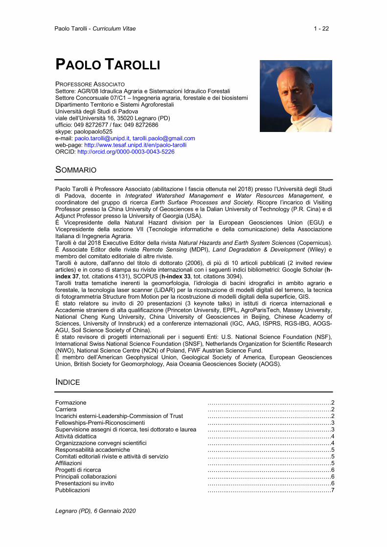
PAOLO TAROLLI PROFESSORE ASSOCIATO Settore: AGR/08 Idraulica Agraria e Sistemazioni Idraulico Forestali Settore Concorsuale 07/C1 – Ingegneria agraria, forestale e dei biosistemi Dipartimento Territorio e Sistemi Agroforestali Università degli Studi di Padova viale dell’Università 16, 35020 Legnaro (PD) ufficio: 049 8272677 / fax: 049 8272686 skype: paolopaolo525 e-mail: [email protected], [email protected] web-page: http://www.tesaf.unipd.it/en/paolo-tarolli ORCID: http://orcid.org/0000-0003-0043-5226
SOMMARIO
Paolo Tarolli è Professore Associato (abilitazione I fascia ottenuta nel 2018) presso l’Università degli Studi di Padova, docente in Integrated Watershed Management e Water Resources Management, e coordinatore del gruppo di ricerca Earth Surface Processes and Society. Ricopre l’incarico di Visiting Professor presso la China University of Geosciences e la Dalian University of Technology (P.R. Cina) e di Adjunct Professor presso la University of Georgia (USA). È Vicepresidente della Natural Hazard division per la European Geosciences Union (EGU) e Vicepresidente della sezione VII (Tecnologie informatiche e della comunicazione) della Associazione Italiana di Ingegneria Agraria. Tarolli è dal 2018 Executive Editor della rivista Natural Hazards and Earth System Sciences (Copernicus). È Associate Editor delle riviste Remote Sensing (MDPI), Land Degradation & Development (Wiley) e membro del comitato editoriale di altre riviste. Tarolli è autore, dall'anno del titolo di dottorato (2006), di più di 10 articoli pubblicati (2 invited review articles) e in corso di stampa su riviste internazionali con i seguenti indici bibliometrici: Google Scholar (h-index 37, tot. citations 4131), SCOPUS (h-index 33, tot. citations 3094). Tarolli tratta tematiche inerenti la geomorfologia, l’idrologia di bacini idrografici in ambito agrario e forestale, la tecnologia laser scanner (LiDAR) per la ricostruzione di modelli digitali del terreno, la tecnica di fotogrammetria Structure from Motion per la ricostruzione di modelli digitali della superficie, GIS. È stato relatore su invito di 20 presentazioni (3 keynote talks) in istituti di ricerca internazionali e Accademie straniere di alta qualificazione (Princeton University, EPFL, AgroParisTech, Massey University, National Cheng Kung University, China University of Geosciences in Beijing, Chinese Academy of Sciences, University of Innsbruck) ed a conferenze internazionali (IGC, AAG, ISPRS, RGS-IBG, AOGS-AGU, Soil Science Society of China). È stato revisore di progetti internazionali per i seguenti Enti: U.S. National Science Foundation (NSF), International Swiss National Science Foundation (SNSF), Netherlands Organization for Scientific Research (NWO), National Science Centre (NCN) of Poland, FWF Austrian Science Fund. È membro dell’American Geophysical Union, Geological Society of America, European Geosciences Union, British Society for Geomorphology, Asia Oceania Geosciences Society (AOGS).
INDICE Formazione Carriera Incarichi esterni-Leadership-Commission of Trust Fellowships-Premi-Riconoscimenti Supervisione assegni di ricerca, tesi dottorato e laurea Attività didattica Organizzazione convegni scientifici Responsabilità accademiche Comitati editoriali riviste e attività di servizio Affiliazioni Progetti di ricerca Principali collaborazioni Presentazioni su invito Pubblicazioni
………..………………………..……………………2 ………..………………………..……………………2 ………..………………………..……………………2 ………..………………………..……………………3 ………..………………………..……………………3 ………..………………………..……………………4 ………..………………………..……………………4 ………..………………………..……………………5 ………..………………………..……………………5 ………..………………………..……………………5 ………..………………………..……………………6 ………..………………………..……………………6 ………..………………………..……………………6 ………..………………………..……………………7
Legnaro (PD), 6 Gennaio 2020
2 - 22 Paolo Tarolli - Curriculum Vitae
FORMAZIONE
2006
Dottorato di ricerca: Gestione Ambientale dei Bacini Idrografici e Tecniche di Rappresentazione del Territorio, con tesi dal titolo “Metodi per l’analisi integrata della stabilità dei versanti”, Università degli Studi di Padova
2003 Esame di Stato: abilitazione alla professione di dottore agronomo e forestale, regolarmente iscritto all’albo dei dottori agronomi e forestali di Brescia dal 2003.
2002
Master 1° livello: Difesa e Manutenzione del Territorio, con tesi dal titolo “Impiego di sensori remoti per l’analisi e distribuzione di fenomeni particolarmente intensi sul territorio”, Università degli Studi di Padova
2001 Laurea: Scienze Forestali ed Ambientali, con tesi dal titolo “Utilizzo del Radar Meteorologico per il monitoraggio dei fenomeni meteorologici intensi”, Università degli Studi di Padova
CARRIERA
2020 2017 – presente 2017 2015 – presente 2013 – presente
2011 – 2014 2011 – 2013
2011 2010 2012 – 2013 2009 – 2011 2008
Visiting Professor: Dalian University of Technology, Beijing (P.R. China) Adjunct Professor. University of Georgia (USA) Visiting Professor: Guangzhou University, Beijing (P.R. China) Professore Associato: Dipartimento TESAF, Università degli Studi di Padova Visiting Professor: China University of Geosciences, Beijing (P.R. China) Ricercatore: Dipartimento TESAF, Università degli Studi di Padova Visiting Professor: Earth Sciences Dep., National Cheng Kung University (Taiwan) Visiting Professor: School of Architecture, Civil and Environmental Engineering, École Polytechnique Fédérale de Lausanne (EPFL), Switzerland Ricercatore Marie Curie: Institute of Inland Waters, Hellenic Centre for Marine Research (Greece) Professore Aggregato: Università Politecnica delle Marche Professore a Contratto: Università Politecnica delle Marche Visiting Scholar: Civil Engineering Dept. and St. Anthony Falls Laboratory, University of Minnesota, USA
2006 – 2010 2005
2005
Assegnista di Ricerca: Dipartimento TESAF, Università degli Studi di Padova Visiting Scholar: EES Dept., New Mexico Tech, USA Visiting Scholar: Civil and Environmental Engineering Dept., Utah State University, USA
INCARICHI ESTERNI – LEADERSHIP – COMMISSION OF TRUST
2019 – presente 2018 – presente 2018 2018 – presente 2016 – 2019 2015 – presente
Vice-Presidente Natural Hazards division, European Geosciences Union (EGU). Coordinatore del gruppo di ricerca Earth Surface Processes and Society (https://www.linkedin.com/in/earthsurfs/) Membro del Panel NERC: NERC-Newton Fund (UK) Vice-Presidente VII sezione (Tecnologie informatiche e della comunicazione), Associazione Italiana Ingegneria Agraria. Chair of the European Geosciences Union SSS subdivision SSS12: Material and Methods in Soil Science Chair of the European Geosciences Union NH subdivision NH6: Remote Sensing & Hazards
2014 – presente Evaluator: Montpellier SupAgro - INRA (France); University of Trieste (Italy); Ecole Polytechnique Fédérale de Lausanne (Switzerland); University of Genova (Italy)
2014 Director: UNIPD-NCKU (Italy-Taiwan) Joint Summer School 2014 “Natural Hazards in the Italian Alps”
2013 Director: EGU Summer School 2013 “Understanding Earth-Surface Processes in the Alpine Environment from High Resolution Topography” (http://intra.tesaf.unipd.it/cms/summeregu2013/)
2013 – Review panel member: U.S. National Science Foundation (NSF), Netherlands Organization for Scientific Research (NWO), National Science Centre (NCN) of Poland, Natural Sciences and Engineering Research Council of Canada, Swiss National Science Foundation (SNSF), FWF Austrian Science Fund, EU
Legnaro (PD), 6 Gennaio 2020
3 - 22 Paolo Tarolli - Curriculum Vitae
Commission. 2011 Evaluator: PhD committee evaluation panel, Ecole Nationale Supérieure des Mines
de Saint-Etienne, Alès (France). 2011 Evaluator: Master of Science committee evaluation panel, Ecole Polytechnique
Fédérale de Lausanne (Switzerland)
FELLOWSHIPS
2014 Visiting Professor Appointment Agreement of Distinguished Scholars at China University of Geosciences in Beijing (P.R. China)
2013 Visiting Professor Appointment Agreement of Distinguished Scholars at National Cheng Kung University (Taiwan)
2010 Marie Curie Fellow – Excellence Grant for Experienced Researcher at the Hellenic Center for Marine Research (Greece)
PREMI – RICONOSCIMENTI
2019 2018 2018 2017 2017 2017
2016 2015
Publons Peer Review Awards in Cross-Field and in Geosciences Publons Peer Review Awards in Geosciences and in Environment/Ecology Outstanding Contribution in Reviewing for the journal Science of the Total Environment, Land Use Policy, Geomorphology, Environmental Research, Int. J. Appl. Earth Obs. And Geoinf., Int. J. Disaster Risk Reduction Outstanding Editor Journal of Mountain Science Outstanding Contribution in Reviewing for the journal Adv. Wat. Res., J. of Hydrology Publons Peer Review Awards in Environmental Science, Remote Sensing, and Earth and Planetary Science Outstanding Contribution in Reviewing for the journal Catena Outstanding Contribution in Reviewing for the journal Geomorphology, Earth Science Reviews
2012 Best Poster Award, XXXIII Italian Conference of Hydraulics and Hydraulic Constructions
2011 Editors’ Citation for Excellence in Refereeing for WRR given by American Geophysical Union
2010 Outstanding Reviewer for the Journal of Hydrologic Engineering, ASCE 2010 Best Poster Award, XXXII Italian Conference of Hydraulics and Hydraulic
Constructions SUPERVISIONE ASSEGNI DI RICERCA, TESI DI DOTTORATO E DI LAUREA Assegni di ricerca Giulia Sofia (2013-2018) (EGU Arne Richter Award 2019), Sara Cucchiaro (2019-2021).
Dottorandi Supervisore: Luca Mauri (2019-2022), Zhang Qifei (2018-2021), Anton Pijil (2017-2020), Wenfang Cao (2017-2019), Giulia Roder (2016-2018), Massimo Prosdocimi (2014-2017) presso l’Università di Padova Co-Supervisore: Kamila Pawłuszek (2017-2019) presso Wroclaw University of Environmental and Life
Sciences; Jie Xiang (2015-2018) presso China University of Geosciences in Beijing; Jin Wang (2014-2018) presso Chinese Academy of Science; Young-Sing Cheng (2014-2019) presso National Cheng Kung University; Ke Li (2013- 2015) presso China University of Geosciences in Beijing
Tesi di laurea Giacomo Nalin (2019), Eugenio Straffelini (2018), Edoardo Quarella (2018), Gaetano Imperatore (2018), Luca Mauri (2018), Michele Tosoni (2017), Loris Torresani (2017), Francesca Breda (2017), Elena Feo (2017), Manuel Stefani (2017), Jessica de Marco (2016), Federica Varisco (2016), Davide Todeschini (2016), Marco Cecchin (2016), Giulia Lo Re (2016), Federica Basso (2016), Nicoletta Pradetto Sordo (2016), Gianluca Favaro (2015), Alberto Bollettin (2015), Giulia Roder (2014), Valeria Contessa (2014), Francesca Savio (2013), Massimo Prosdocimi (2013) presso Università di Padova.
Legnaro (PD), 6 Gennaio 2020
4 - 22 Paolo Tarolli - Curriculum Vitae
Manuela Mancini (2012) e Francesca Brutti (2012) presso Università Politecnica delle Marche. ATTIVITÀ DIDATTICA
2018 – presente 2017 2016 2014 – presente 2014 – presente 2014 – presente 2013 2013 2013 2013 2013 2011 – presente 2011 – 2013
Water Resources Management, Università di Padova & University of Georgia (48 hr, 6 CFU) Earth surface processes analysis using Remote Sensing & GIS, Guangzhou University, P.R. China (16 hr) Digital Terrain Analysis of Anthropogenic Landscapes, European Geoscience Union - EGU General Assembly (1.5 hr) Water Resources Management, Università di Padova (48 hr, 6 CFU) Applicazioni GIS in agricoltura, Università di Padova (32 hr, 4 CFU) Digital Terrain Analysis, China University of Geosciences in Beijing, P.R. China (32 hr, 2 credits) NCKU-UNIPD Joint Summer School, Università di Padova Digital Geomorphology and Statistical Analysis, China University of Geosciences in Beijing, P.R. China (32 hr, 2 credits) Digital Terrain Analysis, National Cheng Kung University, Taiwan (50 hr, 3 credits) NCKU-UNIPD Joint Summer School, National Cheng Kung University, Taiwan EGU Summer School 2013, Università di Padova Integrated Watershed Management, Università di Padova (48 hr, 6 CFU) Geomorphometry, Centro Interdipartimentale di Ricerca in Geomatica (C.I.R.G.E.O.), Università di Padova.
2012 – 2013 Sistemazioni Idraulico-Forestali, Università Politecnica delle Marche (54 hr, 6 CFU) 2009 – 2011 Sistemazioni Idraulico-Forestali, Università Politecnica delle Marche (45 hr, 5 CFU)
ORGANIZZAZIONE DI CONVEGNI SCIENTIFICI
2019 2018
2018 2018 2017
Convener & Chairperson: session NH6.1. Application of remote sensing and Earth-observation data in natural hazard and risk studies (EGU General Assembly) Primary Convener: Fingerprinting the Anthropocene: Observing and Understanding Social Change Across Earth's Landscapes (AGU Fall Meeting) Convener & Chairperson: session NH6.1. Application of remote sensing and Earth-observation data in natural hazard and risk studies (EGU General Assembly) Convener & Chairperson: session SSS2.3. Agricultural terraces of the world. Their pedological, geomorphological and hydrological role (EGU General Assembly) Convener & Chairperson: session HS2.2.3 Lowlands: A hydrologic challenge in the global environmental change era (EGU General Assembly) Convener & Chairperson: session HS2.2.3 Lowlands: A hydrologic challenge in the global environmental change era (EGU General Assembly)
2017 Convener & Chairperson: session SSS2.16/GM7.7/HS11. Agricultural terraces of the world. Their pedological, geomorphological and hydrological role (co-organized) (EGU General Assembly)
2017 Convener & Chairperson: session NH6.1/CR2.7/GI2.8/HS11.29/SM5.7/SSS12.20 Application of remote sensing and Earth-observation data in natural hazard and risk studies (EGU General Assembly)
2017 Co-Convener & Chairperson: session NH3.12 Landslide and Landslide Susceptibility Interactions with Transport Lines (EGU General Assembly)
2017 Co-Convener & Chairperson: session SSS10.8/BG9.6/HS9.11 Soil Erosion, hydrological processes and biological degradation in worldwide vineyards (EGU General Assembly)
2016 2015
Convener & Chairperson: session SSS2.10/GM6.8/HS11.29/NH3.19 Agricultural terraces of the world. Their pedological, geomorphological and hydrological role (EGU General Assembly) Convener & Chairperson: session GM4.1 Human-Landscape interaction in the Anthropocene (EGU General Assembly)
2015 Convener & Chairperson: session SSS2.5/GM6.6/HS12.3 Agricultural terraces of the world. Their pedological, geomorphological and hydrological role (EGU General Assembly)
2014 Convener & Chairperson: session GM4.1/HS9.12/SSS9.18 Human-Earth interaction from the Pleistocene to the Anthropocene: state of the science and future direction
Legnaro (PD), 6 Gennaio 2020
5 - 22 Paolo Tarolli - Curriculum Vitae
(EGU General Assembly) 2014 Co-Convener: session GM2.1 Digital Landscapes: Insights into geomorphological
processes from quantitative interrogation and use (EGU General Assembly) 2013 Convener & Chairperson: session GM4.2/SSS6.12 Landscape in the Anthropocene:
state of the art and future directions (EGU General Assembly) 2013 Co-Convener: session GM2.1 Digital Landscapes: Insights into geomorphological
processes from high-resolution topography, quantitative interrogation and geomorphological mapping (EGU General Assembly)
2012 Co-Convener & Chairperson: session GM2.1 Digital Landscapes: Quantitative Interrogation and Use to Examine Geomorphic Processes (EGU General Assembly)
2011 Co-Convener & Chairperson: session GM2.2/NH10.3/PS10.2 Digital Landscapes: From Laser Scanning and High-resolution Measurement Technologies to Quantitative Interrogation of Geomorphic Processes (EGU General Assembly)
2007 Convener & Chairman: session H43E/H51L/H52E Remotely Sensed DTMs for Hydrogeomorphic Applications (AGU Fall Meeting)
RESPONSABILITÀ ACCADEMICHE
2019 – 2023 2017 – 2022 2017 – 2022 2015
Coordinatore Commissione Terza Missione e Comunicazione del Dip. TESAF dell’Università di Padova Coordinatore Scientifico del Memorandum of Understanding tra Massey University (NZ), University of Lincoln (UK) e Università di Padova. Coordinatore Scientifico del Memorandum of Understanding tra China University of Geosciences e Università di Padova. Membro commissione di valutazione della ricerca VQR di dipartimento. Dept. of Land, Environment, Agriculture and Forestry, Università di Padova.
2012 – 2019 Membro della commissione internazionalizzazione di dipartimento. Dept. of Land, Environment, Agriculture and Forestry, Università di Padova.
COMITATI EDITORIALI RIVISTE
2018 – 2018 – 2017 –
Executive Editor: NHESS (Copernicus) Associate Editor: Land Degradation & Development (Wiley) Associate Editor & Advisory Board Member: Remote Sensing (MDPI)
Editorial Board Member: iScience (Cell Press), Earth Surface Processes and Landforms (Wiley), Anthropocene (Elsevier), Heliyon (Cell Press), Journal of Mountain Science (Springer), Quaternary (MDPI).
ATTIVITÀ DI SERVIZIO
2006 – Reviewer (journals): Science, Nature Communications, Scientific Reports, Earth Science Review, Remote Sensing of Environment, Science of the Total Environment, Remote Sensing, Geomorphology, Water Resources Research, Earth Surface Processes and Landforms, Catena, Geoderma, ed altri. (Publons profile: https://publons.com/researcher/1191792/paolo-tarolli)
AFFILIAZIONI
Vicepresidente – Natural Hazard division European Geosciences Union (EGU) 2019 - presente Vicepresidente – sezione VII (Tecnologie informatiche e della comunicazione) della Associazione Italiana di Ingegneria Agraria -- American Geophysical Union, 2005 - presente Asian Oceania Geosciences Society, 2012 - presene British Society for Geomorphology, 2011 - presente European Geosciences Union, 2006 - presente
Legnaro (PD), 6 Gennaio 2020
6 - 22 Paolo Tarolli - Curriculum Vitae
Geological Society of America, 2005 - 2013 Italian Society of Agricultural Engineering, 2012 - presente
PROGETTI DI RICERCA (ultimi 5 anni)
2019 – 2022 2019 – 2022 2018 – 2023 2018 – 2021 2016 – 2018 2014 – 2020
SOiLUTION SYSTEM - Innovative solutions for soil erosion risk mitigation and a better management of vineyards in hills and mountain landscapes (PSR Veneto 2014-2020) 450,000 € (Coordinatore Scientifico) FITOCHE - From field to cheese (PSR Veneto 2014-2020) 300,000 € (PI - WP4) TerrACE - Terrace Archaeology and Culture in Europe (EU H2020 ERC-AdG) 2,600,000 € (PI - WP1) ViTe - Vineyard Terraced landscapes: understanding the Environmental constraints to improve sustainable managements (University of Padova) 60,000€ (PI) HighLandDEM - High-resolution Digital Elevation Models (DEM) in rainfed Mediterranean cultivated Landscapes for long-term monitoring of artificial features with hydrological impact (ENVIMED French cooperation initiative) 18,000€ (PI - WP2) NIP - New industrial plan for dairy sector (POR FESR – Veneto Region) 608,024€ (team member)
PRINCIPALI COLLABORAZIONI
Ciprian Margarint, geomorphology and hazards, Alexandru Ioan Cuza University of Iasi (Romania) Erle C. Ellis, Anthropocene debate, University of Maryland (USA) Federico Preti, agricultural terraces, University of Florence (Italy) Ian Fuller, anthropogenic alluvium analysis with lidar, Massey University (New Zealand) Jean-Stéphane Bailly, remote sensing analysis of agricultural landscapes, AgroParisTech (France) Jianping Chen, open-pit mining monitoring with UAV, China University of Geosciences (P.R. China) Mark Macklin, floods & human health in anthropogenic landscapes, University of Lincoln (UK) Marco Cavalli, Earth surface processes analysis with lidar, CNR Irpi Padova (Italy) Nunzio Romano, surface runoff in agriculture, University of Naples Federico II (Italy) Wenwu Zhao, geography & sustainability, Beijing Normal University (P.R. China) Xiangzhou Xu, soil and water conservation, Dalian University of Technology (P.R. China) Zhifeng Wu, human-induced land-use change effect on the environment, Guangzhou Univ. (P.R. China) PRESENTAZIONI SU INVITO
Convegni scientifici internazionali
2019 2018 2017
2016 2016
2015
2015 2012
High resolution geomorphologic characterization of conservation agriculture. General Assembly 2019 of the Soil Science Society of China, Dalian (PR China). Observing and understanding the impact of socio-economic change on Earth and human health. Water and Planteary Health: A Catchment Systems Approach symposium - University of Lincoln, Lincoln (UK). The geomorphology of humanity. The 33rd Romanian Symposium of Geomorphology, Iasi (Romania). Keynote talk Roads and agricultural terraces in the mountain areas of the world: their geomorphological and hydrological role. The 33rd International Geographical Congress, Beijing (P.R. China). Keynote talk Hillslope Processes in Anthropogenic Landscapes. AAG Annual Meeting 2016, San Francisco (USA). High-resolution topography for understanding Earth surface processes: Opportunities and challenges. ISPRS Geospatial Week 2015, Montpellier (FR). Keynote talk Geomorphology & Anthropocene. RGS-IBG Annual International Conference, Exeter (UK). Opportunities and challenges from high-resolution topography for understanding earth surface processes. AOGS – AGU (WPGM) Joint Assembly 2012, Singapore.
Istituti di Ricerca ed Accademie internazionali
2019 2019
Humans and the Earth’s Surface. Princeton University (USA). (host: Amilcare Porporato) High-resolution topography for understanding Earth surface processes: opportunities and challenges. Dalian University and Technology (P.R. China). (host: Xiangzhou Xu)
Legnaro (PD), 6 Gennaio 2020
7 - 22 Paolo Tarolli - Curriculum Vitae
2017 2016 2015 2015 2014 2013 2012
2011
The Topographic Signature of Humanity. Beijing Normal University (P.R. China). (host: Wenwu Zhao) Earth surface processes in anthropogenic landscapes. Guangzhou University (P.R. China). (host: Wu Zhifeng) High-resolution topography for understanding Earth surface processes: opportunities and challenges. Innsbruck Summer School of Alpine Research 2015. (host: University of Innsbruck, Faculty of Geo- and Atmospheric Sciences & International Society for Photogrammetry and Remote Sensing - ISPRS) Anthropogenic Landscapes: critical issues and future challenges for Earth Science and Society. Massey University (New Zealand). (host: Ian Fuller) Anthropogenic Landscapes: critical issues and future challenges for Earth Science and Society. Institute of Mountain Hazards and Environment, Chinese Academy of Sciences, Chengdu. (host: Peng Cui) High-resolution topography: the next chapter for the Earth science. China University of Geosciences, Beijing. (host: Chen Jianping) Natural and Engineered Landscapes: new challenges from LiDAR for understanding Earth Surface Processes in the Anthropocene. National Cheng Kung University, Department of Earth Science, Tainan (Taiwan). (host: Ching-Weei Lin) New opportunity and future challenges from high-resolution topography for the analysis of Earth Surface Processes. Central Geological Survey, Taipei (Taiwan). (host: Chao-Tsiung Lin)
2011 New opportunity and future challenges from high-resolution topography for the analysis of Earth Surface Processes. National Cheng Kung University, Department of Earth Science, Tainan (Taiwan, R.O.C.). (host: Ching-Weei Lin)
2011 New opportunity and future challenges from high-resolution topography for the analysis of Earth Surface Processes. AgroParisTech, Montpellier, France. (host: Jean-Stephane Bailly)
2011 New opportunities but also challenges from high-resolution topography. École Polytechnique Fédérale de Lausanne EPFL, Switzerland. (host: Andrea Rinaldo)
2010 High-resolution topography: new opportunities, issues and challenge in the Earth Science. Institute of Inland Waters, Hellenic Centre for Marine Research, Greece. (host: Emmanouil Anagnostou)
2010 2008
Semi-automatic methods for geomorphic features extraction: new opportunities from high-resolution topography. CNR-IRPI. Perugia, Italy. (host: Fausto Guzzetti) High-resolution topography: new opportunities, issues, and future trends. Civil Engineering Dept. and St. Anthony Falls Laboratory, University of Minnesota, Minneapolis, USA. (host: Efi Foufoula-Georgiou)
PUBBLICAZIONI (SINTESI)
Paolo Tarolli è autore, dall'anno del titolo di dottorato (2006), di più di 100 articoli pubblicati (2 revisioni su invito, 8 editorial di special issue) e in corso di stampa su riviste internazionali con i seguenti indici bibliometrici: Google Scholar (h-index 37, totale citazioni 4131), SCOPUS (h-index 33, totale citazioni 3094). Ha pubblicato anche 1 recensione di film e 3 book review su riviste internazionali, 9 articoli su riviste divulgative nazionali, 12 articoli in libri, 20 articoli in atti di convegni, e 159 contributi (8 su invito) a congressi internazionali/nazionali (45 presentazioni orali, 114 poster). PUBBLICAZIONI *corresponding author
Articoli in revisione o in preparazione 1. Tarolli*, P., Sofia, G. Potential responses to sediment dynamics in terraced agricultural landscapes:
high-resolution topography to support rural development planning. 2. Niculiță*, M., Mărgărint, M.C., Tarolli, P. Using UAV and LIDAR data for gully geomorphic changes
monitoring.
Articoli pubblicati su riviste internazionali peer-reviewed
2020
1. Cao*, W., Sofia, G., Tarolli, P. (2020). Geomorphometric characterization of natural and anthropogenic land cover. Progress in Earth and Planetary Science.
Legnaro (PD), 6 Gennaio 2020
8 - 22 Paolo Tarolli - Curriculum Vitae
2. Xiangzhou*, X., Yulei, M., Wenjun, Y., Hongwu, Z., Tarolli, P., Yunzhong, J., Qiao, Y. (2020). Qualifying mass failures on loess gully sidewalls using laboratory experimentation. Catena, doi:10.1016/j.catena. 2019.104252.
3. Borsato*, E., Zucchinelli, M., D'Ammaro, D., Giubilato, E., Zabeo, A., Criscione, P., Pizzol, L., Cohen, Y., Tarolli, P., Lamastra, L., Marinello, F. (2020). Use of Multiple Indicators to compare Sustainability Performance of Organic vs Conventional Vineyard Management. Science of the Total Environment, doi: 10.1016/j.scitotenv.2019.135081.
4. Pijl*, A., Bailly J.S., Feurer, D., El Maaoui M.A., Boussema M.R., Tarolli, P. (2020). TERRA: Terrain Extraction from elevation Rasters through Repetitive Anisotropic filtering. International Journal of Applied Earth Observation and Geoinformation, 84, 101977, doi: 10.1016/j.jag.2019.101977.
5. Zhao*, W., Ding, J., Wang, Y., Jia, L., Cao, W., Tarolli, P. (2020). Ecological water conveyance drives human-water system evolution in the Heihe watershed, China. Environmental Research, 182, 109009, doi: 10.1016/j.envres.2019.109009.
2019
6. Mauri, L., Sallustio, L., Tarolli*, P. (2019). The geomorphologic forcing of wild boars. Earth Surface Processes and Landforms, 44, 2085 – 2094, doi:10.1002/esp.4623.
7. Du*, J., Watts, J.D., Lu, H., Jiang, L., Tarolli, P. (2019). Editorial for Special Issue: “Remote Sensing of Environmental Changes in Cold Regions”. Remote Sensing, 11, 2165, doi:10.3390/rs11182165 (Special Issue Editorial)
8. Du, J., Watts, J.D., Jiang*, L., Lu, H., Cheng, X., Duguay, C., Farina, M., Qiu, Y., Kim, Y., Kimball, J.S., Tarolli, P. (2019). Remote Sensing of Environmental Changes in Cold Regions: Methods, Achievements and Challenges. Remote Sensing, 11, 1952, doi:10.3390/rs11161952 (Review Article)
9. Xiang*, J., Li, S., Xiao, K., Chen, J., Sofia, G., Tarolli, P. (2019). Quantitative Analysis of Anthropogenic Morphologies Based on Multi-Temporal High-Resolution Topography. Remote Sensing, 11, 1493, doi: 10.3390/rs11121493.
10. Torresani*, L., Wu, J., Masin, R., Penasa, M., Tarolli, P. (2019). Estimating soil degradation in montane grasslands of North-eastern Italian Alps (Italy). Heliyon, 5(6), e01825, doi:10.1016/j.heliyon.2019.e01825.
11. Wu*, J., Song, M., Ma, W., Zhang, X., Shen, Z., Tarolli, P., Wurst, S., Shi, P., Ratzmann, G., Feng, Y., Li, M., Wang, X., Tietjen, B. (2019). Plant and soil's δ15N are regulated by climate, soil nutrients, and species diversity in alpine grasslands on the northern Tibetan Plateau. Agriculture, Ecosystems and Environment, 281, 111 – 123, doi:10.1016/j.agee.2019.05.011.
12. Yang*, X., Lu, X., Ran, L., Tarolli, P. (2019). Geomorphometric Assessment of the Impacts of Dam Construction on River Disconnectivity and Flow Regulation in the Yangtze Basin. Sustainability, 11, 3427, doi:10.3390/su11123427.
13. Yang*, X., Lu, X., Park, E., Tarolli, P. (2019). Impacts of Climate Change on Lake Fluctuations in the Hindu Kush-Himalaya-Tibetan Plateau. Remote Sensing, 11, 1082, doi:10.3390/rs11091082.
14. Roder*, G., Hudson, P., Tarolli, P. (2019). Flood risk perceptions and the willingness to pay for flood insurance in the Veneto region of Italy. International Journal of Disaster Risk Reduction, 37, 101172, doi: 10.1016/j.ijdrr.2019.101172.
15. Pijl*, A., Tosoni, M., Roder, G., Sofia, G., Tarolli, P. (2019). Design of Terrace Drainage Networks Using UAV-Based High-Resolution Topographic Data. Water, 11, 814, doi:10.3390/w11040814.
16. Tarolli*, P, Cavalli, M., Masin, R., (2019). High-resolution morphologic characterization of conservation agriculture. Catena, 172, 846–856, doi:10.1016/j.catena.2018.08.026.
17. Tarolli*, P., Cao, W., Sofia, G., Evans, D., Ellis, EC. (2019). From features to fingerprints: a general diagnostic framework for anthropogenic geomorphology. Progress in Physical Geography, 43, 95–128, doi: 10.1177/0309133318825284.
18. Sofia*, G., Ragazzi, F., Giandon, P., Dalla Fontana, G., Tarolli, P. (2019). On the linkage between runoff generation, land drainage, soil properties, and temporal patterns of precipitation in agricultural floodplains. Advances in Water Resources, 124, 120–138, doi:10.1016/j.advwatres.2018.12.003
19. Borsato*, E., Giubilato, E., Zabeo, A., Lamastra, L., Criscione, P., Tarolli, P., Marinello, F., Pizzol, L. (2019). Comparison of Water-focused Life Cycle Assessment and Water Footprint Assessment: The case of an Italian wine. Science of the Total Environment, 666, 1220–1231, doi:10.1016/j.scitotenv.2019.02.331.
20. Pijl*, A., Barneveld, P., Mauri, L., Borsato, E., Grigolato, S., Tarolli, P. (2019). Estimating the impact of mechanization on soil loss in vineyards terraced landscapes. Cuadernos de Investigación Geográfica, 45, 287–308, doi: 10.18172/cig.3774.
21. Li, M., Wu*, J., Song, C., He, Y., Niu, B., Fu, G., Tarolli, P., Tietjen, B., Zhang, X. (2019). Temporal Variability of Precipitation and Biomass of Alpine Grasslands on the Northern Tibetan Plateau. Remote Sensing, 11, 360, doi:10.3390/rs11030360.
22. Viero*, D.P., Roder, G., Matticchio, B., Defina, A., Tarolli, P (2019). Floods, landscape modifications and population dynamics in anthropogenic coastal lowlands: The Polesine (northern Italy) case study. Science of the Total Environment, 651, 1435–1450, doi:10.1016/j.scitotenv.2018.09.121.
Legnaro (PD), 6 Gennaio 2020
9 - 22 Paolo Tarolli - Curriculum Vitae
2018
23. Tarolli*, P (2018). Agricultural Terraces Special Issue Preface. Land Degradation and Development, 29, 3544–3548, doi:10.1002/ldr.3129. (Special Issue Editorial)
24. Pawłuszek*, K., Borkowski, A., Tarolli, P. (2018). Sensitivity analysis of automatic landslide mapping: numerical experiments towards the best solution. Landslides, 15, 1851–1865, doi: 10.1007/s10346-018-0986-0.
25. Lo Re, G., Fuller*, I.C., Sofia, G., Tarolli, P. (2018). High-resolution mapping of Manawatu palaeochannels. New Zealand Geographer, 74, 77–91, doi:10.1111/nzg.12186.
26. Pijl*, A., Brauer, C.C., Sofia, G., Teuling, A.J., Tarolli, P. (2018). Hydrologic impacts of changing land use and climate in the Veneto lowlands of Italy. Anthropocene, 22, 20–30, doi: 10.1016/j.ancene.2018.04.001.
27. Giordan*, D., Hayakawa, Y., Nex, F., Tarolli, P. (2018). Preface: The use of remotely piloted aircraft systems (RPAS) in monitoring applications and management of natural hazards. Natural Hazards and Earth System Sciences, 18, 3085–3087, doi:10.5194/nhess-18-3085-2018. (Special Issue Editorial)
28. Giordan*, D., Hayakawa, Y., Nex, F., Remondino, F., Tarolli, P. (2018). Review article: The use of remotely piloted aircraft systems (RPASs) for natural hazards monitoring and management. Natural Hazards and Earth System Sciences, 18, 1079–1096, doi:10.5194/nhess-18-1079-2018. (Review Article)
29. Xiang, J., Chen*, J., Sofia, G., Tian, Y., Tarolli, P. (2018). Open-pit mine geomorphic changes analysis using multi-temporal UAV survey. Environmental Earth Sciences, 77, 220, doi:10.1007/s12665-018-7383-9.
30. Wang, J., Wu*, Z., Wu, C., Cao, Z., Fan, W., Tarolli, P. (2018). Improving impervious surface estimation: an integrated method of classification and regression trees (CART) and linear spectral mixture analysis (LSMA) based on error analysis. GIScience and Remote Sensing, 55, 583–603, doi: 10.1080/15481603.2017.1417690.
31. Borsato*, E., Tarolli, P., Marinello, F. (2018). Sustainable patterns of main agricultural products combining different footprint parameters. Journal of Cleaner Production, 179, 357–367, doi:10.1016/j.jclepro.2018.01.044.
32. Preti*, F., Guastini, E., Penna, D., Dani, A., Cassiani, G., Boaga, J., Deiana, R., Romano, N., Nasta, P., Palladino, M., Errico, A., Giambastiani, Y., Trucchi, P., Tarolli, P. (2018). Conceptualization of Water Flow Pathways in Agricultural Terraced Landscapes. Land Degradation & Development, 29, 651–662 doi:10.1002/ldr.2764.
33. Rainato*, R., Picco, L., Cavalli, M., Mao, L., Neverman, A. J., Tarolli, P. (2018). Coupling Climate Conditions, Sediment Sources and Sediment Transport in an Alpine Basin. Land Degradation & Development, 29, 1154-1166, doi:10.1002/ldr.2813.
2017
34. Wu*, J., Feng, Y., Zhang, X., Wurst, S., Tietjen, B., Tarolli, P., Song, C. (2017). Grazing exclusion by fencing non-linearly restored the degraded alpine grasslands on the Tibetan Plateau. Scientific Reports, 7, 15202, doi:10.1038/srep40527.
35. Rainato*, R., Picco, L., Cavalli, M., Mao, L., Neverman, A. J., Tarolli, P. (2017). Coupling Climate Conditions, Sediment Sources and Sediment Transport in an Alpine Basin. Land Degradation & Development, doi:10.1002/ldr.2813.
36. Roder*, G., Sofia, G., Zhifeng, W., Tarolli, P. (2017). Assessment of social vulnerability to floods in the floodplain of Northern Italy. Weather, Climate, and Society, 9, 717–737, doi:10.1175/WCAS-D-16-0090.1.
37. Fan*, J., Zhang, X., Su, F., Ge, Y., Tarolli, P., Yang, Z., Zeng, C., Zeng, Z. (2017). Geometrical feature analysis and disaster assessment of the Xinmo landslide based on remote sensing data. Journal of Mountain Science, 14, 1677–1688, doi:10.1007/s11629-017-4633-3.
38. Tarolli*, P., Sofia, G., Ellis, E. (2017), Mapping the topographic fingerprints of humanity across Earth. Eos, 98, doi:/10.1029/2017EO069637.
39. Brown*, A.G., Tooth, S., Bullard, J.E., Thomas, D S.G., Chiverrell, R.C., Plater, A.J., Murton, J., Thorndycraft, V.R., Tarolli, P., Rose, J., Wainwright, J., Downs, P., Aalto, R. (2017). The Geomorphology of The Anthropocene: Emergence, Status and Implications. Earth Surface Processes and Landforms, 42, 71-90, doi:10.1002/esp.3943. (State of the Science Article)
40. Sofia, G., Di Stefano, C, Ferro, V., Tarolli, P. (2017). Morphological similarity of channels: from hillslopes to alpine landscapes. Land Degradation & Development, 28, 1717–1728, doi:10.1002/esp.4081.
41. Sofia*, G., Masin, R, Tarolli, P. (2017). Prospects for crowdsourced information on the geomorphic “engineering” by the invasive Coypu (Myocastor coypus). Earth Surface Processes and Landforms, 42, 365–377, doi:10.1002/esp.4081.
42. Sofia*, G., Roder, G., Dalla Fontana, G., Tarolli, P. (2017). Flood dynamics in urbanised landscapes: 100 years of climate and humans’ interaction. Scientific Reports, 7, 40527, doi:10.1038/srep40527.
43. Sofia*, G., Tarolli, P. (2017). Hydrological response of 30yr of agriculture’s surface water management. Land, 6(1), 3, doi:10.3390/land6010003.
Legnaro (PD), 6 Gennaio 2020
10 - 22 Paolo Tarolli - Curriculum Vitae
44. Ferrato*, C., De Marco, J., Tarolli, P., Cavalli, C. (2017). An updated sediment source areas inventory in the Rio Cordon catchment (Dolomites). Rend. Online Soc. Geol. It., 42, 10-13, doi:10.3301/ROL.2017.02.
45. Pawłuszek*, K., Borkowski, A., Tarolli, P. (2017). Towards the optimal pixel size of DEM for automatic mapping of landslide areas. Int. Arch. Photogramm. Remote Sens. Spatial Inf. Sci., XLII-1/W1, 83-90, doi:10.5194/isprs-archives-XLII-1-W1-83-2017.
46. Prosdocimi*, M., Burguet, M., Di Prima, S., Sofia, G., Terol, E, Rodrigo Comino J., Cerdà, A., Tarolli, P. (2017). Rainfall simulation and Structure-from-Motion photogrammetry for the analysis of soil water erosion in Mediterranean vineyards. Science of the Total Environment, 574, 204-215, ISSN: 0048-9697, doi:10.1016/j.scitotenv.2016.09.036.
2016
47. Tarolli*, P. (2016). Humans and the Earth’s surface, Earth Surface Processes and Landforms, 41, 2301–2304, ISSN: 1096-9837, doi:10.1002/esp.4059 (Special Issue Editorial)
48. Mutzner*, R., Tarolli, P., Sofia, G., Parlange, M.B., Rinaldo, A. (2016). Spatially heterogeneous drainage densities in a high-altitude alpine catchment and impact on travel time distributions, Hydrological Processes, 30, 2138–2152, ISSN: 0885-6087, doi:10.1002/hyp.10783.
49. Sofia*, G., Bailly, J., Chehata, N., Tarolli, P., Levavesseur, F. (2016). Comparison of Pleiades and LiDAR Digital Elevation Models for terraces detection in farmlands, IEEE Journal of Selected Topics in Applied Earth Observations and Remote Sensing, 9(4), 1567-1576, ISSN:1939-1404, doi:10.1109/JSTARS.2016.2516900.
50. Prosdocimi*, M., Tarolli, P., Cerdà, A. (2016). Mulching practice for reducing soil water erosion: A review, Earth-Science Reviews, 161, 191-203. (Review Article)
51. Piermattei*, L., Carturan, L., de Blasi, F., Tarolli, P., Dalla Fontana, G., Vettore, A., Pfeifer, N. (2016). Suitability of ground-based SfM–MVS for monitoring glacial and periglacial processes, Earth Surface Dynamics, 4, 425-443, ISSN: 2196-6311, doi:10.1016/j.catena.2016.02.010.
52. Prosdocimi*, M., Cerdà, A., Tarolli, P. (2016). Soil water erosion on Mediterranean vineyards. A review, Catena, 141, 1-21, ISSN: 0341-8162, doi:10.1016/j.catena.2016.02.010. (Review Article)
53. Sofia*, G., Mariniello, F., Tarolli, P. (2015). Metrics for quantifying anthropogenic impacts on geomorphology: road networks, Earth Surface Processes and Landforms, 41, 240-255, ISSN: 1096-9837, doi:10.1002/esp.3842.
54. Tarolli*, P., Sofia, G. (2016). Human topographic signatures and derived geomorphic processes across landscapes, Geomorphology, 255, 140-161, ISSN: 0169-555X, doi:10.1016/j.geomorph.2015.12.007. (Invited Review Article)
55. Roder, G., Ruljigaljig, T., Lin, C.-W., Tarolli*, P. (2016). Natural hazards knowledge and risk perception of Wujie indigenous community in Taiwan, Natural Hazards, 81, 641–662, ISSN: 0921-030X, doi:10.1007/s11069-015-2100-4.
56. Prosdocimi*, M., Jordán, A., Tarolli, P., Keesstra, S., Novara, A., Cerdà, A. (2016). The immediate effectiveness of barley straw mulch in reducing soil erodibility and surface runoff generation in Mediterranean vineyards, Science of the Total Environment, 547, 323-330, ISSN: 0048-9697, doi:10.1016/j.scitotenv.2015.12.076.
57. Sofia*, G., Tarolli, P. (2016). Automatic characterization of road networks under forest cover: advances in the analysis of roads and geomorphic process interaction, Rend. Online Soc. Geol. It., 39, 23-26, ISSN: ISSN: 2035-8008, doi:10.3301/ROL.2016.38.
58. Cavalli*, M., Tarolli, P., Dalla Fontana, G., Marchi, L. (2016). Multi-temporal analysis of sediment source areas and sediment connectivity in the Rio Cordon catchment (Dolomites), Rend. Online Soc. Geol. It., 39, 27-30, ISSN: 2035-8008, doi:10.3301/ROL.2016.39.
2015
59. Sofia*, G., Tarolli, P., Cazorzi, F, Dalla Fontana, G. (2015). Downstream hydraulic geometry relationships: gathering reference reach-scale width values from LiDAR, Geomorphology, 250, 236-248, ISSN: 0169-555X, doi:10.1016/j.geomorph.2015.09.002.
60. Prosdocimi, M., Sofia, G., Dalla Fontana, G., Tarolli*, P. (2015). Bank erosion in agricultural drainage networks: New challenges from structure-from-motion photogrammetry for post-event analysis, Earth Surface Processes and Landforms, 40, 1891-1906, ISSN: 1096-9837, doi:10.1002/esp.3767.
61. Chen, J., Li, K., Chang, K.-J., Sofia, G., Tarolli*, P. (2015). Open-pit mining geomorphic feature characterization, International Journal of Applied Earth Observation and Geoinformation, 42, 76-86, ISSN: 0303-2434, doi:10.1016/j.jag.2015.05.001.
62. Mutzner*, R., Weijs, S.V., Tarolli, P., Calaf, M., Oldroyd, H.J., Parlange, M.B. (2015). Controls on the diurnal streamflow cycles in a small alpine headwater catchment, Water Resources Research, 51, 3403–3418, ISSN: 1096-9837, doi:10.1002/2014WR016581.
63. Tseng, C.-M., Lin, C.W., Dalla Fontana, G., Tarolli*, P. (2015). The topographic signature of a Major Typhoon, Earth Surface Processes and Landforms, 40, 1129–1136, ISSN: 1096-9837, doi:10.1002/esp.3708.
64. Tarolli*, P., Sofia, G., Calligaro, S., Prosdocimi, M., Preti, F., Dalla Fontana, G. (2015). Vineyards in terraced landscapes: new opportunities from lidar data, Land Degradation & Development, 26, 92-102,
Legnaro (PD), 6 Gennaio 2020
11 - 22 Paolo Tarolli - Curriculum Vitae
ISSN: 1099-145X, doi:10.1002/ldr.2311. 65. Pappalardo*, S.E., Prosdocimi, M., Tarolli, P., Borin, M. (2015). Assessment of energy potential from
wetland plants along the minor channel network on an agricultural floodplain, Environmental Science and Pollution Research, 22(4), 2479-2490, ISSN: 0944-1344, doi:10.1007/s11356-014-3105-3.
2014
66. Li*, K., Chen, J., Tarolli, P., Sofia, G., Feng, Z., Li, J. (2014). Geomorphometric multi-scale analysis for the automatic detection of linear structures on the lunar surface, Earth Science Frontiers, 21(6), 212-222, ISSN: 1005-2321, doi:10.13745/j.esf.2014.06.021. (in chinese)
67. Sofia*, G., Mariniello, F., Tarolli, P. (2014). A new landscape metric for the identification of terraced sites: the Slope Local Length of Auto-Correlation (SLLAC), ISPRS Journal of Photogrammetry and Remote Sensing, 96, 123-133, ISSN: 0924-2716, doi:10.1016/j.isprsjprs.2014.06.018.
68. Tarolli*, P., Vanacker, V., Middelkoop, H., Brown, T. (2014). Landscape in the Anthropocene: state of the art and future directions, Anthropocene, 6, 1-2, ISSN: 2213-3054, doi:10.1016/j.ancene.2014.11.003. (Special Issue Editorial)
69. Tarolli*, P., Preti, F., Romano, N. (2014). Terraced landscapes: from an old best practice to a potential hazard for soil degradation due to land abandonment, Anthropocene, 6, 10-25, ISSN: 2213-3054, doi:10.1016/j.ancene.2014.03.002. (Review Article)
70. Sofia*, G., Prosdocimi, M., Dalla Fontana, G., Tarolli, P. (2014). Modification of artificial drainage networks during the past half-century: Evidence and effects in a reclamation area in the Veneto floodplain (Italy), Anthropocene, 6, 48-62, ISSN: 2213-3054, doi:10.1016/j.ancene.2014.06.005.
71. Passalacqua*, P., Hillier, J.H., Tarolli, P. (2014). Innovative analysis and use of high resolution DTMs for understanding Earth-surface processes, Earth Surface Processes and Landforms, 39, 1400-1403, ISSN: 1096-9837, doi:10.1002/esp.3616. (Special Issue Editorial)
72. Tarolli*, P. (2014). High-resolution topography for understanding Earth surface processes: opportunities and challenges. Geomorphology, 216, 295-312, ISSN: 0169-555X, doi:10.1016/j.geomorph.2014.03.008. (Invited Review Article)
73. Penna, D., Borga, M., Aronica, G.T., Brigandì, G., Tarolli*, P. (2014). The influence of grid resolution on the prediction of natural and road-related shallow landslides, Hydrology and Earth System Sciences, 18, 2127-2139, ISSN: 1027-5606, doi:10.5194/hess-18-2127-2014.
74. Ali*, G., Birkel, C., Tetzlaff, D., Soulsby, C., McDonnell, J.J., Tarolli, P. (2014). A comparison of wetness indices for the prediction of observed connected saturated areas under contrasting conditions, Earth Surface Processes and Landforms, 39, 399-413, ISSN: 1096-9837, doi:10.1002/esp.3506.
75. Sofia, G., Dalla Fontana, G., Tarolli*, P. (2014). High-resolution topography and anthropogenic feature extraction: testing geomorphometric parameters in floodplains, Hydrological Processes, 28, 2046-2061, ISSN: 0885-6087, doi:10.1002/hyp.9727.
2013
76. Mutzner*, R., Bertuzzo, E., Tarolli, P., Weijs, S.V., Ceola, S., Tomasic, N., Rodriguez-Iturbe, I., Parlange, M.B., Rinaldo, A. (2013). Geomorphic signatures on Brutsaert base flow recession analysis, Water Resources Research, 49(9), 5462-5472, ISSN: 1096-9837, doi:10.1002/wrcr.20417.
77. Sofia, G., Pirotti, F., Tarolli*, P. (2013). Variations in multiscale curvature distribution and signatures of LiDAR DTMs errors, Earth Surface Processes and Landforms, 38(10), 1116–1134, ISSN: 1096-9837, doi:10.1002/esp.3363.
78. Calligaro*, S., Sofia, G., Prosdocimi, M., Dalla Fontana, G., Tarolli, P. (2013). Terrestrial Laser Scanner data to support coastal erosion analysis: the Conero case study, Int. Arch. Photogramm. Remote Sens. Spatial Inf. Sci., XL-5/W3, 125-129, doi:10.5194/isprsarchives-XL-5-W3-125-2013.
79. Coppa*, U., Guarnieri, A., Pirotti, F., Tarolli, P., Vettore, A., (2013). Comparing data acquisition methodologies for DTM production, Int. Arch. Photogramm. Remote Sens. Spatial Inf. Sci., XL-5/W3, 59-62, doi:10.5194/isprsarchives-XL-5-W3-59-2013.
80. Tarolli*, P., Cavalli., M. (2013). High resolution topography for Earth Surface Processes analysis, European Journal of Remote Sensing, 46, 60-64, ISSN: 2279-7254, doi:10.5721/EuJRS20134604. (Special Issue Editorial)
81. Tarolli*, P., Calligaro, S., Cazorzi, F., Dalla Fontana, G. (2013). Recognition of surface flow processes influeced by roads and trails in mountain areas using high-resolution topography, European Journal of Remote Sensing, 46, 176-197, ISSN: 2279-7254, doi:10.5721/EuJRS20134610.
82. Carturan*, L., Baldassi, G., Bondesan, A., Calligaro, S., Carton, A., Cazorzi, F., Dalla Fontana, G., Francese, R., Guarnieri, A., Milan, N., Moro, D., Tarolli, P. (2013). Current behavior and dynamics of the lowermost italian glacier (Montasio Occidentale, Julian Alps), Geografiska Annaler: Series A, Physical Geography, 95, 79–96, ISSN: 1468-0459, doi: 10.1111/geoa.12002.
83. Lin, C.W., Tseng, C.-M., Tseng, Y.-H., Fei, L.-Y., Hsieh, Y.-C., Tarolli*, P. (2013). Recognition of large scale deep-seated landslides in forest areas of Taiwan using high resolution topography, Journal of Asian Earth Sciences, 62, 389-400, ISSN: 1367-9120, doi:10.1016/j.jseaes.2012.10.022.
84. Cazorzi*, F., Dalla Fontana, G., De Luca, A., Sofia, G., Tarolli, P. (2013). Drainage network detection and assessment of network storage capacity in agrarian landscape. Hydrological Processes, 27(4), 541-553, ISSN: 0885-6087, doi:10.1002/hyp.9224.
Legnaro (PD), 6 Gennaio 2020
12 - 22 Paolo Tarolli - Curriculum Vitae
2012
85. Lanni*, C., Borga, M., Rigon, R., and Tarolli, P. (2012). Modelling shallow landslide susceptibility by means of a subsurface flow path connectivity index and estimates of soil depth spatial distribution, Hydrol. Earth Syst. Sci., 16, 3959-3971, ISSN: 1027-5606, doi:10.5194/hess-16-1-2012.
86. Tarolli*, P., Borga., M., Morin, E., Delrieu G. (2012). Analysis of flash flood regimes in the North-Western and South-Eastern Mediterranean regions, Nat. Hazards Earth Syst. Sci., 12, 1255-1265, ISSN: 1561-8633, doi:10.5194/nhess-12-1-2012.
87. Tarolli*, P., Sofia, G., Dalla Fontana, G. (2012). Geomorphic features extraction from high-resolution topography: landslide crowns and bank erosion, Natural Hazards, 61, 65-83, ISSN: 0921-030X, doi:10.1007/s11069-010-9695-2.
88. Pirotti*, F., Grigolato, S., Lingua, E., Sitzia, T., Tarolli, P. (2012). Laser Scanner Applications in Forest and Environmental Sciences, Italian Journal of Remote Sensing, 44(1), 109-123, doi:10.5721/ItJRS 20124419, ISSN: 1129-8596. (Review Article)
2011
89. Tarolli*, P., Borga., M., Chang, K.T., Chiang, S.H. (2011). Modeling shallow landsliding susceptibility by incorporating heavy rainfall statistical properties, Geomorphology, 133, 199-211, ISSN: 0169-555X, doi:10.1016/j.geomorph.2011.02.033.
90. Sofia*, G., Tarolli, P., Cazorzi, F., Dalla Fontana, G. (2011). An objective approach for feature extraction: distribution analysis and statistical descriptors for scale choice and channel network identification, Hydrol. Earth Syst. Sci., 15, 1387-1402, ISSN: 1027-5606, doi:10.5194/hess-15-1387-2011.
91. Orlandini*, S., Tarolli, P., Moretti, G., Dalla Fontana, G. (2011). On the prediction of channel heads in a complex alpine terrain using gridded elevation data, Water Resources Research, 47, W02538, ISSN: 0043-1397, doi:10.1029/2010WR009648.
92. Cavalli*, M., Tarolli, P. (2011). Application of LiDAR technology for rivers analysis, Italian Journal of Engineering Geology and Environment, Special Issue 1, 33-44, ISSN 1825-6635, doi:10.4408/IJEGE.2011-01.S-03. (Review Article)
2010
93. Passalacqua*, P., Tarolli, P., Foufoula-Georgiou, E. (2010). Testing space-scale methodologies for automatic geomorphic feature extraction from lidar in a complex mountainous landscape, Water Resources Research, 46, W11535, ISSN: 0043-1397, doi:10.1029/2009WR008812.
94. Pirotti*, F., Tarolli, P. (2010). Suitability of LiDAR point density and derived landform curvature maps for channel network extraction, Hydrological Processes, 24, 1187-1197, ISSN: 0885-6087, doi:10.1002/ hyp.7582.
2009
95. Tarolli*, P., Arrowsmith, J R., Vivoni, E.R. (2009). Understanding earth surface processes from remotely sensed digital terrain models, Geomorphology, 113, 1-3, ISSN: 0169-555X, doi:10.1016/j.geomorph. 2009.07.005. (Special Issue Editorial)
96. Tarolli*, P., Dalla Fontana, G. (2009). Hillslope-to-valley transition morphology: new opportunities from high resolution DTMs, Geomorphology, 113, 47-56, ISSN: 0169-555X, doi:10.1016/j.geomorph. 2009.02.006.
97. Vianello*, A., Cavalli, M., Tarolli, P. (2009). LiDAR-derived slopes for headwater channel network analysis, Catena, 76, 97-106, ISSN: 0341-8162, doi:10.1016/j.catena.2008.09.012.
2008
98. Cavalli*, M., Tarolli, P., Marchi, L., Dalla Fontana, G. (2008). The effectiveness of airborne LiDAR data in the recognition of channel bed morphology, Catena, 73, 249-260, ISSN: 0341-8162, doi:10.1016/ j.catena.2007.11.001.
99. Tarolli*, P., Borga, M., Dalla Fontana, G. (2008). Analysing the influence of upslope bedrock outcrops on shallow landsliding, Geomorphology, 93, 186-200, ISSN: 0169-555X, doi:10.1016/j.geomorph. 2007.02.017.
2006
100. Tarolli*, P., and Tarboton, D.G. (2006). A New Method for Determination of Most Likely Landslide Initiation Points and the Evaluation of Digital Terrain Model Scale in Terrain Stability Mapping, Hydrol. Earth Syst. Sci., 10, 663-677, ISSN: 1027-5606, doi:10.5194/hess-10-663-2006.
Recensione di film pubblicata su rivista internazionale peer-reviewed 1. Tarolli, P. (2017). Movie Review: Review of Anthropocene the movie, Anthropocene, ISSN: 2213-
3054, doi: 10.1016/j.ancene.2017.10.001.
Legnaro (PD), 6 Gennaio 2020
13 - 22 Paolo Tarolli - Curriculum Vitae
Revisioni libri pubblicate su riviste internazionali peer-reviewed 1. Tarolli, P. (2015). Holocene book review: Digital Terrain Analysis in Soil Science and Geology,
Holocene, 25, 1048–1049, ISSN: 0959-6836, doi:10.1177/0959683615572731. 2. Tarolli, P. (2013). Book Review: The Role of Ecosystems in Disaster Risk Reduction, Nat. Hazards
Earth Syst. Sci., 13, 2553–2554, ISSN: 1561-8633, doi:10.5194/nhess-13-2553-2013. 3. Tarolli, P. (2013). Book Review: Natural Hazards in the Asia–Pacific Region: Recent Advances and
Emerging Concepts, Nat. Hazards Earth Syst. Sci., 13, 2551–2552, ISSN: 1561-8633, doi:10.5194/nhess-13-2551-2013.
Riviste nazionali 1. Tarolli, P., Pijl, A. (2018). Droni e sistemi di drenaggio per mitigare il rischio dissesto. Il Corriere
Vinicolo, 32, 14, ISSN:1827-5419. 2. Tarolli, P. (2018). Nuove tecnologie per il rilievo topografico del territorio. Il Corriere Vinicolo, 17, 21,
ISSN:1827-5419. 3. Tarolli, P., Pijl, A. (2018). A rischio dissesto? Il Corriere Vinicolo, 10, 10–11, ISSN:1827-5419. 4. Tarolli, P. (2018). Gestione dei vigneti in aree a forte pendenza: criticità idrogeologiche, monitoraggio
e prospettive future. Il Corriere Vinicolo, 3, 10–11, ISSN:1827-5419. 5. Borsato, E., Marinello, F., Tarolli, P. (2018). L’impronta idrica che premia produttore e consumatore.
L'Informatore Agrario, 18, 48–50, ISSN:0020-0689. 6. Tarolli, P., Mauri, L. (2018). Monitorare i danni da cinghiale con geolocalizzazione GPS. L’Informatore
Agrario, 15, 38–40, ISSN:0020-0689. 7. Tarolli, P., Tosoni, M. (2018). Impiego di droni per conservare i terrazzamenti. L’Informatore Agrario,
10, 70–72, ISSN:0020-0689. 8. Borsato, E., Marinello, F., Tarolli, P. (2018). Per ridurre l'impronta idrica serve una gestione
sostenibile. L’Informatore Agrario, 8, 52–54, ISSN:0020-0689. 9. Tarolli, P., Sofia, G., Masin, R. (2017). Quantificare i danni da nutria con lo smartphone. L’Informatore
Agrario, 7, 68–69, ISSN:0020-0689.Prosdocimi, M., Sofia, G., Dalla Fontana, G., Tarolli, P. (2013). Land use change in the Veneto floodplain and consequences on minor network drainage system, Journal of Agricultural Engineering, 44 (s2), 448-452, eISSN 2239-6268, doi:10.4081/jae.2013.s2.e90.
10. Preti, F., Tarolli, P., Dani, A., Calligaro, S., Prosdocimi, M. (2013). LiDAR derived high resolution topography: the next challenge for the analysis of terraces stability and vineyard soil erosion, Journal of Agricultural Engineering, 44 (s2), 85-89 , eISSN 2239-6268, doi:10.4081/jae.2013.s2.e16.
11. Tarolli, P. (2009). Identificazione della rete idrografica, Sherwood, 15 (7), 43-47, ISSN: 1590-7805.
Enciclopedia 1. Tarolli, P., Sofia, G., Cao, W. (2018). The geomorphology of the human age. Encyclopedia of the
Anthropocene, 35–43. Della Sala and Goldstein (Eds.), Elsevier, ISBN 9780128135761, doi: 10.1016/B978-0-12-809665-9.10501-4. (Invited Article)
2. Tarolli, P., Cavalli, M. (2013). GIS and Natural Hazards, In: Encyclopedia of Natural Hazards, Encyclopedia of Earth Sciences Series, 378-385. P. Bobrowsky (Ed.), Springer, ISBN 978-90-481-8699-0, doi:10.1007/978-1-4020-4399-4.
Libri 1. Tarolli, P., Mudd, S. (2020). Remote Sensing of Geomorphology, Elsevier, ISBN 9780444641779. 2. Du, J., Watts, J.D., Lu, H., Jiang, L., Tarolli, P. (2019). Remote Sensing of Environmental Changes in
Cold Regions, Remote Sensing, MDPI, ISBN 978-3-03921-571-3 3. Varotto, M., Bonardi, L., Tarolli, P. (2019). World Terraced Landscapes: History, Environment, Quality
of Life, Environmental History, Springer, ISBN 978-3-319-96815-5.
Articoli su libri 1. Varotto, M., Bonardi, L., Tarolli, P. (2019). Chapter 1 – Introduction. In: World Terraced Landscapes:
History, Environment, Quality of Life, Environmental History, 9. M. Varotto et al. (eds.), Springer, doi:10.1007/978-3-319-96815-5_1.
2. Tarolli, P., Rizzo, D., Brancucci, D. (2019). Chapter 12 – Terraced Landscapes: Land Abandonment, Soil Degradation, and Suitable Management. In: World Terraced Landscapes: History, Environment, Quality of Life, Environmental History, 9. M. Varotto et al. (eds.), Springer, doi: 10.1007/978-3-319-96815-5_12.
3. Tseng, C.-M., Chang, K.-J., Tarolli, P. (2017). The Sediment Production and Transportation in a Mountainous Reservoir Watershed, Southern Taiwan. In M. Mikoš et al. (eds.), Advancing Culture of Living with Landslides, 291–299, doi:10.1007/978-3-319-53483-1_34.
Legnaro (PD), 6 Gennaio 2020
14 - 22 Paolo Tarolli - Curriculum Vitae
4. Sartori, L., Marinello, F., Pezzuolo, A., Tarolli, P. (2017). Lavorazioni variabili del terreno e semina a dose variabile. In: Agricoltura di precisione - Metodi e tecnologie per migliorare l'efficienza e la sostenibilità dei sistemi colturali, p. 229–247, ISBN: 978-88-506-5510-6.
5. Destro, E., Marchi, L., Amponsah, W., Tarolli, P., Crema, S., Zoccatelli, D., Marra, F., Borga, M. (2016). Similitudine morfologica tra canali di diversa dimensione: dai rill ai tratti alluvionali. In: AA.VV. Attualità delle sistemazioni idraulico-forestali. Quaderni di Idronomia Montana, vol. 34, p. 307–316, Cosenza: Nuova Editoriale Bios, ISBN: 978-88-97181-48-4.
6. Di Stefano, C., Ferro, V., Sofia, G., Tarolli, P., (2016). Analisi idrologica della piena improvvisa del 2 agosto 2014 in un piccolo bacino delle Prealpi venete. In: AA.VV. Attualità delle sistemazioni idraulico-forestali. Quaderni di Idronomia Montana, vol. 34, p. 255–264, Cosenza: Nuova Editoriale Bios, ISBN: 978-88-97181-48-4.
7. Tarolli, P., Sofia, G., Prosdocimi, M., Dalla Fontana, G. (2015). Relative Path Impact Index (RPII): un indicatore morfometrico per quantificare l’effetto delle strutture antropiche sul deflusso superficiale. In: AA.VV. Dissesto Idrogeologico e processi erosivi in ambiente collinare e montano. Quaderni di Idronomia Montana, vol. 32, p. 173–182, Cosenza: EdiBios, ISBN: 978-88-97181-35-4.
8. Sofia, G., Tarolli, P., Cazorzi, F., Dalla Fontana, G. (2012). Impiego dei DTM ad alta risoluzione per la misura automatica di larghezze al bankfull. In: AA.VV. Previsione e mitigazione dei fenomeni di dissesto idrogeologico in Italia. Quaderni di Idronomia Montana, vol. 30, p. 397–405, Cosenza: EdiBios, ISBN: 978-88-97181-19-4.
9. Tarolli P., Dalla Fontana, G. (2008). Potenzialità della tecnologia LiDAR per l’analisi e l’interpretazione delle caratteristiche del sistema alveo-versante in area alpina. In: AA.VV. Ricerca ed innovazione nell’idraulica agraria e nelle sistemazioni idraulico-forestali, p. 89–91, Cosenza: Nuova Editoriale Bios, ISBN: 88-6093-035-9.
10. Tarolli, P., Borga, M., Cesare, B., Zanon, F., Tollardo, M., Maccon, P.P. (2006). Innesco di frane superficiali durante eventi di precipitazione brevi ed intensi in zone alpine. In: AA.VV. Le sistemazioni idraulico-forestali per la difesa del territorio. Quaderni di Idronomia Montana, vol. 26, p. 95–112, Cosenza: Nuova Editoriale Bios, ISBN: 88-6093-009-X.
11. Tarolli, P. (2006). Modellazione dei processi di franamento superficiale. In: AA.VV. F.R.A.N.E., Foreste: Recupero Ambientale Naturalistico Ecologico. Linee-guida per la mitigazione del rischio idrogeologico, p. 85-94, FAGAGNA (UD): Graphis, ISBN: 88-902490-0-5.
12. Dalla Fontana, G., Borga, M., and Tarolli, P. (2005). Modellazione dei processi di instabilità superficiale. In: AA.VV.. La prevenzione del rischio idrogeologico nei piccoli bacini montani della regione: esperienze e conoscenze acquisite con il progetto CATCHRISK, p. 95-112, FELETTO UMBERTO (UD): Graphic Linea.
Pubblicazioni negli atti di convegni 1. Pijl, A., Tosoni, M., Roder, G., Sofia, G., Tarolli, P. (2018). Use of Unmanned Aerial Vehicle (UAV)
data for the maintenance of terraced landscapes – a case study in Valcamonica (BS, Italy) [paper 165]. XXXVI Convegno Nazionale di Idraulica e Costruzioni Idrauliche. ISBN 9788894379907
2. Pijl, A., Tosoni, M., Tarolli, P. (2018). Application of Unmanned Aerial Vehicle (UAV) and Structure-from-Motion (SfM) photogrammetry for the monitoring of vineyard terraced landscapes. Proceedings of the sixth international congress on mountain and steep slope viticulture, ISBN 978-88-902330-5-0.
3. Tarolli, P. (2017). The geomorphology of humanity. Proceedings of the Romanian Geomorphology Symposium, 1, doi:10.15551/prgs.2017.106.
4. Chirico, G.B., Borga, M., Tarolli, P., Rigon, R., Preti F. (2013). Role of Vegetation on Slope Stability under Transient Unsaturated Conditions. Procedia Environmental Sciences, 19, 932-941, ISSN: 1878-0296, doi:10.1016/j.proenv.2013.06.103.
5. Tarolli, P., Righetto, A. (2012). Analisi della relazione area-pendenza: alcuni casi di studio nella Provincia Autonoma di Bolzano. XXXIII Italian Conference of Hydraulics and Hydraulic Constructions, p. 174, Cosenza: EdiBios, ISBN: 978-88-97181-18-7.
6. Sofia, G., Tarolli, P., Cazorzi, F., De Luca, A., Dalla Fontana, G. (2012). Il reticolo di drenaggio minore: caratterizzazione a larga scala di densità di drenaggio e capacità di invaso. XXXIII Italian Conference of Hydraulics and Hydraulic Constructions, p. 160, Cosenza: EdiBios, ISBN: 978-88-97181-18-7.
7. Tarolli, P., Aronica, G.T., Penna, D., Borga, M., Brigandì, G. (2012). Valutazione della suscettibilità al franamento diffuso per il bacino di Giampilieri (Sicilia). XXXIII Italian Conference of Hydraulics and Hydraulic Constructions, p. 177, Cosenza: EdiBios, ISBN: 978-88-97181-18-7.
8. Carturan, L., Calligaro, S., Guarnieri, A., Milan, N., Francese, R., Moro, D., Baldassi, G., Carton, A., Bondesan, A., Tarolli, P., Cazorzi, F., Vettore, A., Dalla Fontana, G. (2011). Recent geophysical, geomorphological and geodetic surveys of Montasio Occidentale Glacier (Julian Alps, Italy). Epitome, 4, 105-106, ISSN: 1972-1552, doi: 10.1474/Epitome.04.0389.Geoitalia2011.
9. Sofia, G., Cazorzi, F., De Luca, A., Dalla Fontana, G., Tarolli, P. (2011). Drainage network detection and quantification of water storage capacity within drainage channels in alluvial plains through LiDAR derived DTMs. Epitome, 4, ISSN: 1972-1552, doi: 10.1474/Epitome.04.0925.Geoitalia2011.
10. Cazorzi, F., Dalla Fontana, G., De Luca, A., Sofia, G., Tarolli, P. (2011). Individuazione e
Legnaro (PD), 6 Gennaio 2020
15 - 22 Paolo Tarolli - Curriculum Vitae
caratterizzazione del reticolo idrografico minore in ambiente agrario. In: AA.VV.. Gestione e controllo dei sistemi agrari e forestali - Memorie. Belgirate, Associazione Italiana di Ingegneria Agraria, ISBN: 9788890627330.
11. Tarolli, P., Calligaro, S., Cazorzi, F., Dalla Fontana, G. (2011). L’alterazione dei deflussi idrici superficiali da parte dei segmenti viari e dei sentieri: l’efficacia della topografia ad alta risoluzione. In: AA.VV.. Gestione e controllo dei sistemi agrari e forestali - Memorie. Belgirate, Associazione Italiana di Ingegneria Agraria, ISBN: 9788890627330.
12. Pirotti, F., Grigolato, S., Lingua, E., Sitzia, T., Tarolli, P. (2010). Applicazioni laser scanner per l'ambiente forestale. Atti 14° Conferenza Nazionale ASITA 2010, 1485-1490, ISBN 978-88-903132-5-7.
13. Tarolli, P., Pirotti, F. (2010). Estrazione semi-automatica del reticolo idrografico da dati LiDAR: un nuovo approccio metodologico. XXXII Italian Conference of Hydraulics and Hydraulic Constructions, p. 336, ISBN: 978-88-903895-2-8.
14. Tarolli, P., Dalla Fontana, G., Moretti, G., Orlandini, S. (2010). On predicting channel initiation from gridded elevation data. XXXII Italian Conference of Hydraulics and Hydraulic Constructions, p. 302, ISBN: 978-88-903895-2-8.
15. Guarnieri, A., Milan, N., Pirotti, F., Tarolli, P. (2009). Integrazione di dati ALS e TLS per la produzione di DTM in zone alpine. Atti 13° Conferenza Nazionale ASITA 2009, 1163-1168, ISBN 978-88-903132-2-6.
16. Tarolli, P., Dalla Fontana, G., (2009). Testing new methodologies for landslide features extraction from high resolution topography. Epitome, 3, 55-56, ISSN: 1972-1552, 10.1474/Epitome.03.0204. Geoitalia2009.
17. Cavalli, M., Tarolli, P. (2009). Airborne LiDAR as a new tool for fluvial geomorphology. Epitome, 3, 156-57, ISSN: 1972-1552, 10.1474/Epitome.03.0578.Geoitalia2009.
18. Tarolli, P., Dalla Fontana, G., Moretti, G., Orlandini, S., (2009). Cell Size Dependence of Threshold Conditions for the Delineation of Drainage Networks from Gridded Elevation Data. In: Geomorphometry 2009, Edited by R. Purves, S. Gruber, R. Straumann and T. Hengl, p. 208-217. University of Zurich, Zurich.
19. Tarolli, P., and Dalla Fontana, G. (2008). Analysis of the headwater basins’ morphology by high resolution LiDAR-derived DTM. International Archives of Photogrammetry, Remote Sensing and Spatial Information Sciences, 36 (5/C55), 297-306, ISSN: 1682-1777.
20. Borga, M., Tarolli, P., Dalla Fontana, G., Cazorzi, F. (2007). Impact of forest roads on subsurface flowpaths and shallow landsliding. IUGG XXIV General Assembly, HW3007, 4762, ISBN: 978-88-95852-24-4.
PROCEEDINGS (CONVEGNI INTERNAZIONALI)
Presentazione orale 1. Tarolli P. (2019). High resolution geomorphologic characterization of conservation agriculture. General
Assembly 2019 of the Soil Science Society of China. [Dalian]. Invited talk 2. Pijl A., Quarella E., Reuter L., Vogel T., Tarolli P. (2019). UAV-based erosion mapping and modelling
for the preservation of terraced cultural landscapes in northern Italy. Geophysical Research Abstracts, 21, EGU2019-10794, eISSN: 1607-7962, [Wien]
3. Margarint M.C., Niculita M., Tarolli P. (2019). Using UAV and LIDAR data for gullies erosion monitoring. Geophysical Research Abstracts, 21, EGU2019-8461, eISSN: 1607-7962, [Wien]
4. Borsato E., Marinello F., Rosa L., Tarolli P., D’Odorico P. (2019). Sustainability assessment of agriculture water use under water scarcity limitation and climate change adaptation. Geophysical Research Abstracts, 21, EGU2019-1293, eISSN: 1607-7962, [Wien]
5. Tarolli, P. (2018). Observing and understanding the impact of socio-economic change on Earth and human health. Water and Planteary Health: A Catchment Systems Approach symposium - University of Lincoln, Lincoln (UK). Invited talk
6. Pawłuszek, K., Borkowski, A., Tarolli, P. (2018). Multi-aspect analysis of automatic landslide mapping using LiDAR data. Geophysical Research Abstracts, 20, EGU2018-9698-1, eISSN: 1607-7962. [Wien]
7. Niculita, M., Ciprian Margarint, M., Tarolli, P. (2018). Sediment disconnectivity in lowland North-Eastern Romania induced by landforms, climate and humans. Geophysical Research Abstracts, 20, EGU2018-5967-1, eISSN: 1607-7962, [Wien]
8. Pijl, A., Tosoni, M., Tarolli, P. (2018). Application of Unmanned Aerial Vehicle (UAV) and Structure-from-Motion (SfM) photogrammetry for the monitoring of vineyard terraced landscapes. Sixth international congress on mountain and steep slope viticulture. [Tenerife]
9. Tarolli, P. (2017). The geomorphology of humanity. The 33rd Romanian Symposium of Geomorphology, Iasi (Romania). Invited talk - Keynote talk
10. Ciprian Margarint, M., Niculita, M., Roder, G., and Tarolli, P. (2017) Stakeholder risk perception associated with natural hazards in Iasi County (Romania). Geophysical Research Abstract, 19, EGU2017-13302, eISSN: 1607-7962, Vienna [Austria]
Legnaro (PD), 6 Gennaio 2020
16 - 22 Paolo Tarolli - Curriculum Vitae
11. Rainato, R., Picco., Cavalli, M., Mao, L., Neverman, A.J. and Tarolli, P. (2017) Coupling climate conditions, sediment sources and sediment transport in an alpine basin. Geophysical Research Abstract, 19, EGU2017-14112, eISSN: 1607-14112, Vienna [Austria]
12. Tarolli, P. (2016) Roads and agricultural terraces in the mountain areas of the world: their geomorphological and hydrological role. The 33rd International Geographical Congress, Beijing (P.R. China). Invited talk - Keynote talk
13. Sofia, G., Masin, R., and Tarolli, P. (2016). Smartphone imagery to analyze animal-induced erosion in riverbanks. Geophysical Research Abstracts, 18, EGU2016-12291-1. eISSN: 1607-7962. [Vienna]
14. Sofia, G., Roder, G., and Tarolli, P. (2016). Land-use, climate and floods dynamics in Northeastern Italy (Veneto). Geophysical Research Abstracts, 18, EGU2016-6520-1. eISSN: 1607-7962. [Vienna]
15. Prosdocimi, M., Pradetto Sordo, N., Burguet, M., Di Prima, S., Terol Esparza, E., Tarolli, P., and Cerdà, A. (2016). Topographic changes detection through Structure-from-Motion in agricultural lands affected by erosion processes. Geophysical Research Abstracts, 18, EGU2016-766. eISSN: 1607-7962. [Vienna]
16. Tarolli, P. (2016) Hillslope Processes in Anthropogenic Landscapes. AAG Annual Meeting 2016, San Francisco (USA). Invited talk
17. Tarolli, P. (2015) High-resolution topography for understanding Earth surface processes: Opportunities and challenges. ISPRS Geospatial Week 2015, Montpellier (FR). Invited talk - Keynote talk
18. Tarolli, P. (2015) Geomorphology & Anthropocene. RGS-IBG Annual International Conference 2015, Exeter (UK). Invited talk
19. Sofia, G., Tarolli, P. (2015) Geomorphology of anthropogenic landscapes. Geophysical Research Abstracts, 17, EGU2015-3372, eISSN: 1607-7962. [Vienna]
20. Prosdocimi, M., Calligaro, S., Sofia, G., Tarolli, P. (2015). Erosion processes by water in agricultural landscapes: a low-cost methodology for post-event analyses. Geophysical Research Abstracts, 17, EGU2015-948, eISSN: 1607-7962. [Vienna]
21. Tarolli, P., Sofia, G., (2014). The topographic signature of anthropogenic geomorphic processes. Abstract EP43E-07 presented at 2014 Fall Meeting, AGU, San Francisco, Calif., 15-19 Dec. [San Francisco]
22. Sofia, G., Marinello, F., Tarolli, P. (2014). Exploring the spatial heterogeneity of terraced ladnscapes using LiDAR: the Slope Local Length of Auto-Correlation (SLLAC). Geophysical Research Abstracts, 16, EGU2014-5790, eISSN: 1607-7962. [Vienna]
23. Piermattei, L., Carturan, L., Calligaro, S., Blasone, G., Guarnieri, A., Tarolli, P., Dalla Fontana, G., Vettore, A. (2014). Application of terrestrial photogrammetry for the mass balance calculation on Montasio Occidentale Glacier (Julian Alps, Italy). Geophysical Research Abstracts, 16, EGU2014-7015, eISSN: 1607-7962. [Vienna]
24. Tarolli, P., Sofia, G., Mariniello, F. (2013). The topographic signature of man. BSG2013 Annual Conference, Royal Holloway, University of London. [Londra]
25. Sofia, G., Tarolli, P., Cazorzi, F., Dalla Fontana, G. (2013). Automatic measurement of bankfull widths from high resolution LiDAR DTMs: a new tool to analyze the link between hydraulic and morphological variables. Geophysical Research Abstracts, 15, EGU2013-5494, eISSN: 1607-7962. [Vienna]
26. Tseng, C.-M., Lin, C.-W., Dalla Fontana, G., Tarolli, P. (2013). The topographic signature of a Major Typhoon. Geophysical Research Abstracts, 15, EGU2013-3132, eISSN: 1607-7962. [Vienna]
27. Prosdocimi, M., Sofia, G., Dalla Fontana, G., Tarolli, P. (2013). Land use change in the last century in the Veneto floodplain: effects on network drainage density, water storage, and related consequences on flood risk. Geophysical Research Abstracts, 15, EGU2013-4842, eISSN: 1607-7962. [Vienna]
28. Rinaldo, A., Mutzner, R., Bertuzzo, E., Tarolli, P., Weijs, S., Ceola, S., Tomasic, N., Rodríguez-Iturbe, I., Parlange, M. (2013). Geomorphic Signatures on Brutsaert Base Flow Recession Analysis. Geophysical Research Abstracts, 15, EGU2013-5856, eISSN: 1607-7962. [Vienna]
29. Tarolli, P. (2012). Opportunities and Challenges from High Resolution Topography for Understanding Earth Surface Processes. Abstract SE101-D5-AM1-Vir3-004 (SE101-A002) presented at AOGS – AGU (WPGM) Joint Assembly 2012. [Singapore] Presentazione su invito
30. Sofia, G., Dalla Fontana, G., Tarolli, P. (2012). LiDAR and Geomorphic Parameters for Anthropogenic Feature Extraction in Floodplains. Abstract IWG04-D5-AM2-Leo3-003 (IWG04-A007) presented at AOGS – AGU (WPGM) Joint Assembly 2012. [Singapore]
31. Tarolli, P., Sofia, G., Dalla Fontana, G. (2012). Opportunities and challenges from high resolution topography for understanding earth surface processes. BSG2012 Annual Conference 2012, University of Nottingham. [Nottingham]
32. Tarolli, P., Passalacqua, P. (2011). The statistical signature of Earth-Surface Processes. Geophysical Research Abstracts, 13, EGU2011-5594, eISSN: 1607-7962. [Vienna]
33. Sofia, G., Tarolli, P., Cazorzi, F., Dalla Fontana, G. (2011). Channel network identification from high-resolution DTM: a statistical approach. Geophysical Research Abstracts, 13, EGU2011-2980, eISSN: 1607-7962. [Vienna]
34. Tarolli, P., Sofia, G., Pirotti, F., Dalla Fontana, G. (2010). Semi-automatic methods for landslide features and channel network extraction in a complex mountainous terrain: new opportunities but also

Legnaro (PD), 6 Gennaio 2020
17 - 22 Paolo Tarolli - Curriculum Vitae
challenges from high resolution topography. Geophysical Research Abstracts, 12, EGU2010-15176, eISSN: 1607-7962. [Vienna]
35. Borga, M., Lagouvardos, K., Llasat, M.C., Mugnai, A., Price, C., Tarolli, P. (2010). Integrating lightening information into real-time flash flood forecasting and warning procedures. Geophysical Research Abstracts, 12, EGU2010-14035, eISSN: 1607-7962. [Vienna]
36. Tarolli, P., Dalla Fontana, G., Moretti, G., Orlandini, S. (2009). Cell Size Dependence of Threshold Conditions for the Delineation of Drainage Networks from Gridded Elevation Data. Geomorphometry 2009, University of Zurich. [Zurigo]
37. Borga, M., Tarolli, P. (2009). Hydrometeorological analysis of a major debris flow in the Central Italian Alps. Geophysical Research Abstracts, 11, EGU2009-8725, eISSN: 1607-7962. [Vienna]
38. Cavalli, M., Tarolli, P., Marchi, L., Dalla Fontana, G. (2007). The effectiveness of airborne LiDAR data in the recognition of channel bed morphology. Eos Trans. AGU 88(52): Fall Meet. Suppl., Abstract H52E-07. [San Francisco]
39. Borga, M., Tarolli, P., Dalla Fontana, G., Cazorzi, F. (2007). Impact of forest roads on subsurface flowpaths and shallow landsliding. IUGG XXIV General Assembly, HW3007, 4762, ISBN: 978-88-95852-24-4. [Perugia]
40. Tarolli, P., and Dalla Fontana, G. (2007). Analysis of the headwater basins’ morphology by high resolution LiDAR-derived DTM. 5th International Symposium on Mobile Mapping Technology. [Padova]
41. Tarolli, P., and Dalla Fontana, G. (2006). Evaluation of LiDAR derived DEM resolution to terrain stability hazard mapping. Geophysical Research Abstracts, 8, EGU06-A-03503, eISSN: 1607-7962. [Vienna]
Presentazione poster 1. Paliaga G., Faccini F., Luino F., Turconi L., Tarolli P. (2019). Geo-hydrological risk mitigation in a
terraced landscape: LiDAR data analysis in the Portofino natural park, Italy. Geophysical Research Abstracts, 21, EGU2019-18777, eISSN: 1607-7962, [Wien]
2. Pawłuszek K., Marczak S., Borkowski A., Tarolli P. (2019). Landslide detection using object oriented approach and LiDAR-derived DEM. Geophysical Research Abstracts, 21, EGU2019-1040, eISSN: 1607-7962, [Wien]
3. Verdonen M., Tarolli P., Korpelainen P., Kolari T., Tahvanainen T., Kumpula T. (2019). Application of UAS in the analysis of the spatial distribution of active layer thickness in Palsa mounds. Geophysical Research Abstracts, 21, EGU2019-13158-1, eISSN: 1607-7962, [Wien]
4. Mauri L., Sallustio L., Tarolli P. (2019). Wild boars as geomorphologic agent: a conceptual framework. Geophysical Research Abstracts, 21, EGU2019-11023-2, eISSN: 1607-7962, [Wien]
5. Gao X., Roder G., Jiao Y., Ding Y., Liu Z., Tarolli P. (2019). Farmers’ landslide risk perceptions, willingness for restoration and conservation on Laohuzui Terraces of the world heritage of Honghe Hani Rice Terraces (China). Geophysical Research Abstracts, 21, EGU2019-10999, eISSN: 1607-7962, [Wien]
6. Tarolli, P., Pijl, A., & Vogel, T. (2018). UAV-based photogrammetry: opportunities for maintenance and design of vineyard terrace landscapes. TERENO International Conference 2018 [paper 7207]. [Berlin]
7. Pijl, A., Bettella, F., D'Agostino, V., Tarolli, P. (2018). Quantifying soil erosion in terraced landscapes: integration of high-resolution topography, RPII morphological index and hydrological modelling. Geophysical Research Abstracts, 20, EGU2018-18235-1, eISSN: 1607-7962, [Wien].
8. Feurer, D., Pijl, A., Bailly, J.S., Tarolli, P. (2018). Terrain modelling in vegetated terraced landscapes from SfM and LiDAR point clouds. Geophysical Research Abstracts, 20, EGU2018-13924, eISSN: 1607-7962, [Wien].
9. Pijl, A., Tosoni, M., Roder, G., Sofia, G., Tarolli, P. (2018). Unmanned Aerial Vehicle (UAV) data for monitoring and maintenance of terraced landscapes – a case study in Lombardy vineyards (Italy). Geophysical Research Abstracts, 20, EGU2018-875-1, eISSN: 1607-7962, [Wien].
10. Roder, G., Scolobig, A., Tarolli, P. (2018). Public perception of flood risk and insurance for residential losses: evidence from an Italian region. Geophysical Research Abstracts, 20, EGU2018-13386, eISSN: 1607-7962, [Wien].
11. Ciprian Margarint, M., Niculita, M., Roder, G., Tarolli, P. (2018). Stakeholders’ preparedness level in the face of natural hazards in the rural communities of north-eastern Romania. Gully erosion of lowland old anthropic lakes beds. Geophysical Research Abstracts, 20, EGU2018-7346, eISSN: 1607-7962, [Wien].
12. Viero, D.P., Roder, G., Matticchio, B., Defina, A., Tarolli, P. (2018). Past and current flood risk: human and landscape interactions in the anthropogenic floodplain of Polesine (Italy). Gully erosion of lowland old anthropic lakes beds. Geophysical Research Abstracts, 20, EGU2018-13305, eISSN: 1607-7962, [Wien]. PICO
13. Niculita, M., Ciprian Margarint, M., Necula, N., Tarolli, P. (2018). Gully erosion of lowland old anthropic lakes beds. Geophysical Research Abstracts, 20, EGU2018-9037, eISSN: 1607-7962, [Wien]. PICO
14. Imperatore, G., Yang, X., Wu, Z., Tarolli, P. (2018). Analysis of land use change in lowlands of Pearl River Delta (Guangdong Province, P.R. China) from 1986 to 2017. Geophysical Research Abstracts,
Legnaro (PD), 6 Gennaio 2020
18 - 22 Paolo Tarolli - Curriculum Vitae
20, EGU2018-19788, eISSN: 1607-7962, [Wien]. PICO 15. Sofia, G., Gazzin, A., Dalla Fontana, G., Tarolli, P. (2018). Human impacts on hydrological change:
the relative role of soil type and irrigation networks. Geophysical Research Abstracts, 20, EGU2018-637-1, eISSN: 1607-7962, [Wien]. PICO
16. Cao, W., Sofia, G., Ellis, E.C., Tarolli, P. (2018). Geomorphometric characterization of natural and anthropogenic land cover in different landscapes context. Geophysical Research Abstracts, 20, EGU2018-1043, eISSN: 1607-7962, [Wien]. PICO
17. Cao, W., Sofia, G., Evans, D., Ellis, E.C. Tarolli, P. (2018). Developing a framework to observe and analyze anthropogenic geomorphology across millennia. Geophysical Research Abstracts, 20, EGU2018-780-3, eISSN: 1607-7962, [Wien]. PICO
18. Borsato, E., Sartori, L., Tarolli, P., Marinello, F. (2018). Decrease the Water Footprint using precision agriculture: a comparison between conventional and conservative agriculture. Geophysical Research Abstracts, 20, EGU2018-769-3, eISSN: 1607-7962, [Wien]. PICO
19. Roder, G., Toffanin, S., Tarolli, P. (2018). High-value viticulture in Northern Italy: farmers’ perception of soil erosion in the Prosecco DOCG area. Geophysical Research Abstracts, 20, EGU2018-707-1, eISSN: 1607-7962, [Wien]. PICO
20. Tarolli, P., Fuller, I.C, Basso, F., Cavalli, M., and Sofia, G. (2017). Hydro-geomorphic connectivity and landslide features extraction to identifying potential threats and hazardous areas. Geophysical Research Abstract, 19, EGU2017-17143, eISSN: 1607-7962, Vienna [Austria]. PICO
21. Tarolli, P., Cecchin, M., Prosdocimi, M., Masin, R. (2017). Geomorphological characterization of conservation agriculture. Geophysical Research Abstract, 19, EGU2017-13201, eISSN: 1607-7962, Vienna [Austria]. PICO
22. Xiang, J., Chen, J., Sofia, G., Lai, Z., Huang, H., Tarolli, P. (2017). Monitoring of Open-pit mining using geomorphometry and Unmanned Aerial Vehicles (UAVs). Geophysical Research Abstract, 19, EGU2017-13593, eISSN: 1607-7962, Vienna [Austria]. PICO
23. Cheng, Y.S., Yu, T.T., Egozy, R., and Tarolli, P. (2017). Pioneer Vegetation Detection by Hyperspectral Images on Temporal Landslides: A case study of Tzengwen catchment upstream, Taiwan. Geophysical Research Abstract, 19, EGU2017-16706, eISSN: 1607-7962, Vienna [Austria].
24. Cheng, Y.S., Yu, T.T., and Tarolli, P. (2017). Landslide detection using LiDAR data and data mining technology: Ali Mountain Highway case study (Taiwan). Geophysical Research Abstract, 19, EGU2017-16499, eISSN: 1607-7962, Vienna [Austria].
25. Chen, J., Xiang. J., Xiem S., Liu, Jing and Tarolli, P. (2017). Investigation of Land Subsidence using ALOS PALSAR data: a case study in Mentougou (Beijing, China). Geophysical Research Abstract, 19, EGU2017-8866, eISSN: 1607-7962, Vienna [Austria].
26. Niculita, M., Ciprian Margarint, M., Tarolli, P. (2017) Historical reservoir construction: potential hotspot of anthropogenic induced sediments in lowland Northeastern Romania. Geophysical Research Abstract, 19, EGU2017-1922, eISSN: 1607-7962, Vienna [Austria]. PICO
27. Sofia, G., Pizzulli, F., and Tarolli, P. (2017) Humans reclaimed lands in NorthEastern Italy and artificial drainage networks: effects of ~30 years of Agricultural Surface Water Management. Geophysical Research Abstract, 19, EGU2017-7942, eISSN: 1607-7962, Vienna [Austria]. PICO
28. Pijl, A., Brauer, C., Sofia, G., Teuling, R., and Tarolli, P. (2017) Hydrological Assessment of Model Performance and Scenario Analyses of Land Use Change and Climate Change in lowlands of Veneto Region (Italy). Geophysical Research Abstract, 19, EGU2017-1464, eISSN: 1607-7962, Vienna [Austria]. PICO
29. Torresani, L., Prosdocimi, M., Masin, R., Pensa., M and Tarolli P. (2017). Estimation of grazing-induced erosion through remote-sensing technologies in the Autonomous Province of Trento, Northern Italy. Geophysical Research Abstract, 19, EGU2017-10222, eISSN: 1607-7962, Vienna [Austria]
30. Cerdà, A., Keesstra, S., Pulido, M., Jordán, A., Novara, A., Giménez-Morera, A., Borja, M.E.L., Martínez-Murillo, J.F., Rodrigo-Comino, J., Pereira, P., Nadal-Romero, E., Taguas, T., Úbeda, X., Brevik, E. C., Tarolli, P., Bagarello, V., Parras Alcantara, L., Muñoz-Rojas, M., Oliva, M., and di Prima S. (2017). Soil erosion and degradation in Mediterranean Type Ecosystems. The Soil Erosion and Degradation Research Group (SEDER) approach and findings. Geophysical Research Abstract, 19, EGU2017-3799, eISSN: 1607-7962, Vienna [Austria]
31. Jin, W., Cao, W., Wu, Z., Tarolli, P., Peng, J. (2017). Detection and Analysis of Coastline and Landuse Change from 1960 to 2012 in Pearl River Delta, China. Geophysical Research Abstract, 19, EGU2017-1430, eISSN: 1607-7962, Vienna [Austria].
32. Brancucci, G., Brancucci, M., Marescotti, E., Poggi. E., Solimano, M., Vegnuti, R., Giostrella, P., and Tarolli, P. (2017) Geological characterization of agricultural terraces as a tool for the territorial safeguard and for the valorization of "Terroir". Geophysical Research Abstract, 19, EGU2017-9550, eISSN: 1607-7962, Vienna [Austria]. PICO
33. Borsato, E., Marinello, F., and Tarolli, P. (2017). Correlation of water with carbon/energy footprints for effective agricultural and livestock products classification. Geophysical Research Abstract, 19, EGU2017-1353, eISSN: 1607-7962, Vienna [Austria]. PICO
34. Cvetković, V.M., Roder, G., Tarolli, P., Öcal, A., Ronan, K., Dragićević, S. (2017). Gender disparities in flood risk perception and preparedness: a Serbian case study. Geophysical Research Abstract, 19,
Legnaro (PD), 6 Gennaio 2020
19 - 22 Paolo Tarolli - Curriculum Vitae
EGU2017-6720, eISSN: 1607-7962, Vienna [Austria]. PICO 35. Roder, G., Sofia, G., Zhifeng, W., and Tarolli, P. (2017). Social vulnerability in the flood-prone
anthropogenic landscape of Northern Italy. Geophysical Research Abstract, 19, EGU2017-1262, eISSN: 1607-7962, Vienna [Austria].
36. Tarolli, P., and Sofia, G. (2016). Anthropogenic features and hillslope processes interaction. Geophysical Research Abstracts, 18, EGU2016- 12102. eISSN: 1607-7962. [Vienna]
37. Roder, G., and Tarolli, P. (2016). Natural disasters and gender dynamics. Geophysical Research Abstracts, 18, EGU2016- 12255. eISSN: 1607-7962. [Vienna]
38. Lo Re, G., Fuller, I.C., Sofia, G., Holt, K., Macklin, M.G., and Tarolli, P. (2016). High-resololution topography for the analysis of palaeochannels in the Manawatu river (New Zealand). Geophysical Research Abstracts, 18, EGU2016-14562, eISSN: 1607-7962. [Vienna] PICO
39. Pappalardo, S.E., Ferrarese, F., Tarolli, P., and Varotto, M. (2016). Implementing automatic LiDAR and supervised mapping methodologies to quantify agricultural terraced landforms at landscape scale: the case of Veneto Region. Geophysical Research Abstracts, 18, EGU2016-14755-1, eISSN: 1607-7962. [Vienna] PICO
40. Cerdà, A., Burguet, M., Keesstra, S., Prosdocimi, M., Di Prima, S., Brevik, E., Novara, A., Jordan, A., and Tarolli, P. (2016). The impact of agriculture terraces on soil organic matter, aggregate stability, water repellency and bulk density. A study in abandoned and active farms in the Sierra de Enguera, Eastern Spain. Geophysical Research Abstracts, 18, EGU2016-18104, eISSN: 1607-7962. [Vienna] PICO
41. Chen, J., Xiang, J., Tarolli, P., and Lai, Z. (2016). The Method and Key Technology of Dynamic RS-GIS Environment Monitoring. Geophysical Research Abstracts, 18, EGU2016-1926. eISSN: 1607-7962. [Vienna]
42. Prosdocimi, M., Jordán, A., Tarolli, P., and Cerdà, A. (2016). The effects of mulching on soil erosion by water. A review based on published data. Geophysical Research Abstracts, 18, EGU2016- 13590. eISSN: 1607-7962. [Vienna]
43. Tarolli, P., Prosdocimi M., Sofia, G., Dalla Fontana, G. (2015) Smartphones for post-event analysis: a low-cost and easily accessible approach for mapping natural hazards. Geophysical Research Abstracts, 17, EGU2015-12550, eISSN: 1607-7962. [Vienna]
44. Roder, G., Ruljigaljig, T., Lin, C.W., Tarolli, P. (2015). Natural hazards knowledge and risk perception of Wujie indigenous community in Taiwan. Geophysical Research Abstracts, 17, EGU2015-6515, eISSN: 1607-7962. [Vienna]
45. Prosdocimi, M., Cerdà, A., Tarolli, P. (2015) Soil water erosion on Mediterranean vineyards. A review based on published data. Geophysical Research Abstracts, 17, EGU2015-4034, eISSN: 1607-7962. [Vienna]
46. Chen, J., Li, K., Sofia, G., Tarolli, P. (2015) Analysis of open-pit mines using high-resolution topography from UAV. Geophysical Research Abstracts, 17, EGU2015-4572, eISSN: 1607-7962. [Vienna] PICO
47. Piermattei, L., Carturan, L., De Blasi, F., Tarolli, P., Dalla Fontana, G., Vettore, A. (2015) Analysis of glacial and periglacial processes using the SfM-MVS approach. Geophysical Research Abstracts, 17, EGU2015-5311, eISSN: 1607-7962. [Vienna] PICO
48. Preti, F., Caruso, M., Dani, A., Cassiani, G., Romano, N., Tarolli P. (2015) Agricultural terraces montoring and modeling: a field survey in Chianti region, Firenze, Italy – Second part. Geophysical Research Abstracts, 17, EGU2015-7653, eISSN: 1607-7962. [Vienna]
49. Giostrella, P., Ferrarese, F., Faccini, F., Brandolini, P., Lazzeri, R., Melillo, M., Mozzi, P., Varotto, M., Tarolli, P., Guzzetti, F. (2015) Maintenance and recovery of agricultural terraces to reduce geo-hydrological hazards: the Santa Giulia in Centaura (Liguria, Italy) and Valstagna (Veneto, Italy) case studies. Geophysical Research Abstracts, 17, EGU2015-9547, eISSN: 1607-7962. [Vienna]
50. Bailly, J.S., Sofia, G., Chehata, N., Tarolli, P., Levavasseur, F. Farmland terrace slope detection from Pleiades digital elevation models. Geophysical Research Abstracts, 17, EGU2015-10021, eISSN: 1607-7962. [Vienna]
51. Romano, N., De Falco, M., Speranza, G., Tarolli, P. (2015) A functional-oriented assessment of environmental criticality due to anthropic actions along the hillslopes of the Somma-Vesuvio volcano (Naples, Italy). Geophysical Research Abstracts, 17, EGU2015-4063, eISSN: 1607-7962. [Vienna]
52. Feng, Z., Chen, J., Li, K., Tarolli, P. (2015) Multi-temporal and multi-platforms remote sensing data for the analysis of open-pit mining earth surface dynamics. Geophysical Research Abstracts, 17, EGU2015-4583, eISSN: 1607-7962. [Vienna]
53. Giostrella, P., Faccini, F., Maggi, R., Mondini, A.C., Tarolli, P., Guzzetti F. (2015) Human-induced landscape changes and geo-hydrological risk: the Rupinaro catchment, Liguria, Italy. Geophysical Research Abstracts, 17, EGU2015-9269, eISSN: 1607-7962. [Vienna]
54. Mutzner, R., Weijs, S.V., Tarolli, P., Calaf, M, Oldroyd, H.J., Parlange, M.B., (2014). Controls on diurnal streamflow cycles in a high altitude catchment in the Swiss Alps. Abstract C41A-0325 presented at 2014 Fall Meeting, AGU, San Francisco, Calif., 15-19 Dec. [San Francisco]
55. Prosdocimi, M., Sofia, G., Preti, F., Dalla Fontana, G., Tarolli, P. (2014). Relative Path Impact Index (RPII): a morphometric approach to quantify the effect of anthropogenic features on surface flow
Legnaro (PD), 6 Gennaio 2020
20 - 22 Paolo Tarolli - Curriculum Vitae
processes in agricultural landscapes. Abstract EP53A-3590 presented at 2014 Fall Meeting, AGU, San Francisco, Calif., 15-19 Dec. [San Francisco]
56. Sofia, G., Prosdocimi, M., Dalla Fontana, G., Tarolli, P. (2014). Recent Changes in Floodplain Urban Development and in Intense Rainfall Patterns: Evidence and Effects for the Reclamation Network in North-Eastern Italy. Abstract H51H-0713 presented at 2014 Fall Meeting, AGU, San Francisco, Calif., 15-19 Dec. [San Francisco]
57. Piermattei, L., Carturan, L., De Blasi, F., Tarolli, P., Dalla Fontana, G., Vettore, A., (2014). Monitoring Glacial and Periglacial Environments in the Ortles-Cevedale (Eastern Italian Alps) Using the Sfm-Mvs Approach. Abstract C31A-0269 presented at 2014 Fall Meeting, AGU, San Francisco, Calif., 15-19 Dec. [San Francisco]
58. Tarolli, P. (2014). Natural vs. Human forcing: the new challenge for the Earth science community in the Anthropocene. Geophysical Research Abstracts, 16, EGU2014-6850, eISSN: 1607-7962. [Vienna] PICO
59. Li, K., Chen, J., Sofia, G., Tarolli, P. (2014) Geomorphometric multi-scale analysis for the recognition of Moon surface features using multi-resolution DTMs. Geophysical Research Abstracts, 16, EGU2014-6687, eISSN: 1607-7962. [Vienna] PICO
60. Tarolli, P., Sofia, G., Calligaro, S., Prosdocimi, M., Preti, F., Dalla Fontana, G. (2014). Erosion in vineyards and LiDAR: new opportunities for anthropogenic terraced landscapes. Geophysical Research Abstracts, 16, EGU2014-5939, eISSN: 1607-7962. [Vienna]
61. Chen, J., Tarolli, P., Li, K., Yang, X. (2014). Using multi-temporal remote sensing for mining area monitoring and management: the Yunnan Province case study (China). Geophysical Research Abstracts, 16, EGU2014-6587, eISSN: 1607-7962. [Vienna]
62. Chirico, G.B., Borga, M., Tarolli, P., Rigon, R., Preti, F. (2014) Stability of vegetated slopes in unsaturated conditions: a numerical study. Geophysical Research Abstracts, 16, EGU2014-12815, eISSN: 1607-7962. [Vienna]
63. Carturan, C., Baldassi, G.A., Calligaro, S., Carton, A., Cazorzi, F., Dalla Fontana, G., Moro, D., Tarolli, P. (2013). Response of Montasio Occidentale glacier (Eastern Italian Alps) to the warm summer 2012, investigated by terrestrial laser scanner. Geophysical Research Abstracts, 15, EGU2013-4367, eISSN: 1607-7962. [Vienna] PICO
64. Savio, F., Prosdocimi, M., Tarolli, P., Rulli, C. (2013). Analysis of vegetation distribution in relation to surface morphology. Geophysical Research Abstracts, 15, EGU2013-9677, eISSN: 1607-7962. [Vienna] PICO
65. Tseng, C.-M., Lin, C.-W., Dalla Fontana, G., Tarolli, P. (2013). Variation of Slope-Area Relationship Caused by a Catastrophic Landslide. Geophysical Research Abstracts, 15, EGU2013-3157, eISSN: 1607-7962. [Vienna] PICO
66. Mutzner, R., Tarolli, P., Parlange, M.B., Rinaldo, A. (2013). Accurate drainage network extraction and monitoring in a high-mountain catchment. Geophysical Research Abstracts, 15, EGU2013-8991, eISSN: 1607-7962. [Vienna] PICO
67. Calligaro, S., Sofia, G., Guarnieri, A., Tarolli, P. (2013). LIDAR data to support coastal erosion analysis: the Conero study case. Geophysical Research Abstracts, 15, EGU2013-5393, eISSN: 1607-7962. [Vienna] PICO
68. Tarolli, P., Preti, F., Romano, N. (2013). Terraced landscape: from an old best practice to a rising land abandoned-related soil erosion risk. Geophysical Research Abstracts, 15, EGU2013-3355, eISSN: 1607-7962. [Vienna]
69. Tarolli, P., Marra, F., Penna, D., Nikolopoulos, E.I. (2013). Extreme rainfall and debris flows from an orographic thunderstorm in the Eastern Italian Alps. Geophysical Research Abstracts, 15, EGU2013-10961, eISSN: 1607-7962. [Vienna]
70. Tarolli, P., Righetto, A. (2012). Regional scale analysis of the topographic signatures of landslide/debris flow dominated processes. Geophysical Research Abstracts, 14, EGU2012-9865, eISSN: 1607-7962. [Vienna]
71. Lin, C.-W., Tarolli, P., Tseng, C.-M., Tseng, Y.-H. (2012). Recognition of large scale deep-seated landslides in vegetated areas of Taiwan. Geophysical Research Abstracts, 14, EGU2012-3422, eISSN: 1607-7962. [Vienna]
72. Tseng, C.-M., Tarolli, P., Lin, C.-W., (2012). Variations of Geomorphic Signatures after a Major Typhoon. Geophysical Research Abstracts, 14, EGU2012-5000-2, eISSN: 1607-7962. [Vienna]
73. S. Calligaro, S., Tarolli, P., Mancini, M., Righetto, A., Capraro, D., Mei, G., Spinazzè, A. (2012). Terrestrial Laser Scanner survey of a small headwater basin in the Dolomites. Geophysical Research Abstracts, 14, EGU2012-5035-2, eISSN: 1607-7962. [Vienna]
74. Aronica, G.T., Tarolli, P., Penna, D., Borga, M. (2012). Shallow landslides and debris flows triggering and rainfall thresholds using a quasi-dynamic wetness index: a case study in Sicily. Geophysical Research Abstracts, 13, EGU2012-12230, eISSN: 1607-7962. [Vienna]
75. Carturan, L., Calligaro, S., Cazorzi, F., Baldassi, G., Moro, D., Carton, A., Dalla Fontana, G., Guarnieri, A., Milan, N., Tarolli, P. (2012). Mass balance and surface dynamics of Montasio Occidentale glacier (Eastern Italian Alps) investigated by Terrestrial Laser Scanner. Geophysical Research Abstracts, 14, EGU2012-7660, eISSN: 1607-7962. [Vienna]
Legnaro (PD), 6 Gennaio 2020
21 - 22 Paolo Tarolli - Curriculum Vitae
76. Sofia, G., Tarolli, P., Dalla Fontana, G. (2012). LiDAR DTMs and anthropogenic feature extraction: testing the feasibility of geomorphometric parameters in floodplains”. Geophysical Research Abstracts, 14, EGU2012-4114-2, eISSN: 1607-7962. [Vienna]
77. Tarolli, P., Righetto, A. (2012). Regional scale analysis of the topographic signatures of landslide/debris flow dominated processes. Geophysical Research Abstracts, 14, EGU2012-9865, eISSN: 1607-7962. [Vienna]
78. Tarolli, P., Nikolopoulos, E.I., Anagnostou, E.N., Vivoni, E.R., Papadopoulos, A. (2011). The effect of high resolution topography information on complex terrain flash-flood response modeling. Geophysical Research Abstracts, 13, EGU2011-12234, eISSN: 1607-7962. [Vienna]
79. Aronica, G.T., Tarolli, P., Penna, D., Borga, M. (2011). Analysis of shallow landsliding triggered by extreme precipitation: the October 1, 2009 event in Giampilieri (Sicily). Geophysical Research Abstracts, 13, EGU2011-4293, eISSN: 1607-7962. [Vienna]
80. Dalla Fontana, G., Calligaro, S., Cazorzi, F., Tarolli, P. (2011). Automatic recognition of road and pathway induced slope instabilities by high resolution topography. Geophysical Research Abstracts, 13, EGU2011-9718, eISSN: 1607-7962. [Vienna]
81. Guarnieri, A., Milan, N., Vettore, A., Tarolli, P. (2011). A prototipe of landslide observatory in the eastern italian alps. Geophysical Research Abstracts, 13, EGU2011-12173, eISSN: 1607-7962. [Vienna]
82. Carturan, L., Calligaro, S., Guarnieri, A., Milan, N., Tarolli, P., Moro, D., Baldassi, G., Cazorzi, F., Vettore, A., Dalla Fontana, G. (2011). Terrestrial Laser Scanner survey of two small glacial formations in the Eastern Italian Alps. Geophysical Research Abstracts, 13, EGU2011-6204, eISSN: 1607-7962. [Vienna]
83. Cazorzi, F., Tarolli, P., Sofia, G., De Luca, A., Dalla Fontana, G. (2011). Surface water storage in alluvial and urbanized plains: the effectiveness of high resolution topography. Geophysical Research Abstracts, 13, EGU2011-3804, eISSN: 1607-7962. [Vienna]
84. Dalla Fontana, G., Tarolli, P., Passalacqua, P. (2010). Recognition of topographic signature of Earth-surface processes in high altitude regions. Abstract EP51D-0575 presented at 2010 Fall Meeting, AGU, San Francisco, Calif., 13-17 Dec. [San Francisco]
85. Tarolli, P., Nikolopoulos, E.I., Anagnostou, E.N., Borga, M., Vivoni, E.R., Papadopoulos, A. (2010). The effect of high resolution topography information on complex terrain flash-flood response modeling. Abstract H41F-1151 presented at 2010 Fall Meeting, AGU, San Francisco, Calif., 13-17 Dec. [San Francisco]
86. Aronica, G., Tarolli, P., Penna, D., Borga M. (2010). Analysis of shallow landsliding and debris flows triggered by extreme precipitation: the October 1, 2009 event in Giampilieri (Sicily). Plinius Conference Abstracts, 12, 12-99. [Corfu]
87. Tarolli, P., Zocatelli, D., Penna, D., Borga, M. (2010). Spatial moments of catchment rainfall and their use to quantify the influence of spatial rainfall variability on runoff response. Geophysical Research Abstracts, 12, EGU2010-14173, eISSN: 1607-7962. [Vienna]
88. Gobbi, A., Settin, T., Rossa, A., Tarolli, P. (2010). Regional frequency analysis of extreme precipitation in north-eastern Italy and the September 26, 2007 flash flood. Geophysical Research Abstracts, 12, EGU2010-10671, eISSN: 1607-7962. [Vienna]
89. Orlandini, S., Moretti, G., Tarolli, P., Dalla Fontana, G. (2010). Identification and prediction of channel heads from gridded elevation data. Geophysical Research Abstracts, 12, EGU2010-7131, eISSN: 1607-7962. [Vienna]
90. Tarolli, P., Sofia, G., Dalla Fontana, G. (2009). Semi−automatic methodologies for landslide features extraction: new opportunities but also challenges from high resolution topography. Eos 90(52): Fall Meet. Suppl., Abstract NH41C-1263. [San Francisco]
91. Orlandini, S., Moretti, G., Tarolli, P., Dalla Fontana, G. (2009). Identification of surface flow paths, slopes, and channel networks from gridded elevation data. Eos 90(52): Fall Meet. Suppl., Abstract H33B-0873. [San Francisco].
92. Passalacqua, P., Tarolli, P., Foufoula-Georgiou, E. (2009). Space-scale methodologies for geomorphic feature extraction from LiDAR: An assessment. Eos 90(52): Fall Meet. Suppl., Abstract EP31A-0584. [San Francisco]
93. Tarolli, P., Passalacqua, P., Foufoula-Georgiou, E., Dietrich, W.E. (2008). Testing the next generation of algorithms for geomorphic feature extraction from LiDAR: a case study in the Rio Cordon Basin, Italy. Eos Trans. AGU 89(53): Fall Meet. Suppl., Abstract H51D-0840. [San Francisco]
94. Petroselli, A., Santini, M., Nardi, F., Tarolli, P., Grimaldi, S. (2008). Evaluating topographic and hydrologic attribute sensitivity to upscaled resolution DEMs from LiDAR data. Eos Trans. AGU 89(53): Fall Meet. Suppl., Abstract H11H-0865. [San Francisco]
95. Tarolli, P., Zanon, F, Macconi, P. (2008). Hydrometeorological analysis of a major debris flow in the Central Italian Alps. Geophysical Research Abstracts, 10, EGU2008-A-05132, eISSN: 1607-7962. [Vienna]
96. Vianello, A., Cavalli, M., Tarolli, P., D’Agostino, V. (2008). LiDAR and field surveys for channel morphology analysis. Geophysical Research Abstracts, 10, EGU2008-A-07313, eISSN: 1607-7962. [Vienna]
Legnaro (PD), 6 Gennaio 2020
22 - 22 Paolo Tarolli - Curriculum Vitae
97. Tarolli, P. (2007). Green Alder Pattern in Relation to Slope-Area Scaling Regimes of a Headwater Basin in the Eastern Italian Alps. Eos Trans. AGU 88(52): Fall Meet. Suppl., Abstract H51H-0877. [San Francisco]
98. Vianello, A., Cavalli, M., Tarolli, P. (2007). Geomorphic Channel Network Analysis of a Headwater Basin in the Italian Alps. Eos Trans. AGU 88(52): Fall Meet. Suppl., Abstract H51E-0789. [San Francisco]
99. Tarolli, P., Istanbulluoglu, E., and Dalla Fontana, G. (2006). Linking the topography signature of LiDAR-derived vegetation types and geomorphic processes as preliminary steps in integrating landscape evolution with vegetation dynamics. Eos Trans. AGU 87(52): Fall Meet. Suppl., Abstract H13A-1349. [San Francisco]
100. Dalla Fontana, G., Tarolli, P. (2006). The accuracy and limits of high resolution LiDAR-derived DEM for the analysis of topographic surface and some related physical processes. Eos Trans. AGU 87(52): Fall Meet. Suppl., Abstract H53B-0628. [San Francisco]
101. Tarolli, P., and Tarboton, D.G. (2005). A New Method for Determination of Most Likely Initiation Points and the Evaluation of Digital Terrain Model Scale in Terrain Stability Mapping. Eos Trans. AGU 86(52): Fall Meet. Suppl., Abstract H51C-0377. [San Francisco]
102. D’Agostino, V., Tarolli, P. (2004). Morphological units and their pattern in the mount Everest Region, Nepal. 32nd International Geological Congress, Abstract T11.12 (251). [Firenze]
PROCEEDINGS (CONVEGNI NAZIONALI)
Presentazione orale 1. Pijl, A., Tosoni, M., Roder, G., Sofia, G., Tarolli, P. (2018). Use of Unmanned Aerial Vehicle (UAV)
data for the maintenance of terraced landscapes – a case study in Valcamonica (BS, Italy) [paper 165]. XXXVI Convegno Nazionale di Idraulica e Costruzioni Idrauliche. [Ancona]
2. Prosdocimi, M., Sofia, G., Dalla Fontana, G., Tarolli, P. (2013). Land use change in the Veneto floodplain and consequences on minor network drainage system. AIIA 2013 (X Conference of the Italian Society of Agricultural Engineering). [Viterbo]
3. Sofia, G., Cazorzi, F., De Luca, A., Dalla Fontana, G., Tarolli, P., (2011). Drainage network detection and quantification of water storage capacity within drainage channels in alluvial plains through LiDAR derived DTMs. Geoitalia 2011 (VIII Forum Italiano di Scienze della Terra). [Torino]
4. Tarolli, P., Dalla Fontana, G. (2009). Testing new methodologies for landslide features extraction from high resolution topography. Geoitalia 2009 (VII Italian Forum of Earth Sciences). [Rimini]
5. Cavalli, M., Tarolli, P. (2009). Airborne LiDAR as a new tool for fluvial geomorphology. Geoitalia 2009 (VII Forum Italiano di Scienze della Terra). [Rimini]
Presentazione poster 1. Tarolli, P., Righetto, A. (2012). Analisi della relazione area-pendenza: alcuni casi di studio nella
Provincia Autonoma di Bolzano. XXXIII Convegno Nazionale di Idraulica e Costruzioni Idrauliche. [Brescia] Premio miglior poster
2. Sofia, G., Tarolli, P., Cazorzi, F., De Luca, A., Dalla Fontana, G. (2012). Il reticolo di drenaggio minore: caratterizzazione a larga scala di densità di drenaggio e capacità di invaso. XXXIII Convegno Nazionale di Idraulica e Costruzioni Idrauliche. [Brescia]
3. Tarolli, P., Aronica, G.T., Penna, D., Borga, M., Brigandì, G. (2012). Valutazione della suscettibilità al franamento diffuso per il bacino di Giampilieri (Sicilia). XXXIII Convegno Nazionale di Idraulica e Costruzioni Idrauliche. [Brescia]
4. Tarolli, P., Calligaro, S., Cazorzi,F., Dalla Fontana, G. (2011). L’alterazione dei deflussi idrici superficiali da parte dei segmenti viari e dei sentieri: l’efficacia della topografia ad alta risoluzione. Convegno Nazionale di medio termine dell'Associazione Italiana di Ingegneria Agraria (AIIA). [Belgirate]
5. Cazorzi F., Dalla Fontana, G., De Luca, A., Sofia, G., Tarolli, P., (2011). Individuazione e caratterizzazione del reticolo idrografico minore in ambiente agrario. Gestione e controllo dei sistemi agrari e forestali. Convegno Nazionale di medio termine dell'Associazione Italiana di Ingegneria Agraria (AIIA). [Belgirate]
6. Tarolli, P., Pirotti, F. (2010). Estrazione semi-automatica del reticolo idrografico da dati LiDAR: un nuovo approccio metodologico. XXXII Convegno Nazionale di Idraulica e Costruzioni Idrauliche. [Palermo] Premio miglior poster
7. Tarolli, P., Dalla Fontana, G., Moretti, G., Orlandini, S. (2010). On predicting channel initiation from gridded elevation data. XXXII Convegno Nazionale di Idraulica e Costruzioni Idrauliche. [Palermo]
Paolo Tarolli