Piramidi - Valle di Cembra e Altopiano di Piné · importanza, perché modera l’azione erosiva...
13
Segonzano Piramidi di terra Valle di Cembra Italia
Transcript of Piramidi - Valle di Cembra e Altopiano di Piné · importanza, perché modera l’azione erosiva...
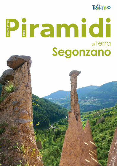
SegonzanoPiramidi
di terra
Valle di Cem
bra
Italia

Il punto di partenza per la visita alle Piramidi di terra è dal ponte sul Rio Regnana, sulla strada provinciale che collega Lases a Segonzano. Il visitatore le può osservare da vari punti della Valle, ma, per una visita completa, è preferibile seguire il sentiero attrez-zato che parte dal piccolo centro visitatori con parcheggio, punto di ristoro e tabelle descrittive. Il percorso raggiunge le formazioni dei primi tre gruppi e scorre in un bosco misto di conifere e latifoglie, che offrono nei mesi estivi un sicuro refrigerio. Il quarto gruppo, un po’ distante e posto verso est, non è toccato dal sentiero; quest’ultimo si può ugualmente osservare dall’alto, sulla strada che collega Segonzano alla frazione di Quaras.Note tecniche: la visita dal sentiero attrezzato è possibile tutto l’anno (neve e ghiaccio permettendo).
Si consiglia: abbigliamento sportivo, scarpe leggere da trekking, macchina fotografica, binocolo.
È previsto un ticket d’ingresso istituito dal Comune di Segonzano (tariffe su www.visitpinecembra.it)
Escursioni guidate su prenotazione: Associazione Accompagnatori di Territorio del Trentino: [email protected] www.accompagnatoriditerritorio.it
Comune di Segonzano
Visitaalle Piramidi

Tempi di percorrenza partendo dal punto informazioniGehzeiten vom Info-Punkt | Time needed from infopoint 1° gruppo | Gruppe | group: 15 min. 2° gruppo | Gruppe | group: 35 min. 3° gruppo | Gruppe | group: 50 min.
Percorso adatto a | Route geeignet für | Route for:
Difficoltà | Schwierigkeitsgrad |Difficulty:
Partenza | Beginn | Starting point:
Quota alla partenza | Höhenlage am Beginn | Starting altitude: 604 mt
Quota all'arrivo | Höhenlage am Ziel | Arrival altitude: 875 mt
Dislivello | Höhendifferenz | Altitude difference: 271 mt
Durata percorso |Dauer der Wanderung | Duration: 2,45 h (a/r)
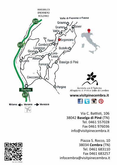
LONA-LASES ALBIANO TRENTO
CEMBRA
CAVALESE

Nel periodo Quaternario i ghiacciai dell’Avisio abbandonarono nella Valle del rio Regnana enormi depositi morenici, costituiti da una mescolanza di materiale finissimo, ciottoli e grandi massi. Questi accumuli sono dovuti alla disgregazione e al disfacimento delle creste e dei fianchi della montagna, operata dal movimento del ghiaccio. Nel corso dei millenni, l’azione erosiva dell’acqua ha poi dato origine alla formazione di incisioni profonde e vallette parallele.
GEOLOGICAL BASE
GEOLOGISCHE BASISWährend des Quartärs transpor-tierten die Gletscher des Avisio gewaltige Mengen Gesteinsma-terial in das Tal des Rio Regnana. Diese bildeten im Laufe der Zeit riesige Moränenlager aus feinem Kiesel und großen Felsblöcken. Die Anhäufungen sind auf die Zerbröckelung und den Abbruch von Bergkämmen und-hängen zurückzuführen, die durch die Bewegung der Gletscher verursacht wurden. Im Laufe von mehreren tausend Jahren hat die Erosionswirkung des Wassers tiefe Einschnitte und parallel verlaufende schmale Talsenken geschaffen.
In the Quaternary period glaciers around the Avisio river left a lot of material in the Regnana river valley forming huge moraine deposits made up of a mixture of material consisting of very fine pebbles and large boulders. This accumulation of material was due to the disintegration and collapse of the mountain sides and ridges caused by the movement of the ice. Over the millennia, the erosive action of water has also given rise to the formation of pyramids.
ba
se g
eo
log
ica

Le gocce di pioggia, quando colpiscono il terreno, ne smuovono le varie particelle, esercitando un’azione erosiva che aumenta con la pendenza. Il terreno non è asportato totalmente gra-zie alla composizione mista dei materiali disposti caoticamente dal ghiaccio, che rappresentano un punto di protezione contro l’azione meccanica ed erosiva delle acque. Nel 1932 alcuni studiosi avanzarono l’ipotesi, poi totalmente smentita, che le piramidi esisterebbero già preformate e l’acqua non avrebbe altra funzione che quella di disseppellirle.
Wenn die Regentropfen das Erdreich treffen, bewegen sie die verschiedenen Teilchen und verüben eine erodierende Tätigkeit, die durch die Neigung noch verstärkt wird. Aber das Erdreich wird, dank der vom Gletscher chaotisch abgelagerten gemischten Bestandteile, nicht ganz abgetragen. Sie bilden gewis-sermaßen eine Art „Schutzpanzer“ gegen die mechanische Abtra-gungstätigkeit des Wassers. 1932 haben einige Wissenschaftler die Hypothese aufgestellt, dass die Erdpyramiden bereits vorgeformt im Boden bestünden, und das Wasser lediglich die Aufgabe hät-te, sie auszugraben. Diese The-orie wurde dann später gänzlich verworfen.
The drops of rain, when they hit the ground, churn the various particles, exerting a corrosive action that increases with the steepness. The ground is not completely removed because of the mixed composition of the material that was disposed chaotically by the ice. This shows how it can protect itself against the mechanical and erosive action of the water. In 1932, some scholars suggested, and later totally denied, that the pyramids already existed and the water would have no other function but to dig into them.
FORMATIONBILDUNG
form
azi
on
e

La forma classica di una piramide è quella di un tronco a cono sormontato da un masso. Accanto a questa si possono osservare le piramidi a punta con stelo conico e prive del masso di protezione: sono, in genere, non molto alte e ciò dimostra una rapida evoluzione. Un'altra tipica forma è quella a cresta, costituita da una lama di terreno seghettato e affilato, la cui formazione è dovuta all’assottigliamento dello spartiacque, compreso fra due canaloni. Talvolta le piramidi sono raggruppate a "canne d’organo".
FORM SHAPEDie klassische Pyramidenform gleicht einem Ein Kegelstumpf, über dem ein Schutzfels ruht. Ne-ben dieser Form kann man spitz zulaufende Erdsäulen erkennen. Kennzeichnend für sie ist ihr kegelförmiger Stamm, der von keinem „Felshut“ geschützt wird. Sie sind gewöhnlich nicht sehr hoch und der Beweis für eine verhältnismäßig rasche Evolution. Eine weitere typische Form ist die „Kammform“. Sie besteht aus einer spitz gezackten Erdwand, die sich durch die Verdünnung der Wasserscheide zwischen den beiden Rinnen bildete. Manchmal sind die Pyramiden auch wie Orgelpfeifen angeordnet.
The classic shape of a pyramid is that of a truncated cone surmounted by boulders. Next to this you can see the tip of the pyramids with and without the tapered shank of the rock protection: they are generally not very high which shows rapid evolution. Another typical form is one called "a cresta", consisting of a sharp serrated blade of earth, whose formation is the result of a thinning of the divide between two canyons. Sometimes the pyramids are grouped together as "organ pipes".
form
a

Nella formazione delle piramidi ha importanza fondamentale la presenza del "cappello" e, soprattutto, la sua forma, perché condiziona l’esistenza e la durata della stessa piramide. La più idonea è quella del lastrone un po’ squadrato, lievemente inclinato a valle, che fa da tetto naturale alla piramide. Se il masso cade, la piramide assume una forma appuntita, facilmente aggredibile dall’acqua. Il suo destino è segnato, se lungo il suo stelo non si trova un altro masso, futuro "cappello". Una piramide situata nel II gruppo ha un cappello veramente notevole del peso valutato in circa 100 quintali.
SHAPE OF THE STONE
FORM DESFELSENBei der Bildung der Pyramiden ist die Anwesenheit des „Hutes“, und vor allem seine Form, wesentlich, denn er beeinflusst die Bestän-digkeit und die Lebensdauer der Pyramide. Besonders geeignet ist hierfür eine eher quadratische Felsplatte, leicht talabwärts geneigt, die der Pyramide als natürliches Dach dient. Sollte dieser „Felshut“ fallen, nimmt die Pyramide eine zugespitzte Form an, die sehr anfällig gegen Wasser ist. Ihr Schicksal ist besiegelt, falls an ihrem Stamm entlang kein an-derer Fels existiert, der zu ihrem zukünftigen „Schutzhut“ wird. Eine Pyramide in der 2. Gruppe hat einen besonders ansehnlichen „Hut“, mit einem geschätzten Gewicht von rund 100 dz.
The presence, and moreover the shape of the “hat”, was essential to the formation of the pyramids because it determines their existence and age. More importantly, the square-shaped slab, slightly tilted towards the valley, forms a natural roof for the pyramid. If the stone falls, the pyramid will assume a pointed shape, easily permitting an attack from the water and sealing its fated unless there is another rock along the stem which, in time, will become the future “hat”. A pyramid located within the 2nd group, has a notable “hat” for its substantial weight estimated at approximately 100 tons.
form
a d
el m
asso

Bei der Erhaltung der Pyramide spielt die Pflanzendecke eine wichtige Rolle, denn sie hemmt die Erosionswirkung des Wassers: Wurzeln, Moos und Blätter hal-ten die Erde wirksam zusammen und verhindern die Abtragung. Die Anwesenheit einer Pflanzen-decke in den Erdrinnen ist ein Zei-chen von erodierender Tätigkeit, die sich beträchtlich vermindert hat. Einige Pyramiden haben auf ihren Spitzen als Schutz Büsche oder Bäume, deren Vegetation völlig unverändert blieb.
The vegetation covering the pyra-mids is of notable importance to their conservation because it alleviates the erosive action of water: the roots, moss and leaves effectively detain it, preventing erosion. The presence of vegetation in the gullies indicates that the erosive activity has been considerably reduced. At the summit of some of the pyramids there are bushes and trees keeping the vegetation intact which therefore acts as a protection.
Nella conservazione delle piramidi la copertura vegetale riveste una notevole importanza, perché modera l’azione erosiva dell’acqua: le radici, il muschio e le foglie trattengono efficacemente la terra, impe-dendo l’erosione. La presenza di vegetazione nei canaloni è indizio di un’attività erosiva, che si è ridotta considerevolmente. Alcune piramidi hanno come protezione dei cespugli o alberi, alla sommità dei quali è rimasta intatta la vegetazione.
VEGETATION VEGETATION
ve
ge
tazi
on
e

ZERFALL DETERIORATION
de
teri
ora
me
nto
Das starke Erdbeben vom 6.Mai 1976 in Friaul wurde in Segonza-no im 5. Grad der Mercalli-Skala wahrgenommen. Viele Pyrami-den verloren ihre Schutzfelsen. Andere höhere und schlankere haben, dank ihrer Schwankun-gen, diesem Naturereignis Wi-derstand geleistet. Auch des Menschen Hand kann diesem be-merkenswerten Naturphänomen Schaden zufügen: Laut Über-lieferung dienten die Felshüte von einigen dieser Pyramiden während des 1. Weltkriegs als Zielscheiben für Schießübungen einer Kanonenbatterie. Diese - ihres „Felshutes“ beraubten - Pyramiden, sind in kürzester Zeit erschwunden.
The violent earthquake that struck Friuli on 6th May 1976 sent a warning to Segonzano with a reading of 5 on the Richter scale: many pyramids lost the stone protection whereas others, taller and leaner, survived, vibrating without damage. Human activity may also have contributed to the harming of these wonderful formations: it is said that during the First World War a gun battery in training, shot against the surface blocks near the road: without this pro-tection the pyramids quickly deteriorated.
Il violento terremoto che colpì il Friuli il 6 maggio 1976, è stato avvertito a Segonzano con intensità del V grado della scala Mercalli;molte piramidi persero il masso di protezione altre, più alte e snelle, hanno resistito, vacillando senza danni. Anche l’azione dell’uomo può contribuire a danneggiare queste mirabili formazioni: si racconta che durante Ia Grande Guerra una batteria di cannoni si esercitò ai tiri, sparando ai blocchi di copertura di alcune piramidi: queste, private del masso, in breve tempo scomparvero.
SCHUTZMAUERNBRIDLE RETRAINING WALLSIm Herbst 1882 gab es im
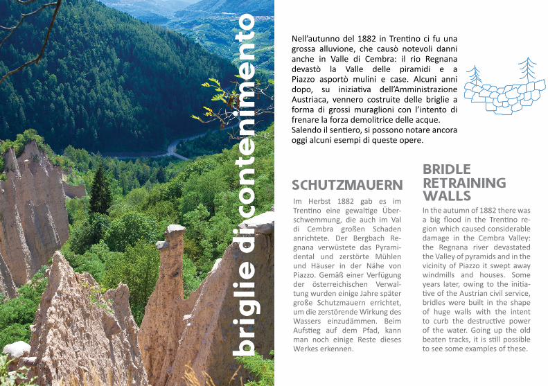
Trentino eine gewaltige Über-schwemmung, die auch im Val di Cembra großen Schaden anrichtete. Der Bergbach Re-gnana verwüstete das Pyrami-dental und zerstörte Mühlen und Häuser in der Nähe von Piazzo. Gemäß einer Verfügung der österreichischen Verwal-tung wurden einige Jahre später große Schutzmauern errichtet, um die zerstörende Wirkung des Wassers einzudämmen. Beim Aufstieg auf dem Pfad, kann man noch einige Reste dieses Werkes erkennen.
In the autumn of 1882 there was a big flood in the Trentino re-gion which caused considerable damage in the Cembra Valley: the Regnana river devastated the Valley of pyramids and in the vicinity of Piazzo it swept away windmills and houses. Some years later, owing to the initia-tive of the Austrian civil service, bridles were built in the shape of huge walls with the intent to curb the destructive power of the water. Going up the old beaten tracks, it is still possible to see some examples of these.
Nell’autunno del 1882 in Trentino ci fu una grossa alluvione, che causò notevoli danni anche in Valle di Cembra: il rio Regnana devastò la Valle delle piramidi e a Piazzo asportò mulini e case. Alcuni anni dopo, su iniziativa dell’Amministrazione Austriaca, vennero costruite delle briglie a forma di grossi muraglioni con l’intento di frenare la forza demolitrice delle acque. Salendo il sentiero, si possono notare ancora oggi alcuni esempi di queste opere.
bri
gli
e d
i co
nte
nim
en
to

1959 kamen im Museum für Naturwissenschaften von Tren-to Fotodokumente zutage, die vermutlich gegen Ende des 19. Jh. aufgenommen wurden. Im Oktober 1959 wurde dieselbe Gegend neuerlich fotografiert. Dabei hat man festgestellt, dass in etwas mehr als 60 Jahren vie-le Erdpyramiden verschwunden sind. Die Erosion betraf nicht nur die anfälligeren Pyramiden, ohne schützende Felsbedeckung, sondern auch die klassischen For-men. Ein weiteres, uraltes Zeu-gnis stammt vom Kunstmaler Al-brecht Dürer, der 1494, bei seiner Durchreise, das Schloss von Se-gonzano malte. Als Hintergrund seines Gemäldes deutete er eine Pyramide, mitten im Wald, an.
In 1959, photographic docu-ments, probably taken at the end of last century, were found in the Museum of Natural Histo-ry in Trento. In October 1959 the same area was photographed. It was noted that in fewer than 60 years, many of the pyramids had disappeared. The erosion had affected not only the pyramids without the huge slabs, which were the most vulnerable, but also the classic ones. Another historic record is that of the painter Albrecht Dϋrer: passing through Segonzano in 1494, he painted the castle with a glim-pse of a pyramid in the middle of a forest.
Nel 1959, nel museo di Storia Naturale a Trento sono stati trovati dei documenti fotografici eseguiti probabilmente alla fine del XX secolo; nell’ottobre del 1959 si fotografò la stessa zona. Si è notato che in poco più di 60 anni molte piramidi sono scomparse: l’erosione ha interessato non solo le piramidi prive del masso, che sono le più vulnerabili, ma anche quelle classiche. Un’altra antica documentazione è quella del pittore Albrecht Dϋrer che, passando per Segonzano nel 1494, ne dipinse il castello lasciando intravedere al centro del bosco una piramide.
ev
olu
zio
ne
EVOLUTION EVOLUTION

Un interessante punto panoramico sulle Piramidi e sui vigneti terrazzati si trova sul nuovo sentiero della Val Pomara. È una passeggiata meno impegnativa, adatta a famiglie con passeggini e ai diversamente abili con carrozzina. La partenza è da località Prada (fraz. di Sevignano) dalla quale, in breve (1,2 km), si raggiunge il balcone che si apre sull’area naturalistica. Rientro dalla stessa strada. Nota: per chi volesse raggiungere l’area di accesso alle Piramidi è possibile proseguire sulla strada forestale (con pendenza in discesa del 15-18%) che interseca la Provin-ciale (strada delle Strente). È possibile attraversare il letto del torrente per poi iniziare il percorso didattico.
Testi e impaginazione grafica: A.p.T. Piné CembraTraduzioni: Renate Wilke e Katie MartinRealizzazione mappe: A.p.T. Piné CembraFotografie: Archivio A.p.T. Piné Cembra, Sandro GiacomozziSi ringraziano: Ing. Ermanno Fassan e Ing. Franco Buffa
Il Comune di Segonzanoè certificato
Strada panoramicaVal Pomara
An interesting panoramic viewpoint on the Pyramids and terraced vineyards can be rea-ched by a new path in the Val Po-mara (Pomara Valley). This walk is less challenging than the others and therefore suitable for both families with pushchairs and peo-ple with limited mobility. Wheel-chair users are welcome as well. The departure point is “Località Prada” (Sevignano), from where walkers can shortly reach (1,2 km) the panoramic viewpoint that opens up on the naturalistic area. Return along the same road. Note: for those who want to reach the area of access to the Pyramids, it is possible to go ahead along the forest road (15 – 18 % grade downwards), as far as the road intersects the main street (named “Strada delle Strente”). It is possible to cross the river and get to the starting point of the didactic path.
Ein fantastisches Panorama auf die Erdpyramiden und die ter-rassierten Weinberge bietet sich vom neuen Weg des Val Poma-ra. Er lädt zu einem weniger be-schwerlichen Spaziergang ein, der auch für Familien mit Bug-gys und Behinderte im Rollstuhl geeignet ist. Der Weg beginnt bei der „Loc. Prada“ (Sevignano). Von dort erreicht man in Kürze (1,2 km) die Aussichtsterras-se mit Blick auf die Natur der Umgebung und in die Ferne. Merke: auf einer Forststraße - mit einem Gefälle von 15-18% - , die sich mit der Landstraße (Strada delle Strente) kreuzt, gelangt man zum Zugangsweg der Erdpyramide. Man kann auch das Bachbett dur-chqueren und anschließend auf den Lehrpfad einbiegen.
Via C. Battisti, 106 38042 Baselga di Piné (TN)
Tel. 0461 557028 Fax 0461 976036
Piazza S. Rocco, 10 38034 Cembra (TN)
Tel. 0461 683110 Fax 0461 683257
www.visitpinecembra.it